- Gyeongsangnam-do
Infobox Korean Provinces
Name = South Gyeongsang
Name2 = 경남
Hangul = 경상 남도
Hanja = 慶尙南道
Revised Romanization = Gyeongsangnam-do
McCune-Reischauer = Kyŏngsangnam-to
Government = Province
Capital =Changwon
Governor = Kim Tae-ho
Region =Yeongnam
Dialect = Gyeongsang
TotalArea = 11,859
AreaRank = 3rd
PopDate = 2000
Population = 2,970,929
PopRank = 2nd
Density = 251
Cities = 10
Counties = 10
Website = [http://english.gsnd.net/default.jsp gsnd.net] en icon
Flower =Rose
Tree =Zelcova
Bird = White Heron
OtherSymbol1 =
OtherSymbol1Value =
OtherSymbol2 =
OtherSymbol2Value =
Emblem = Gyeongsangnam Emblem.gif
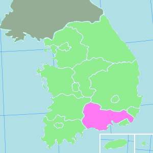
EmblemName =Gyeongsangnam-do (South Gyeongsang) is a province in the southeast of
South Korea . The provincial capital is located atChangwon .History
Before 1895, the area corresponding to modern-day Gyeongsangnam-do was part of
Gyeongsang Province, one of the Eight Provinces ofKorea during theJoseon Dynasty . In 1895, southern Gyeongsang was replaced by the Districts ofJinju in the west andDongnae (modern-dayBusan ) in the east. In 1896, the two districts were merged to form Gyeongsangnam-do.The provincial capital was originally located at Jinju, then moved in 1925 to Busan. In 1948, Gyeongsangnam-do became part of
South Korea . In 1963, Busan separated from Gyeongsangnam-do to become a Directly Governed City ("Jikhalsi"). In 1983, the provincial capital moved from Busan to Changwon. In 1995, Busan became a Metropolitan City ("Gwangyeoksi"). In 1997,Ulsan separated from Gyeongsangnam-do to become a Metropolitan City.In 1982, police officer
Woo Bum-kon carried out the world's worst known incident ofspree killing , killing 58 (including himself), and wounding 35 in Gyeongsangnam-do.Geography
The province is part of the
Yeongnam region, and is bounded on the east by theSea of Japan (East Sea), on the north byGyeongsangbuk-do province, on the westJeollabuk-do andJeollanam-do provinces, and on the south by theKorea Strait . Most of the province is drained by theNakdong River and its tributaries.Resources
The Nakdong delta plain around
Gimhae is one of the best granaries in South Korea. Agricultural products form Gyeongsangnam-do includerice ,beans ,potatoes , andbarley . The area is renowned for itscotton ,sesame , andfruits which are grown along the southern seaside. A number of marine products are caught. The province is one of the country's leading fisheries.Major cities
The largest cities in the region are
Busan andUlsan , which are separately administered as provincial-level Metropolitan Cities. Apart from Changwon, other large or notable cities includeGimhae ,Jinhae ,Masan , andJinju .Attractions
Gyeongsangnam-do is the home of
Haeinsa , a Buddhist temple that houses the "Tripitaka Koreana " and attracts many tourists. It is located in the national park aroundJirisan (1,915 m) on the border with Jeollabuk-do. The temple was first built in 802.Administrative divisions
Gyeongsangnam-do is divided into 10 cities ("si") and 10 counties ("gun"). The names below are given in English,
hangul , andhanja .Cities
Counties
ee also
*
List of Korea-related topics
*Igeum-dong site - complex archaeological site in Sacheon-siExternal links
* [http://english.gsnd.net/default.jsp Gyeongsangnam-do English-language home page]
* [http://www.worknplay.co.kr/recruitings/public_gyeongsangnamdo.htm Jobs in Gyeongsangnam-do]
Wikimedia Foundation. 2010.