Dores do Rio Preto, Espírito Santo

Dores do Rio Preto, Espírito Santo
Dores do Rio Preto
—  Municipality  —
The Municipality of Dores do Rio Preto
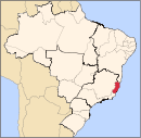
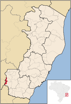
Location of Dores do Rio Preto in the State of Espírito Santo
Coordinates: 20°41′20″S 41°50′42″W / 20.68889°S 41.845°W / -20.68889; -41.845Coordinates: 20°41′20″S 41°50′42″W / 20.68889°S 41.845°W / -20.68889; -41.845
Country  Brazil
Region Southeast
State Bandeira do Espírito Santo.svg Espírito Santo
Founded April 7, 1964
Government
 – Mayor Cláudia Martins Bastos (PSDB)
Area
 – Total 153.106 km2 (59.1 sq mi)
  [1]
Elevation 55 m (180 ft)
Population (2008)
 – Total 6,288
 – Density 44.9/km2 (116.3/sq mi)
  [2]
Time zone UTC-3 (UTC-3)
HDI (2000) 0.674 – medium[3]

Dores do Rio Preto is the westernmost municipality in the Brazilian state of Espírito Santo. Its population was 6,288 (2008) and its area is 153.106 km². The village Pedras Meninas in Dores is the location for the entrance to Caparaó National Park and the Pico da Bandeira from Espirito Santo.

References


Wikimedia Foundation. 2010.

Игры ⚽ Нужно решить контрольную?

Look at other dictionaries:

  • Dores do Rio Preto — in Espírito Santo Dores do Rio Preto ist eine Gemeinde im brasilianischen Bundesstaat Espírito Santo. Die Gemeinde wurde 1964 eigenständig, vorher gehörte sie zu Guaçuí. Es leben dort 6 870 Einwohner (2006) auf 153,1 km². Der Ort auf 770 Metern… …   Deutsch Wikipedia

  • Rio Preto — can refer to:Places*Dores do Rio Preto, Espírito Santo, a municipality located in Espírito Santo state, Brazil *Rio Preto, Minas Gerais, a municipality located in Minas Gerais state, Brazil *Rio Preto da Eva, a municipality located in Amazonas… …   Wikipedia

  • Espírito Santo Municipalities — Espírito Santo state ( estado in Portuguese) and all municipalities ( municípios in Portuguese) in alphabetical order.List of Espírito Santo s MunicipalitiesBy Name*Afonso Cláudio (42) *Água Doce do Norte (01) *Águia Branca (15) *Alegre (68)… …   Wikipedia

  • Espírito Santo — Infobox Brazilian State name = State of Espírito Santo motto = Trabalha e Confia ( capital = Vitória latd= |latm= |latNS= |longd= |longm= |longEW= largest city = Vila Velha demonym = capixaba or espiritossantense leader name1 = Paulo Hartung… …   Wikipedia

  • Divino de São Lourenço, Espírito Santo — Coordinates: 20°37′12″S 41°41′09″W / 20.62°S 41.68583°W / 20.62; 41.68583 Divino de São Louren …   Wikipedia

  • Liste des villes d'Espírito Santo — Liste des villes de l Espírito Santo Sommaire 1 Municipalités 1.1 A/I 1.2 J/V 2 Sources // …   Wikipédia en Français

  • Liste der Gemeinden in Espírito Santo — Die untenstehenden Gemeinden liegen im brasilianischen Bundesstaat Espírito Santo. Die Zahl hinter den Namen ist die Bevölkerung im Gemeindegebiet in einer Schätzung des brasilianischen Bundesamtes für Statistik und Geographie (IBGE) für den 1.… …   Deutsch Wikipedia

  • Marataízes, Espírito Santo — Marataizes   City   …   Wikipedia

  • Conceição da Barra, Espírito Santo — Conceição da Barra   Municipality   The Municipality of Conceição da Barra Main church of Conceição da Barra …   Wikipedia

  • Mucurici, Espírito Santo — Mucurici   Municipality   The Municipality of Mucurici Motto: Ação e desenvolvimento (Action and development) …   Wikipedia

Share the article and excerpts

Direct link
Do a right-click on the link above
and select “Copy Link”