Mauretania Public House

Mauretania Public House

Coordinates: 51°27′12″N 2°36′6″W / 51.45333°N 2.60167°W / 51.45333; -2.60167

Mauretania Public House
General information
Town or city Bristol
Country  England
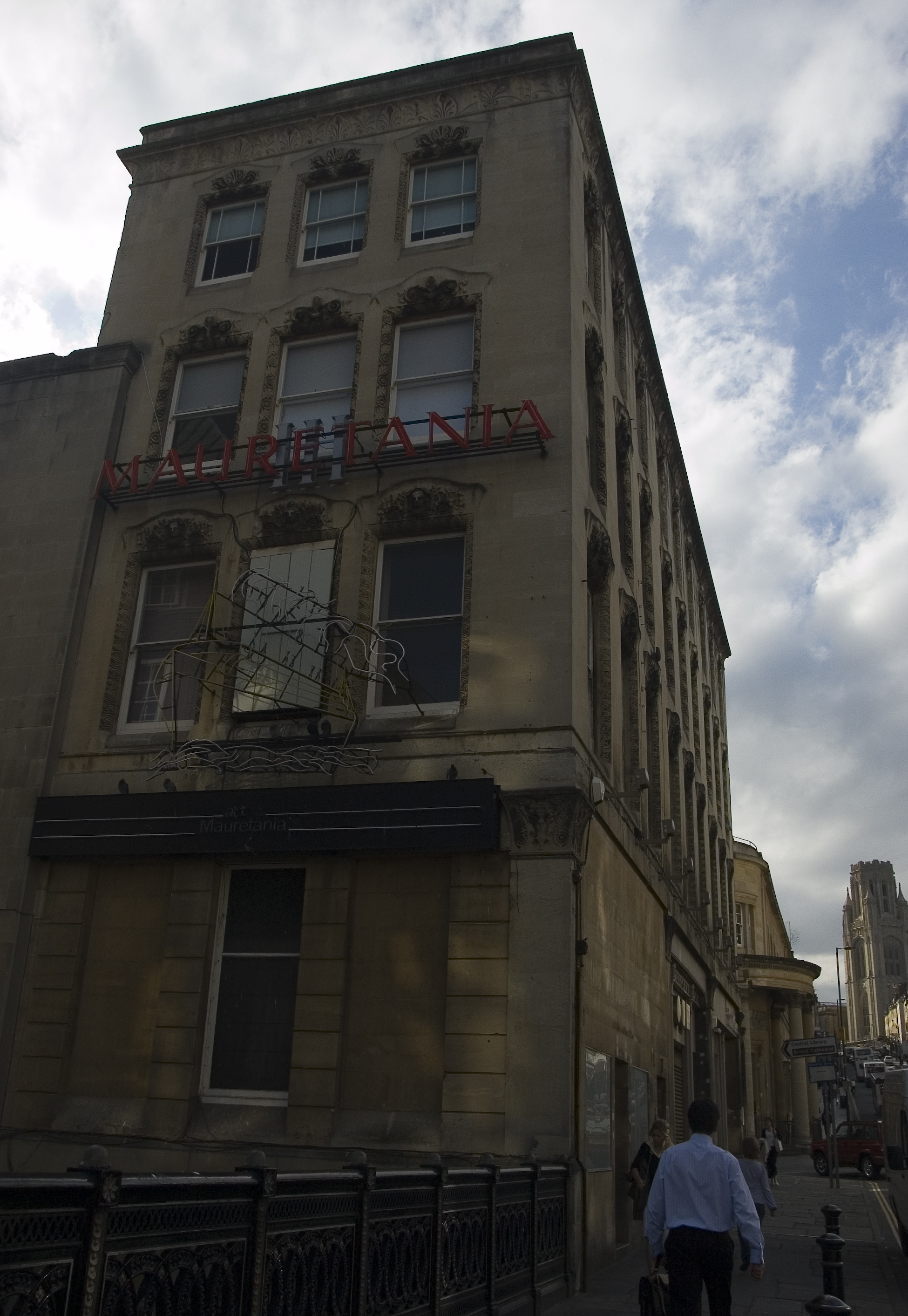
Completed 1870
Design and construction
Architect Henry Masters

The Mauretania Public House is on Park Street, Bristol.

It was built in 1870 by Henry Masters, with a rear extension being added in 1938 by WH Watkins. It has been designated by English Heritage as a grade II listed building.[1]

Some of the furnishings from the RMS Mauretania were installed in a bar/restaurant complex at the bottom of Park Street, initially called "Mauretania", now "Java". The lounge bar was the library with mahogany panelling: above the first-class Grand Saloon with French-style gilding overlooks Frog Lane. The neon sign on the south wall still advertises the "Mauretania": installed in 1938 this was the first moving neon sign in Bristol.

References


Wikimedia Foundation. 2010.

Игры ⚽ Нужен реферат?

Look at other dictionaries:

  • Clifton Lido and The Victoria Public House — Clifton Pool and The Victoria Public House …   Wikipedia

  • List of public houses in the United Kingdom — This is an incomplete list, which may never be able to satisfy particular standards for completeness. You can help by expanding it with reliably sourced entries. The following is a list of public houses in the United Kingdom. Contents 1 England 1 …   Wikipedia

  • Charles Wesley's House — Charles Wesley s House …   Wikipedia

  • Buildings and architecture of Bristol — Bristol, the largest city in South West England, has an eclectic combination of architectural styles, ranging from the medieval to 20th century brutalism and beyond. During the mid 19th century, Bristol Byzantine, an architectural style unique to …   Wikipedia

  • Bristol Old Vic — This article is about Bristol Old Vic Theatre Company. For Bristol Old Vic Theatre School, see Bristol Old Vic Theatre School. Coordinates: 51°27′07″N 2°35′38″W / 51.452°N 2.594°W …   Wikipedia

  • College Green, Bristol — Coordinates: 51°27′09″N 2°36′05″W / 51.4526°N 2.6015°W / 51.4526; 2.6015 …   Wikipedia

  • Stoke Park, Bristol — Coordinates: 51°29′28″N 2°33′17″W / 51.491096°N 2.554622°W / 51.491096; 2.554622 …   Wikipedia

  • The Coronation Tap — Public house information Location 8 Sion Place, Clifton, Bristol BS8 4AX Established pre 1806 Telephone +44 (0)117 9739617 …   Wikipedia

  • Park Street, Bristol — Bristol mapbox latitude=51.456868 longitude= 2.605766 caption=Shown within Bristol and the UKPark Street in Bristol runs from College Green up a steep incline northwards to join Park Row at the southern apex of the Clifton Triangle. Looking up… …   Wikipedia

  • Nova Scotia, Bristol — Nova Scotia Hotel …   Wikipedia

Share the article and excerpts

Direct link
Do a right-click on the link above
and select “Copy Link”