- Ninepin Group
-
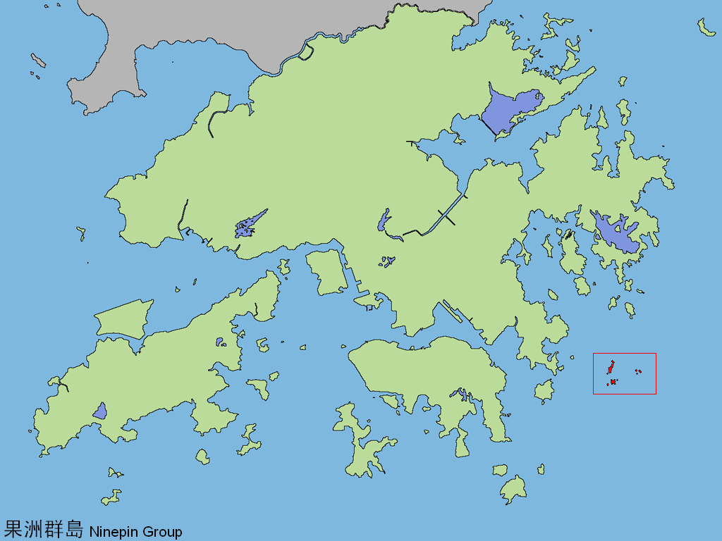
 Location of the Ninepin Group within Hong Kong
 South Ninepin Island
 North Ninepin Island
The Ninepin Group (Chinese: 九針群島) or Kwo Chau Islands (果洲群島) is a group of 29 islands in the easternmost waters of Hong Kong. The Ninepin Group falls under the jurisdiction of Sai Kung District of Hong Kong.
Contents
Islands
The islands of the group include:
- East Ninepin Island (Tung Kwo Chau; 東果洲)
- Lung Shuen Pai (龍船排) or Fo Siu Pai (火燒排)
- Tuen Chau Chai (短洲仔)
- Tuen Chau Mei (短洲尾)
- Shue Long Chau (蕃莨洲) or Kong Tau Pai (光頭排)
- North Ninepin Island (Pak Kwo Chau; 北果洲)
- Hok Chai Pai (殼仔排)
- Ngan Peng Keng
- Ngan Peng Tau
- North Ninepin Island (北果洲)
- Sai Chau Mei (細洲尾)
- Tuen Keng
- South Ninepin Island (Nam Kwo Chau; 南果洲)
- Tai Chau (大洲) - where the Kwo Chau Wan (果洲灣) beach is located
- Tai Chau Mei (大洲尾)
- Ta Long Pai (打浪排)
- Lai Chi Pai (荔枝排)
Geography
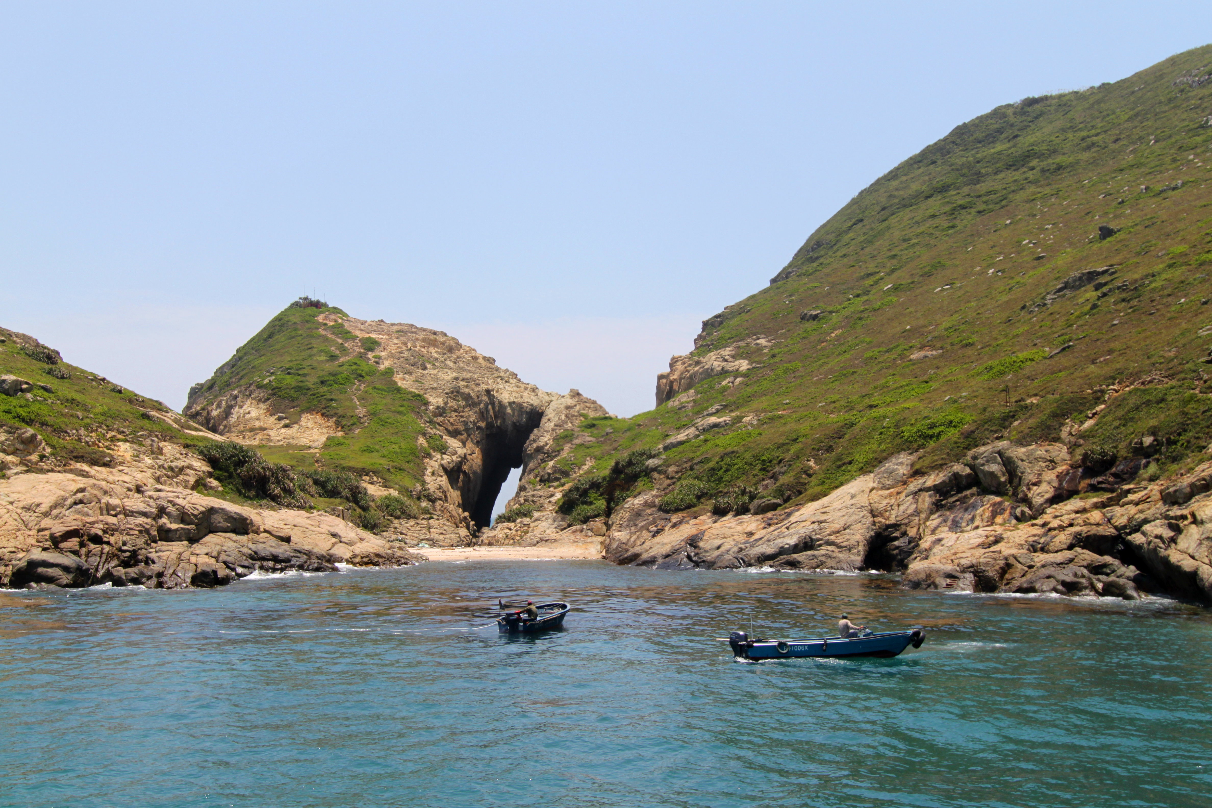
The Ninepin Group features hexagonal vertical rhyolite columns, the volcanic rock resulting from a volcanic eruption near Sai Kung about 140 million years ago. Ninepin Group is extremely eroded due to the heavy tides that wash against the islands every day. It features several sea caves as a result of erosion. For a long time, the Ninepin Group was devoid of human presence. However, there is a temple dedicated to Tin Hau, located on South Ninepin Island for any fishermen who landed on the island.
Transportation
Because no one lives on Ninepin Group, there is no public transportation to the islands. One must rent a boat in order to reach the Ninepin Group.
See also
- Hong Kong National Geopark
External links
- Webpage about the Ninepin Group, with pictures
- Spectacular joint columns – Ninepin Group
- Photo album
- Map of the Ninepin Group
- Satellite view on Google Maps
 Major islands of Hong Kong
By size Lantau Island · Hong Kong Island · Lamma Island · Chek Lap Kok · Tsing Yi · Kau Sai Chau · Po Toi Islands (Po Toi • Waglan) · Cheung Chau · Tung Lung Chau · Crooked Island · Double Island · Hei Ling Chau · Grass Island · Ap Lei Chau · Soko Islands (Tai A Chau • Siu A Chau) · Ping Chau · Peng Chau · Ma Wan · Ninepin Group · The Brothers · Green Island · Kowloon Rock
Former islands Coordinates: 22°15′51″N 114°21′29″E / 22.26417°N 114.35806°E
Categories:- Islands of Hong Kong
- Uninhabited islands of Hong Kong
- Sai Kung District
- Volcanism of Hong Kong
- Hong Kong National Geopark
- Hong Kong geography stubs
- East Ninepin Island (Tung Kwo Chau; 東果洲)

Wikimedia Foundation. 2010.