- Kat O
-
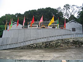
 Tin Hau Temple on Kat O
Kat O (Chinese: 吉澳,Hakka: ket au) or Crooked Island is an island of Hong Kong located in the north-east of the territory. Administratively, it is part of North District.
Contents
Geography
Kat O has an area of 2.35 km².[1] It is the largest island in North District, the second largest being Wong Wan Chau. The village of Tung O is located on its northwest coast.[2]
Conservation
Kat O is part of the Plover Cove (Extension) Country Park since 1979.[3]
Kat O Geoheritage Centre at No.142, Kat O Main Street, Kat O, was opened in 2010 by Kat O villagers, voluntary groups and the government to raise public awareness of geo-conservation, as part of the Hong Kong Geopark.[4]
See also
- Crooked Harbour
- Double Haven
- Pat Sin Leng Country Park
- Islands of Hong Kong
References
- ^ landsd.gov.hk
- ^ K.W. Lai, S.D.G. Campbell & R. Shaw, Geology of the Northeastern New Territories, p. 15, Civil Engineering Dept, Geotechnical Engineering Office, December 1996
- ^ Agriculture, Fisheries and Conservation Department: Plover Cove Country Park
- ^ Kat O Geoheritage Centre Hong Kong Geopark
External links
- Kut-O Chinese Association (Kent area) Website
- Pictures of Kat O
- Lee Yuk Ying Introduces the Cultural History of Kat O to Visitors Hong Kong GeoPark.
 Major islands of Hong Kong
By size Lantau Island · Hong Kong Island · Lamma Island · Chek Lap Kok · Tsing Yi · Kau Sai Chau · Po Toi Islands (Po Toi • Waglan) · Cheung Chau · Tung Lung Chau · Crooked Island · Double Island · Hei Ling Chau · Grass Island · Ap Lei Chau · Soko Islands (Tai A Chau • Siu A Chau) · Ping Chau · Peng Chau · Ma Wan · Ninepin Group · The Brothers · Green Island · Kowloon Rock
Former islands Coordinates: 22°32′28″N 114°17′43.9″E / 22.54111°N 114.295528°E
Categories:- Islands of Hong Kong
- North District, Hong Kong
- Hong Kong National Geopark
- Hong Kong geography stubs
Wikimedia Foundation. 2010.


