- Claughton, Merseyside
-
Coordinates: 53°23′41″N 3°03′28″W / 53.3947°N 3.0577°W
Claughton 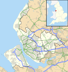
 Claughton
Claughton shown within MerseysidePopulation 13,723 (2001 Census)[1] OS grid reference SJ297891 Metropolitan borough Wirral Metropolitan county Merseyside Region North West Country England Sovereign state United Kingdom Post town BIRKENHEAD Postcode district CH41 Dialling code 0151 Police Merseyside Fire Merseyside Ambulance North West EU Parliament North West England UK Parliament Birkenhead List of places: UK • England • Merseyside Claughton (pronounced /ˈklɔːtən/ "Clawton") is a residential district in Birkenhead, on the Wirral Peninsula, England. It is close to the main shopping area of Birkenhead town centre, and Birkenhead Park is partly located within its boundaries. Administratively, Claughton is a ward of the Metropolitan Borough of Wirral. Before local government reorganisation on 1 April 1974, it was part of the County Borough of Birkenhead, within the geographical county of Cheshire. At the 2001 Census, the population of Claughton was 13,723, consisting of 6,498 males and 7,225 females.[1]
History
The name is of Viking origin, deriving from the Old Norse Klakkr-tun, meaning "hamlet on a hillock".[2]
Claughton Manor House was built in about 1850 by local benefactor Sir William Jackson, with its gardens designed by Sir Joseph Paxton. It occupied a site between Egerton Road and Manor Hill until it was pulled down in the 1930s.[3]
The Birkenhead Institute was founded in 1889 by a local philanthropist, George Atkin, who established the school as a commercial company with shareholders and directors.[4] Originally situated in Whetstone Lane, Birkenhead, it was later relocated to premises on Tollemache Road, Claughton until its closure and subsequent demolition in the 1990s. Wilfred Owen, the World War I poet attended the school at its original location.[5] A residential road has been named after him on the Tollemache Road site.
Description
Claughton Village lies on the A5027 road, which continues on westbound to Saughall Massie and joins the A553 road towards Birkenhead. Map The village has a large number of shops, as well as cafes, a bank, post office, garage and local pubs such as the 'Claughton Hotel', the 'Heather Brow' and 'Houlihan's Variety Club'.
Claughton is also the location of Birkenhead Sixth Form College, which was established by the local education authority in 1988.[6]
References
- ^ a b 2001 Census: Claughton, Office for National Statistics, http://neighbourhood.statistics.gov.uk/dissemination/LeadKeyFigures.do?a=7&b=5941387&c=claughton&d=14&e=16&g=361336&i=1001x1003x1004&m=0&enc=1, retrieved 2 July 2007
- ^ Sulley, Philip (1889), The Wirral Hundred
- ^ Bidston, Carol E (1985), Birkenhead... Of Yesteryear, Metropolitan Borough of Wirral, ISBN 0-904582-07-8
- ^ Edwardian Notes, http://www.adnax.com/notes/7edwardiannotes.htm, retrieved 30 March 2007
- ^ Wilfred Owen Biography, Britain Unlimited, http://www.britainunlimited.com/Biogs/Owen.htm, retrieved 30 March 2007
- ^ Birkenhead Sixth Form College, http://www.bsfc.ac.uk, retrieved 30 March 2007
Categories:- Towns and villages in Wirral (borough)

Wikimedia Foundation. 2010.