- Nüdlingen
-
Nüdlingen 

 NüdlingenLocation of Nüdlingen within Bad Kissingen district
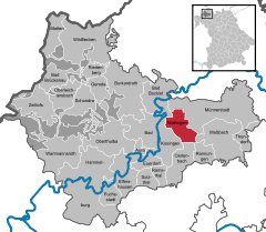
Coordinates 50°13′N 10°8′E / 50.21667°N 10.13333°ECoordinates: 50°13′N 10°8′E / 50.21667°N 10.13333°E Administration Country Germany State Bavaria Admin. region Lower Franconia District Bad Kissingen Local subdivisions 2 Ortsteile Mayor Günter Kiesel (CSU) Basic statistics Area 26.35 km2 (10.17 sq mi) Elevation 256 m (840 ft) Population 4,155 (31 December 2010)[1] - Density 158 /km2 (408 /sq mi) Other information Time zone CET/CEST (UTC+1/+2) Licence plate KG Postal code 97720 Area code 0971 Website www.nuedlingen.de Nüdlingen is a municipality in the district of Bad Kissingen in Bavaria in Germany.
Contents
Divisions of the municipality
The municipality is divided into the following towns:
- Haard
- Nüdlingen
History
Nüdlingen was first mentioned in 772 in the records of the monastery at Fulda.
With secularization of the government in 1803, the territory of the present municipality became part of Bavaria. In the Treaty of Pressburg between France and Austria in 1805, the lands of the Bishop of Würzburg were given to Ferdinand III, Grand Duke of Tuscany, and he was made Grand Duke of Würzburg, a new state, as a reward for his support of Napoleon. These lands then again became part of Bavaria in 1814 (this time permanently) at the defeat of Napoleon.
Population
Year Population 1970 3570 1987 3520 2000 4210 2005 4257 Economy
As of 1998, there were 392 businesses in the municipality. As of 1999, there were 39 agricultural businesses, with 1451 ha under cultivation, 1284 ha in fields, and 163 ha in pasture.
External links
References
- ^ "Fortschreibung des Bevölkerungsstandes" (in German). Bayerisches Landesamt für Statistik und Datenverarbeitung. 31 December 2010. https://www.statistikdaten.bayern.de/genesis/online?language=de&sequenz=tabelleErgebnis&selectionname=12411-009r&sachmerkmal=QUASTI&sachschluessel=SQUART04&startjahr=2010&endjahr=2010.
- This article incorporates information from the German Wikipedia.
Aura | Bad Bocklet | Bad Brückenau | Bad Kissingen | Burkardroth | Elfershausen | Euerdorf | Fuchsstadt | Geroda | Hammelburg | Maßbach | Motten | Münnerstadt | Nüdlingen | Oberleichtersbach | Oberthulba | Oerlenbach | Ramsthal | Rannungen | Riedenberg | Schondra | Sulzthal | Thundorf | Wartmannsroth | Wildflecken | Zeitlofs Categories:
- Municipalities in Bavaria
- Bad Kissingen district


Wikimedia Foundation. 2010.