- Douglas Township, Iroquois County, Illinois
-
Douglas Township — Township — Location in Iroquois County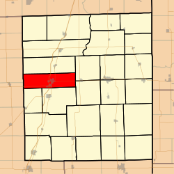 Iroquois County's location in Illinois
Coordinates: 40°46′14″N 88°00′15″W / 40.77056°N 88.00417°WCoordinates: 40°46′14″N 88°00′15″W / 40.77056°N 88.00417°W Country United States State Illinois County Iroquois Established May, 1858 Area – Total 44.7 sq mi (115.78 km2) – Land 44.64 sq mi (115.61 km2) – Water 0.07 sq mi (0.17 km2) 0.15% Elevation 653 ft (199 m) Population (2000) – Total 2,098 – Density 47/sq mi (18.1/km2) Time zone CST (UTC-6) – Summer (DST) CDT (UTC-5) ZIP codes 60930, 60938, 60955, 60959, 60970 GNIS feature ID 0428907 Douglas Township is one of twenty-six townships in Iroquois County, Illinois, USA. As of the 2000 census, its population was 2,098[1]. Douglas Township was formed from a portion of Onarga Township in May 1858.
Contents
Geography
According to the United States Census Bureau, Douglas Township covers an area of 44.7 square miles (116 km2); of this, 44.64 square miles (115.6 km2) (99.85 percent) is land and 0.07 square miles (0.18 km2) (0.15 percent) is water.
Cities, towns, villages
Unincorporated towns
- La Hogue at 40°45′48″N 88°05′17″W / 40.7633683°N 88.0880988°W
- Leonard at 40°46′07″N 87°55′19″W / 40.768646°N 87.9219823°W
(This list is based on USGS data and may include former settlements.)
Cemeteries
The township contains Wenger Cemetery.
Major highways
Airports and landing strips
- Kuiper Landing Strip
School districts
- Crescent Iroquois Community Unit School District 249
- Iroquois West Community Unit School District 10
- Tri Point Community Unit School District 6-J
Political districts
- Illinois' 15th congressional district
- State House District 105
- State Senate District 53
References
- "Douglas Township, Iroquois County, Illinois". Geographic Names Information System, U.S. Geological Survey. http://geonames.usgs.gov/pls/gnispublic/f?p=gnispq:3:::NO::P3_FID:0428907. Retrieved 2010-01-17.
- United States Census Bureau 2007 TIGER/Line Shapefiles
- United States National Atlas
External links

Danforth Township Brenton Township, Ford County
Pella Township, Ford County
Crescent Township
Iroquois Township Douglas Township

Ridgeland Township Onarga Township Municipalities and communities of Iroquois County, Illinois Cities 
Villages Ashkum | Beaverville | Buckley | Chebanse‡ | Cissna Park | Clifton | Crescent City | Danforth | Donovan | Iroquois | Loda | Martinton | Milford | Onarga | Papineau | Sheldon | Thawville | Wellington | Woodland
Townships Artesia | Ash Grove | Ashkum | Beaver | Beaverville | Belmont | Chebanse | Concord | Crescent | Danforth | Douglas | Fountain Creek | Iroquois | Loda | Lovejoy | Martinton | Middleport | Milford | Milks Grove | Onarga | Papineau | Pigeon Grove | Prairie Green | Ridgeland | Sheldon | Stockland
Unincorporated
communitiesAlonzo | Bryce | Claytonville | Coaler | Cutmer | Darrow | Eastburn | Effner | Fountain Creek | Goodwine | Greer | Hallock | Hickman | Hooper | L'Erable | La Hogue | Leonard | North Hooper | Pitchin | Pittwood | Ridgeville | Schwer | Stockland | Webster | Woodland Junction | Woodworth
Footnotes ‡This populated place also has portions in an adjacent county or counties
Categories:- Townships in Iroquois County, Illinois


Wikimedia Foundation. 2010.