- Martinton Township, Iroquois County, Illinois
-
Martinton Township — Township — Location in Iroquois County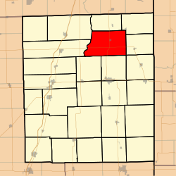 Iroquois County's location in Illinois
Coordinates: 40°54′04″N 87°44′18″W / 40.90111°N 87.73833°WCoordinates: 40°54′04″N 87°44′18″W / 40.90111°N 87.73833°W Country United States State Illinois County Iroquois Established September 1857 Area - Total 54.42 sq mi (140.95 km2) - Land 54.24 sq mi (140.48 km2) - Water 0.18 sq mi (0.47 km2) 0.33% Elevation 623 ft (190 m) Population (2000) - Total 1,063 - Density 19.6/sq mi (7.6/km2) Time zone CST (UTC-6) - Summer (DST) CDT (UTC-5) ZIP codes 60912, 60931, 60951, 60970 GNIS feature ID 0429334 Martinton Township is one of twenty-six townships in Iroquois County, Illinois, USA. As of the 2000 census, its population was 1,063[1]. Buchanan Township formed from a portion of Papineau Township, then known as Wygant Township, in September 1857; its name was changed to Martinton Township on an unknown date.
Contents
Geography
According to the United States Census Bureau, Martinton Township covers an area of 54.42 square miles (140.9 km2); of this, 54.24 square miles (140.5 km2) (99.67 percent) is land and 0.18 square miles (0.47 km2) (0.33 percent) is water.
Cities, towns, villages
Extinct towns
- Freedville at 40°51′39″N 87°44′35″W / 40.8608677°N 87.7430898°W
Cemeteries
The township contains these four cemeteries: Greentown, Mount Olivet, Old Burg and Teege.
Major highways
School districts
- Donovan Community Unit School District 3
- Iroquois County Community Unit School District 9
Political districts
- Illinois' 15th congressional district
- State House District 79
- State Senate District 40
References
- "Martinton Township, Iroquois County, Illinois". Geographic Names Information System, U.S. Geological Survey. http://geonames.usgs.gov/pls/gnispublic/f?p=gnispq:3:::NO::P3_FID:0429334. Retrieved 2010-01-17.
- United States Census Bureau 2007 TIGER/Line Shapefiles
- United States National Atlas
External links

Papineau Township Beaverville Township Ashkum Township
Chebanse Township
Beaver Township  Martinton Township

Iroquois Township Middleport Township Concord Township Municipalities and communities of Iroquois County, Illinois County seat: Watseka Cities 
Villages Ashkum | Beaverville | Buckley | Chebanse‡ | Cissna Park | Clifton | Crescent City | Danforth | Donovan | Iroquois | Loda | Martinton | Milford | Onarga | Papineau | Sheldon | Thawville | Wellington | Woodland
Townships Artesia | Ash Grove | Ashkum | Beaver | Beaverville | Belmont | Chebanse | Concord | Crescent | Danforth | Douglas | Fountain Creek | Iroquois | Loda | Lovejoy | Martinton | Middleport | Milford | Milks Grove | Onarga | Papineau | Pigeon Grove | Prairie Green | Ridgeland | Sheldon | Stockland
Unincorporated
communitiesAlonzo | Bryce | Claytonville | Coaler | Cutmer | Darrow | Eastburn | Effner | Fountain Creek | Goodwine | Greer | Hallock | Hickman | Hooper | L'Erable | La Hogue | Leonard | North Hooper | Pitchin | Pittwood | Ridgeville | Schwer | Stockland | Webster | Woodland Junction | Woodworth
Footnotes ‡This populated place also has portions in an adjacent county or counties
Categories:- Townships in Iroquois County, Illinois


Wikimedia Foundation. 2010.