- Milks Grove Township, Iroquois County, Illinois
-
Milks Grove Township — Township — Location in Iroquois County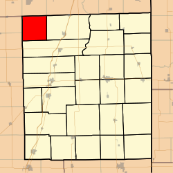 Iroquois County's location in Illinois
Coordinates: 40°57′12″N 88°04′35″W / 40.95333°N 88.07639°WCoordinates: 40°57′12″N 88°04′35″W / 40.95333°N 88.07639°W Country United States State Illinois County Iroquois Established Before 1921 Area – Total 36.35 sq mi (94.16 km2) – Land 36.35 sq mi (94.16 km2) – Water 0 sq mi (0 km2) 0% Elevation 669 ft (204 m) Population (2000) – Total 177 – Density 4.9/sq mi (1.9/km2) Time zone CST (UTC-6) – Summer (DST) CDT (UTC-5) ZIP codes 60911, 60922, 60927, 60941 GNIS feature ID 0429364 Milks Grove Township is one of twenty-six townships in Iroquois County, Illinois, USA. As of the 2000 census, its population was 177[1]. Milks Grove Township formed from a portion of Chebanse Township on an unknown date, but before 1921. Milks Grove is said to be named for the late 19th-century midwestern land speculator Lemuel Milk.
Contents
Geography
According to the United States Census Bureau, Milks Grove Township covers an area of 36.35 square miles (94.1 km2).
Cemeteries
The township contains Milk's Grove Cemetery.
Airports and landing strips
- Berns Airport
- Porter Airport
School districts
- Central Community Unit School District 4
- Herscher Community Unit School District 2
Political districts
- Illinois' 15th congressional district
- State House District 105
- State Senate District 53
References
- "Milks Grove Township, Iroquois County, Illinois". Geographic Names Information System, U.S. Geological Survey. http://geonames.usgs.gov/pls/gnispublic/f?p=gnispq:3:::NO::P3_FID:0429364. Retrieved 2010-01-17.
- United States Census Bureau 2007 TIGER/Line Shapefiles
- United States National Atlas
External links
Municipalities and communities of Iroquois County, Illinois Cities 
Villages Ashkum | Beaverville | Buckley | Chebanse‡ | Cissna Park | Clifton | Crescent City | Danforth | Donovan | Iroquois | Loda | Martinton | Milford | Onarga | Papineau | Sheldon | Thawville | Wellington | Woodland
Townships Artesia | Ash Grove | Ashkum | Beaver | Beaverville | Belmont | Chebanse | Concord | Crescent | Danforth | Douglas | Fountain Creek | Iroquois | Loda | Lovejoy | Martinton | Middleport | Milford | Milks Grove | Onarga | Papineau | Pigeon Grove | Prairie Green | Ridgeland | Sheldon | Stockland
Unincorporated
communitiesAlonzo | Bryce | Claytonville | Coaler | Cutmer | Darrow | Eastburn | Effner | Fountain Creek | Goodwine | Greer | Hallock | Hickman | Hooper | L'Erable | La Hogue | Leonard | North Hooper | Pitchin | Pittwood | Ridgeville | Schwer | Stockland | Webster | Woodland Junction | Woodworth
Footnotes ‡This populated place also has portions in an adjacent county or counties
Categories:- Townships in Iroquois County, Illinois


Wikimedia Foundation. 2010.