- One Mile, New South Wales
-
For the suburb of the same name in Queensland, see One Mile, Queensland.
One Mile
New South Wales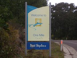
Road sign at the northern entrance to One Mile.Population: 185[1] Note1 Postcode: 2316 Coordinates: 32°46′S 152°6.76′E / 32.767°S 152.11267°ECoordinates: 32°46′S 152°6.76′E / 32.767°S 152.11267°E Area: 4.7 km² (1.8 sq mi) Note4 Time zone: • Summer (DST)
AEST (UTC+10) AEDT (UTC+11)
Location: - 202 km (126 mi) NNE of Sydney
- 55 km (34 mi) NE of Newcastle
- 41 km (25 mi) ENE of Raymond Terrace
LGA: Port Stephens Council Region: Hunter County: Gloucester[2] Parish: Tomaree[2] State District: Port Stephens Federal Division: Paterson Mean max temp Mean min temp Annual rainfall 27.3 °C
81 °F8.4 °C
47 °F1,348.9 mm
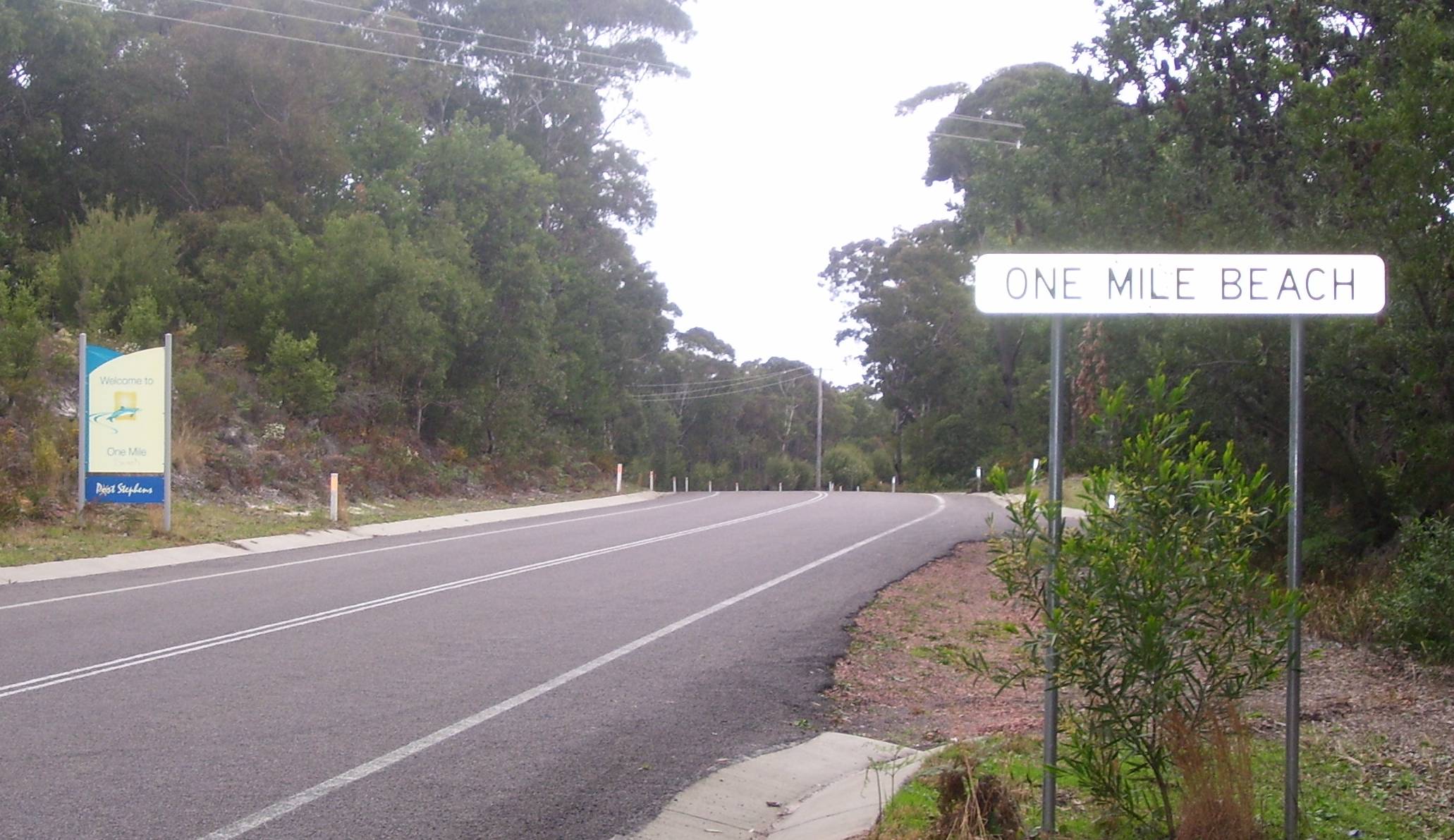
53.1 inSuburbs around One Mile: Anna Bay Nelson Bay, Fingal Bay Fingal Bay Anna Bay One Mile Tasman Sea Anna Bay Boat Harbour Tasman Sea 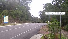 Road signs identifying suburb as both One Mile and (incorrectly) One Mile Beach
One Mile is a suburb of the Port Stephens Local Government Area in the Hunter Region of New South Wales, Australia.[3] The suburb is semi-rural with a small urban settlement west of Gan Gan Road and a number of caravan parks to the east of Gan Gan Road. The parks are positioned to provide quick access to the suburb's two beaches.[4]
One Mile Beach, after which the area was named, is a family-friendly surf beach that is popular with tourists while Samurai Beach is clothing optional. Both beaches, like a large percentage of the locality, lie within the Tomaree National Park. The beaches form most of the coastline in Anna Bay which gave the adjacent suburb of Anna Bay its name.[5]
Although the suburb is formally called One Mile residents often refer to it as One Mile Beach. Even some road signs identify the area incorrectly as One Mile Beach.
Notes
- ^ The population data presented here is not an accurate indication of the population of One Mile as it includes Anna Bay and Boat Harbour residents living south of Gan Gan Road while excluding One Mile residents living to the west of Gan Gan Road.[6] Based on aerial imagery provided by the Land and Property Management Authority there is a strong likelihood that the population of One Mile is higher than the figure presented by the Australian Bureau of Statistics.[4]
- ^ Area calculation is based on 1:100000 map 9232 NEWCASTLE.
References
- ^ Australian Bureau of Statistics (25 October 2007). "One Mile (State Suburb)". 2006 Census QuickStats. http://www.censusdata.abs.gov.au/ABSNavigation/prenav/LocationSearch?collection=Census&period=2006&areacode=SSC18465&producttype=QuickStats&breadcrumb=PL&action=401. Retrieved 31 May 2008. Map
- ^ a b "Geographical Names Register Extract: One Mile (suburb)". Geographical Names Register (GNR) of NSW. Geographical Names Board of New South Wales. http://www.gnb.nsw.gov.au/name_search/extract?id=KWYbFxWAIt. Retrieved 31 May 2008.
- ^ "Suburb Search - Local Council Boundaries - Hunter (HT)". New South Wales Department of Local Government. http://www.dlg.nsw.gov.au/dlg/dlghome/dlg_Regions.asp?region=HT®iontype=1. Retrieved 31 May 2008.
- ^ a b "One Mile". Land and Property Management Authority - Spatial Information eXchange. New South Wales Land and Property Management Authority. http://imagery.maps.nsw.gov.au/?role=mysuburb&search=suburb&suburb=One%20Mile. Retrieved 31 May 2008.
- ^ "Geographical Names Register Extract: Anna Bay (bay)". Geographical Names Register (GNR) of NSW. Geographical Names Board of New South Wales. http://www.gnb.nsw.gov.au/name_search/extract?id=MawGXt. Retrieved 31 May 2008.
- ^ "One Mile (State Suburb) map". 2006 Census QuickStats. Australian Bureau of Statistics. 25 October 2007. http://www.censusdata.abs.gov.au/ABSNavigation/ImageServer?id=map,Census,2006,SSC18465. Retrieved 23 May 2008.
- "Nelson Bay (Nelson Head)". Climate statistics for Australian locations. Bureau of Meteorology. http://www.bom.gov.au/climate/averages/tables/cw_061054.shtml. Retrieved 2 June 2008.
Towns, suburbs and localities of Port Stephens Council | Hunter Region | New South Wales Towns, suburbs
& localitiesAnna Bay • Balickera • Boat Harbour • Bobs Farm • Brandy Hill • Butterwick • Campvale • Corlette • Duns Creek • Eagleton • East Seaham • Fern Bay • Ferodale • Fingal Bay • Fishermans Bay • Fullerton Cove • Glen Oak • Heatherbrae • Hinton • Karuah • Lemon Tree Passage • Mallabula • Medowie • Nelson Bay • Nelsons Plains • One Mile • Osterley • Oyster Cove • Raymond Terrace • Salamander Bay • Salt Ash • Seaham • Shoal Bay • Soldiers Point • Swan Bay • Tanilba Bay • Taylors Beach • Tomago • Twelve Mile Creek • Wallalong • Williamtown • Woodville
Other places &
points of interestEdgeworth David quarry • Hunter River • Karuah River • Newcastle Airport • Paterson River • Port Stephens • RAAF Base Williamtown • Stockton Beach • MV Sygna shipwreck • Tomaree National Park • Williams River
Categories:- Suburbs of Port Stephens Council
- Bays of New South Wales
- Beaches of New South Wales

Wikimedia Foundation. 2010.