- Anna Bay, New South Wales
Infobox Australian Place
type = suburb
name = Anna Bay
state = nsw
imagesize = 270
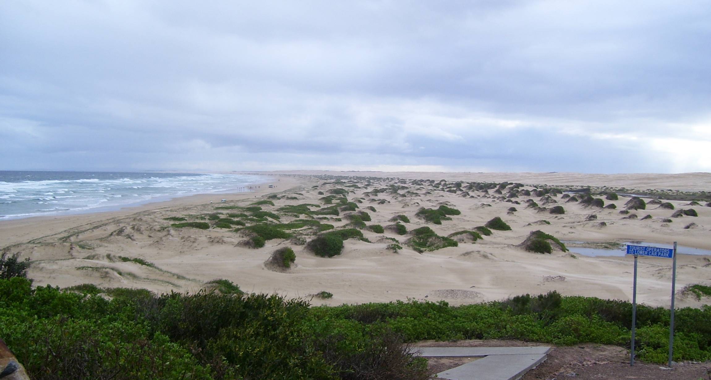
caption = North-eastern end of Stockton Beach at Anna Bay
pop = 2,638
pop_footnotes = Census 2006 AUS|id=UCL101200|name=Anna Bay (Urban Centre/Locality)|accessdate=2008-05-19|quick=on|] ref|population|Note1
density = 1819.3
density_footnotes = ref|density|Note2
est =
postcode = 2316
coordinates = coord|32|46|S|152|05|E|type:town_region:AU-NSW|display=inline,title
elevation =
elevation_footnotes=
area = 23.1
area_footnotes = ref|area|Note3
timezone = AEST
utc = +10
timezone-dst = AEDT
utc-dst = +11
propval = $400,000 [cite web|url=http://www.domain.com.au/public/suburbprofile.aspx?searchTerm=Anna+Bay&mode=research#mapanchor|title=Anna Bay suburb profile @ domain.com.au|publisher=domain.com.au|accessdate=2008-05-19]
dist1 = 200
dir1 = NNE
location1 =Sydney
dist2 = 51
dir2 = NE
location2 = Newcastle
dist3 = 34
dir3 = E
location3 = Raymond Terrace
lga =Port Stephens Council cite web|url=http://www.dlg.nsw.gov.au/dlg/dlghome/dlg_Regions.asp?regiontype=2&slacode=6400®ion=HT|title=Suburb Search - Local Council Boundaries - Hunter (HT) - Port Stephens|publisher=New South Wales Department of Local Government |accessdate=2008-06-08]
region = Hunter
county = Gloucestercite web|url=http://www.gnb.nsw.gov.au/name_search/extract?id=MnqwlMWAMn|title=Geographical Names Register Extract: Anna Bay (suburb)|work=Geographical Names Register (GNR) of NSW|publisher=Geographical Names Board of New South Wales |accessdate=2008-05-19] cite web|url=http://www.gnb.nsw.gov.au/name_search/extract?id=MawGjz|title=Geographical Names Register Extract: Anna Bay (town)|work=Geographical Names Register (GNR) of NSW|publisher=Geographical Names Board of New South Wales |accessdate=2008-05-19]
parish = Tomaree
stategov = Port Stephens
fedgov = Paterson
maxtemp = 27.3
mintemp = 8.4
rainfall = 1348.9
near-n = Taylors Beach, Salamander Bay
near-ne = Nelson Bay
near-e = One Mile, Boat Harbour
near-se = Boat Harbour, Fishermans Bay
near-s = "Tasman Sea ", Fishermans Bay
near-sw = "Tasman Sea "
near-w = Bobs Farm
near-nw = "Port Stephens ", Taylors BeachAnna Bay is the name of a suburb, a town and a bay in the Port Stephens Local Government Area in the
Hunter Region ofNew South Wales ,Australia .cite web|url=http://www.gnb.nsw.gov.au/name_search/extract?id=MawGXt|title=Geographical Names Register Extract: Anna Bay (bay)|work=Geographical Names Register (GNR) of NSW|publisher=Geographical Names Board of New South Wales |accessdate=2008-05-23] It is immediately adjacent to the north-eastern end of Stockton Beach and the town provides one of the major entry points to the beach here. [DoL suburb image|name=Anna Bay|codename=Anna%20Bay|accessdate=2008-05-19] Anna Bay was named after the bay of the same name which is now located in the adjacent suburb of One Mile.During
World War II Stockton Beach was heavily fortified against a possible amphibious assault byImperial Japanese forces and a line of tank traps was installed to prevent entry to the local area through the town. Many of the tank traps were removed after the war and now feature significantly around the car parking areas at the beach.Gallery
Notes
# ABS Quickstats are not available for the geographically recognised suburb of Anna Bay or for just the township itself. The population figure stated in this article is for both the Anna Bay township and the residential part of Fishermans Bay.
# The population density provided here is for both the Anna Bay township and the residential part of Fishermans Bay. See Note 1 above for more information.
# The area calculation is based on NSW GNB maps for the whole suburb of Anna Bay. The area of the Anna Bay township and the residential part of Fishermans Bay that was used to calculate the population density (see Notes 1 & 2 for further information) is Convert|1.45|km2|sqmi|2|lk=on. Most of Anna Bay consists of unpopulated beaches and wetlands and sparsely populated rural areas. However, there are also some other residential areas, mainly on Nelson Bay Road, for which data is not available. For this reason the population density provided cannot be assumed to be representative of the whole suburb.References
*
External links
* [http://www.australianexplorer.com/anna_bay.htm Anna Bay at Australian Explorer]
Wikimedia Foundation. 2010.