- Blue Knob (Pennsylvania)
Geobox|Summit
name = Blue Knob
native_name =
other_name =
other_name1 =
topo_maker = USGS
topo_
range = Allegheny Mountains
parent = Allegheny Front
category =
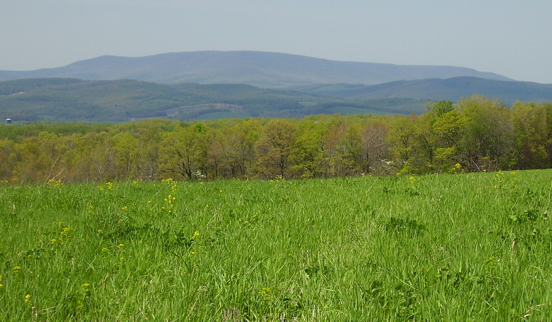
image_caption = Blue Knob Mountain.
etymology_type =
etymology =
country = United States
country_
state = Pennsylvania
state_
region_type = County
region = Bedford
district_type =
district =
district1 =
district2 =
city =
city1 =
location =
lat_d = 40
lat_m = 17
lat_s = 18
lat_NS = N
long_d = 78
long_m = 33
long_s = 43
long_EW = W
elevation_imperial = 3136
elevation_round = 1
prominence_imperial = 800
prominence_note = [Key col elevation between 2,320 and 2,340 ft at coord|40|21.4|N|78|33.5|W |region:US-PA. ]
area_unit = acre
area_imperial =
area_round = 1
area_note =
area1_imperial =
area1_type =
length_imperial =
length_orientation =
width_imperial =
width_orientation =
highest =
highest location =
highest_lat_d =
highest_lat_m =
highest_lat_s =
highest_lat_NS =
highest_long_d =
highest_long_m =
highest_long_s =
highest_long_EW =
highest_elevation_imperial =
lowest =
lowest_location =
lowest_lat_d =
lowest_lat_m =
lowest_lat_s =
lowest_lat_NS =
lowest_long_d =
lowest_long_m =
lowest_long_s =
lowest_long_EW =
lowest_elevation_imperial =
biome =
biome_share =
biome1 =
biome1_share =
geology = Burgoon Sandstone
geology1 =
plant =
plant1 =
animal =
animal1 =
access = drive-up via Knob Road
established_type =
established =
established_note =
established1_type =
established1 =
established1_note =
owner = Pennsylvania Department of Conservation and Natural Resources
management =
management_lat_d =
management_lat_m =
management_lat_s =
management_lat_NS =
management_long_d =
management_long_m =
management_long_s =
management_long_EW =
management_elevation =
visitation =
visitation_year =
free_type = Nearest city
free_label = Nearest city
free = Pavia,Pennsylvania
free1_type =
free1 =

map_caption = Location of Blue Knob in Pennsylvania
map_locator = Pennsylvania
map_first =
website = [http://www.dcnr.state.pa.us/stateparks/parks/blueknob.aspx Blue Knob State Park]Blue Knob is a peak in the
Allegheny Mountains ofPennsylvania in theUnited States at 3,136 feet (955 m) above sea level. It is distinctive in that its broad dome dominates the countryside. Blue Knob is the most northern of the 3,000 footers in the Allegheny Mountain range. Until 1921, Blue Knob was believed to be the highest mountain in Pennsylvania. TheU.S. Geological Survey then determined that a point on Negro Mountain, in Somerset County, to be higher at 3,213 feet (979 m), later named Mount Davis.A portion of the mountain lies within the
Blue Knob State Park , which covers 5,874 acres (24 km²) and contains approximately 18 miles (29 km) of hiking trails and numerous overlooks. A ski area is located on the mountain's north slopes.The towns of Johnstown, Altoona and Bedford are located within 25 miles (40 km) of the mountain. The towns of Pavia and Claysburg lie at the foot of the mountain.
Geology
The
geology of Blue Knob is what gave the mountain its isolated position, separated from the rest of theAllegheny Front escarpment . The lower base of the mountain is made up ofsiltstone andshale of theDevonian Catskill Formation and theDevonian -Mississippian Rockwell Formation. The upper slopes and summit are made up of the buff-coloredMississippian Burgoon Formation ofsandstone and conglomerate, which is far more resistant to weathering than the underlyingshale andsiltstone . The rocks near the summit have a bluish-green appearance, giving Blue Knob its name.The satellite peaks of Blue Knob include:
Herman Point 3,034 feet (925 m),Spruce Knob 2,475 feet (754 m),Round Knob 2,791 feet (851 m),Cattle Knob 2,842 feet (866 m),
Pine Knob 2,704 feet (824 m),Ritchey Knob 2,865 feet (873 m) andSchaefer Head 2,950 feet (899 m)These peaks along with Blue Knob form a grouping of mountains that stand out as a
massif from the rest of theAllegheny Front and form some of the highest elevations in Pennsylvania'sAllegheny Mountains .ummit
Blue Knob's summit was once used as a location for an
Air Force long-rangeradar station , known as the Claysburg AFS, during the early years of theCold War in the 1950s. The 772nd AC&W Squadron was the unit located at the facility and lived in the barracks on the summit of the mountain. The station was deactivated in 1961 and shortly after the Blue Knob Ski area was developed. Signs from the former station are still noticeable on the summit as one of the buildings was converted for use as a ski lodge. The remaining buildings and structures, including afire lookout tower have been removed.The area was cleared of vegetation during the time of the radar installation and thus remains as a bald summit. Today ski lifts, a ski lodge and a couple of maintenance structures occupy the broad summit of Blue Knob. There are also a few ski chalets located just down from the summit area.
The views from the summit on a clear day are extensive. Views to the north include;
Brush Mountain (17 miles),Schaefer Head (2.5 miles) and the other satellite peaks listed above, the Allegheny Front, The "Loop" inTussey Mountain (27 miles) andLock Mountain (13 miles).To the east the views are of
Dunning Mountain (7 miles),Tussey Mountain (16 miles),Jacks Mountain withButler Knob (31 miles),Sideling Hill (28 miles), and on the distant horizonBig Mountain (41 miles) and theTuscarora Mountain Ridge. To the south;Wills Mountain (32 miles),Savage Mountain (28 miles) and Bald Knob on the Allegheny Front (20 miles). The town of Bedford is hidden byKinton Knob (18 miles).The views west include Laurel Hill and the Conemaugh Gorge (22 miles) and the
Allegheny Plateau .Climate
Blue Knob is infamous for its wind and snowy conditions. The state record snowfall was recorded on the mountain at 225 inches during the winter of 1890-91. In the month of December 1890, 86 inches fell on the mountain alone. Average snowfall is about convert|12|ft|m annually, while temperatures usually are 10 to 12 degrees cooler than in the surrounding towns.
Blue Knob's weather can be attributed to its
aspect and elevation. The mountain rises approximately 500 + feet above the plateaus to the west. Theprevailing winds hit the mountain's slopes, accelerating up and over its bald summit. It is these conditions that can causewind chill factors to dip below zero during the winter months.Drainages
The mountain has many springs that flow out of it and streams that run down its hollows. A few of the major streams are Big Lick Branch, Rhodes Run, Pavia Run, Deep Hollow Run, Scubgrass Creek, Beaverdam Creek and Little Beaverdam Creek.
Bob's Creek which is in the valley below the mountain is a "Class A" trout stream and popular among local fisherman. Adjacent to the mountain on the Allegheny Front are Big Break Hollow and Wallacks Branch, portions of these streams are located within the State Park boundary.Vegetation
On the lower slopes of the mountain along the streams, Eastern Hemlock can still be found, Pennsylvania's state tree. The drier east and southeast face of the mountain is predominately Red and White oak and maple mix, with grapevines and some exotic invasive species where there are holes in the canopy. While the north and western face of the mountain contain
Tulip poplar ,American Beech and other associated hardwoods due to the richer soils. The upper slopes of the mountain haveBlack Cherry ,Striped Maple ,Scrub Oak and a forest floor ofBlueberry andFern . Over the convert|3000|ft|m|sing=on contour the trees are distinctively stunted due to the winds and fierce weather.In September 2004, during
Hurricane Ivan , strong winds calledderechos streamed through the saddle between Herman Point and Blue Knob, leveling trees on the ridges that abut the mountain. Many of the larger trees were blown down like match sticks, opening great holes in the forest canopy. The park conducted salvage efforts to remove wood from the park and reopen trails and camp areas.Wildlife
Wildlife is abundant on the slopes of Blue Knob. Species such aswhite-tailed deer ,ruffed grouse ,turkey ,coyote ,porcupine andfox are difficult to see but finding their tracks in the snow is not uncommon. Black bear is another resident on the mountain and are more likely to be seen during the early morning and evening hours.Red-tailed hawks ,warblers , vireos and songbirds are found here throughout the seasons.Adjacent to the State Park is the 11,926 acre (48 km²)
Pennsylvania State Game Lands No. 26. This area combined with the park is an area over 17,000 acres (69 km²) of public land. There are a few areas in Blue Knob State Park which are closed to hunting (see park map). Hikers need to be extremely careful during the hunting season in late November and through December.Hiking
Blue Knob contains a vast network of hiking trails that range from easy walks to difficult and challenging day hikes. The total network of trails is approximately convert|18|mi|km in length. Most of these trails are multiple use for hiking,
cross country skiing ,mountain biking , horseback riding andsnowmobiling . Below is a brief description of each trail that can be found on the mountain.Mountain View Trail
This trail is convert|5|mi|km in length and one of the more difficult on the mountain. It is marked with a double red blaze and the trailhead can be found on the Tower Road just below the summit. The Mountain View Trail begins at about the convert|3000|ft|m|abbr=on contour and begins by looping around a gentle grade on the upper portion of the mountain's east shoulder. This part of the mountain is marked by stunted and wind deformed trees, mainly
scrub oak andstriped maple . Also large slabs of the conglomerate rocks that form this mountain may be seen strewn about on these upper slopes. This trail passes two lookouts, the Pavia and Queen before descending into the Beaverdam Creek drainage and the lowest portion of this trail at the convert|2000|ft|m|abbr=on contour. The trail then traverses the east face of the mountain to the Willow Springs picnic area before it begins its steep ascent on the west face of the mountain and back to the trailhead.Three Springs Trail
Three Springs Trail trail is convert|2|mi|km in length and follows and old roadbed. The trail is wide and good for snowmobiles and horseback riding. This trail can be accessed from the Mountain View Trail at about the convert|3050|ft|m|abbr=on contour and generally runs downslope before it bisects the east face, and ends at the convert|2500|ft|m|abbr=on contour where it junctions once again with the Mountain View Trail. Along its length you can see how the trail got its name by the number of springs that are used for supplying water to the villages below the mountain.
Rock N' Ridge Trail
The trail begins at the convert|1550|ft|m|abbr=on contour just above the gated entrance to the park headquarters. It is convert|2.8|mi|km in length and marked by an inverted blue "T". The trail is located on the west side of the mountain and begins by following a ridge that abuts the main dome of the mountain. On this trail you may see
mountain laurel which is the Pennsylvania State Flower. When the mountain laurel blooms in June it makes for a very scenic hike. The trail eventually junctions into the Sawmill Trail at the convert|2400|ft|m|abbr=on contour, before this however, the trail has a turnoff which willdescend the Pavia Run drainage and end at the Mowry Hollow Picinc Area.Sawmill Trail
The Sawmill Trail crosses the west face of the mountain and is convert|3|mi|km in length marked by yellow blazes. This is another wide trail that follows an old roadbed and is conducive to snowmobiles and mountain biking. The trailheads are located at either end of the trail off the Knob Road or on State Route 403 on Ickes Hill. If you begin on Ickes Hill, you will begin ascending the southwest buttress of the mountain to the Willow Springs Picinic Area at the convert|2250|ft|m|abbr=on contour. From there you will navigate shortly on the Mountain View Trail before you again pick up the Sawmill Trail. The trail moves across the hollows of the mountain at approximately the convert|2400|ft|m|abbr=on contour before it ends at that north end of Chappel Field and the trail head on the Knob Road. This hike takes you through rich hardwoods and passes over mountain seeps which drain from the upper slopes of the mountain, it is one of the easier hikes in the park.
Homestead Trail
This trail is a small loop at convert|1.8|mi|km in length and marked by orange blazes. The Homestead Trail may be gained by access off the Whysong Road or by a connector trail off the Sawmill Trail. The hike is on the lower portions of the mountain and only gains to the convert|2100|ft|m|abbr=on contour. The trail is easy and wide open and as its name suggests, marks the site of an old settlers house site. Hiking along this pathway affords good opportunities for viewing wildlife.
Chappell's Field Trail
The Chappell's Field Trail is accessible at points on the Knob Road and campground areas. The trail is located on one of the main ridges that are found on the west side of the mountain. On the top of this ridge, which is over convert|2400|ft|m|abbr=on, Chapell's Field holds one of the best views in the park as it looks up at the main summit of Blue Knob and down on the valley below. The trail encircles the top of this ridge and is convert|2.5|mi|km in length, a loop marked by inverted orange "V" blazes.
Crist Ridge Trail
The convert|1.9|mi|km|sing=on orange blazed trail connects to the Chappell's Field Trail at the convert|2250|ft|m|abbr=on contour and winds its way down the ridge ending on the Knob Road. This trail had large areas of blowdowns on it following the wind events in September 2004. Since then the trail has been cleared and is a good trail for mountain biking and cross country skiing. In the winter with the
foliage down, views of Blue Knob Mountain can be seen through the trees.Lost Turkey Trail
This is the longest and most difficult trail at convert|26|mi|km long. The trail begins on convert|3034|ft|m|sing=on Herman Point and is marked by red blazes. The trail crosses over both public and private lands as it eventually ends in neighboring Somerset County. To begin this hike you must proceed up the Tower Road and pass by the gated road which leads to Herman Point and the
transmitter towers on its summit. Just behind the fenced in towers, you can see the trail which proceeds down the steep face of the mountain into the Rhodes Run drainage. From here the trail follows Ciana Run before crossing Hogback ridge, then beginning its steep ascent up Forks Ridge and the Allegheny Front beyond. Once on top of theAllegheny Plateau it winds its way through high elevation forests and mountainbogs . Proper footwear is recommended for this hike as it is steep in some areas and stream crossings are required along its length.Connector Trails
There are several connector trails that make up the remaining mileage on Blue Knob's trails system. They are double blue blazed markings and vary in length and difficulty.
References
* cite web
url = http://www.topoquest.com/map.asp?lat=40.28866&lon=-78.56328&datum=nad27&u=4&layer=DRG25&s=50
title = Latitude and Longitude from TopoQuest
publisher = TopoQuest.com* cite web
url = http://www.dcnr.state.pa.us/stateparks/parks/blueknob.aspx
title = Blue Knob State Park
access date = 2007-02-25
publisher =Pennsylvania Department of Conservation and Natural Resources Alan R. Geyer (1979) "Outstanding Geologic Features of Pennsylvania",
Geological Survey of Pennsylvania Charles H. Shultz (1999) "The Geology of Pennsylvania",
Geological Survey of Pennsylvania ISBN 0-8182-0227-0Jere Martin (1997) "Pennsylvania Almanac" published by: Stackpole Books ISBN 0-8117-2880-3
External links
* [http://www.peakbagger.com/peak.aspx?pid=7341 Peakbagger.com]
* [http://www.onthesnow.com/PA/59/weather.html?XE_AFF=Visalia%20Times-Delta&XE_LNK=Weather Current conditions at Blue Knob]
* [http://www.topoquest.com/map.asp?lat=40.28833&lon=-78.56194&datum=nad27&u=4&layer=DRG25&size=l&s=100 Topographic map of Blue Knob]
* [http://www.peakware.com/peaks.html?pk=1076 Blue Knob at Peakware.com]
* [http://www.summitpost.org/mountain/rock/152995/blue-knob.html Blue Knob at Summitpost.org]
* [http://terraserver-usa.com/image.aspx?T=1&S=14&Z=17&X=221&Y=1394&W=2 Aerial photo by Terra Server]


Wikimedia Foundation. 2010.