- Davao River
-
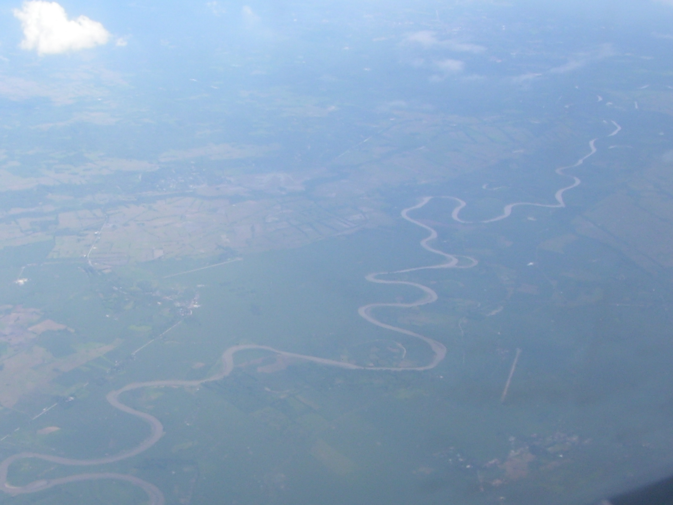
Davao River Ilog ng Davao River  Aerial photograph of Davao River
Country  Philippines
Region Northern Mindanao (Bukidnon) and Davao Region Tributaries - right Salug River Source Salug River - location San Fernando, Bukidnon Mouth - location Davao Gulf - elevation 0 m (0 ft) Length 150 km (93 mi) Basin 1,623 km2 (627 sq mi) The Davao River catchment is the third largest river catchment on the Southern Philippines Island of Mindanao. It drains an area of over 1700 km² with a river length of 160 km. Most of the area is uplands. Average flows within the river near to the mouth are estimated at 70-80 cubic meters per second. The climate type is relatively uniform throughout the year with evenly distributed rainfall and temperatures and humidity (rainfall = 2600mm, Actual Evap 1028mm). The area rarely experiences typhoons.
Contents
Stats
- River Length: 150 km[1]
- Maximum Elevation: 1875m
- Rainfall Average: Mean annual rainfall is 1800mm. Rainfall is evenly distributed throughout the year.
Topography/Soil Type
Plains and Valley: Parent Material:
- San Maguel Silty Clay Loam: Alluvium of igneous
- Matina Clay Loam : Alluvium from limestone, shale and sandstones
Intermediate Upland:
- Tugbok Clay: Igneous rock Andesites
- Faraon Clay: Soft Coralline limestone
- Cabantain Clay: Soft shales with mix of weathered gravels and pebbles
Hills and Mountains:
- Camansa sandy clay loam: Shale and sandstone with weathered gravel and sand
- Mountain Soils: undifferentiated : Various igneous and metamorphic rock
Demographic properties
- DRW Population: ~ 800,000
- Average per capita income: 144,039 per family per annum (2000 National average)
- Industrial and agricultural Gross Domestic Product: 64.1 Billion Peso for Region XI
- Population Below Poverty Line: 45% in rural areas ; 27% in urban areas (for southern Mindanao)
- Water Poverty Index parameters: Medium (WPI 56-61.9).
Land uses
The landform and landcover within the basin is highly diverse. Ranging from lowland urban, agricultural, wetland and mangrove to natural riparian, plantations, upland agriculture and mountainous forest including primary forest. The area is classified by DENR as 77.5% forestlands and 22.5% alienable and disposable land. This is not a true land uses (or land cover) classification. Detailed land use is not available. Information is available from several sources including the Comprehensive Land Use Plan of the City, however this data is as yet theoretical and does not represent the realities or suitability of land at the barangay (lowest tier of local government) level. However the City Planning Office is collecting and digitizing data for land use maps.
Water resources and uses in the basin
River discharge measurements taken from 1984 to 1990 indicated an average river flow of approximately 78 cubic meters per second for the period.
The main drinking water sources for Davao City are in the neighboring Talomo watershed. These sources are under pressure and the Davao River Basin is likely to be required for water abstraction in the near future.
The Environmental Management Bureau samples 8 sites from the confluence of the Tamugan river downsteam to the mouth of the river. From the Tamugan River confluence with the Davao River down stream to DDF Subdivision, Mandug the water is classified as Class A – Public Water Supply Class II. Downstream of this point to the sea is classified as Class B or recreational water class I. Analyses for dissolved oxygen over the past 4 years has indicated no significant change in quality. The current monitoring of water quality is insufficient to monitor and evaluate pollution levels and trends in the river.
External links
References
- ^ "Principal River Basins of the Philippines", Published by the National Water Resources Board, October 1976 (p. 12)
- D Hearne, crs, proposal to HELP UNESCO, 2004
Principal River Systems of the Philippines Watershed Size Abra River · Abulog River · Agno River · Agus River · Agusan River · Bicol River · Buayan-Malungun River · Cagayan River · Cagayan River (Mindanao) · Davao River · Ilog-Hilabangan River · Jalaur River · Mindanao River · Pampanga River · Panay River · Pasig-Marikina River (Pasig River and Marikina River) · Tagoloan River · Tagum-Libuganon River
Coordinates: 7°04′N 125°37′E / 7.067°N 125.617°E Davao Water PartnershipCategories:- Rivers of the Philippines
Wikimedia Foundation. 2010.