- Agno River
Geobox River
name = Agno River
native_name =
other_name =
other_name1 =
other_name2 =
other_name3 =
other_name4 =
other_name5 =
image_size =
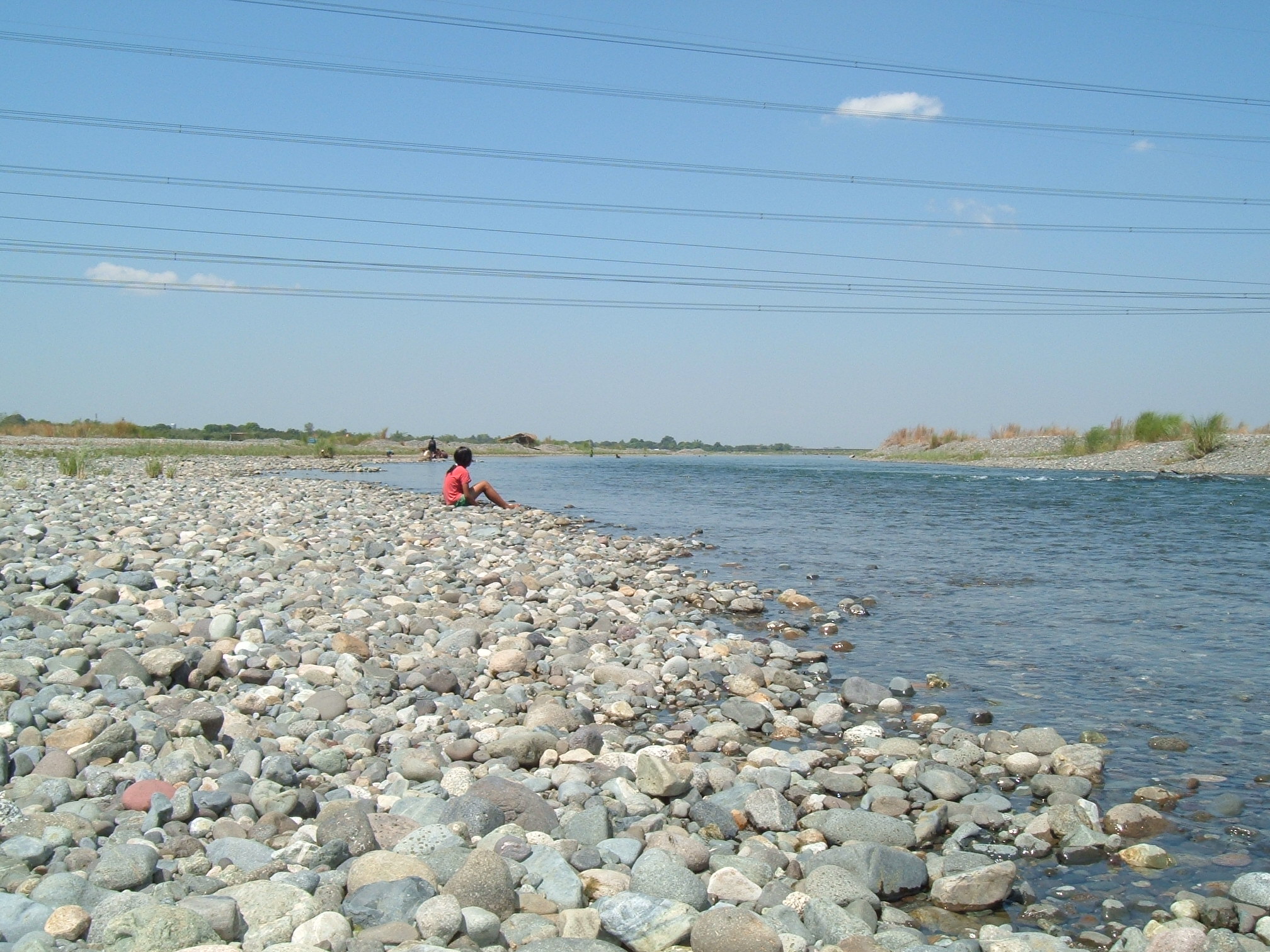
image_caption = A portion of the Agno River that is flowing down from San Roque Dam to in between the town of Asingan and Sta. Maria,Pangasinan .
country = flagicon|PhilippinesPhilippines
region =Central Luzon
region1 =Cordillera Administrative Region
district =
district1 =
city =
city1 =
length = 206
length_round = 0
watershed = 5952
watershed_round = 0
discharge_location =Lingayen Gulf
discharge = 660
discharge_round = 2
discharge_max =
discharge_max_round =
discharge_min =
discharge1_location =
discharge1 =
source_name =
source_location =Cordillera Mountains
source_district =
source_region =
source_state =
source_country =
source_lat_d =
source_lat_m =
source_lat_s =
source_lat_NS =
source_long_d =
source_long_m =
source_long_s =
source_long_EW =
source_elevation = 2090
source_length =
mouth_name =
mouth_location = Lingayen Gulf
mouth_district =
mouth_region =Central Luzon
mouth_country =
mouth_lat_d =
mouth_lat_m =
mouth_lat_s =
mouth_lat_NS =
mouth_long_d =
mouth_long_m =
mouth_long_s =
mouth_long_EW =
mouth_elevation = 0
tributary_left =Tarlac River
tributary_left1 =
tributary_right =
tributary_right1 =
free_name =
free_value =
map_size = 250
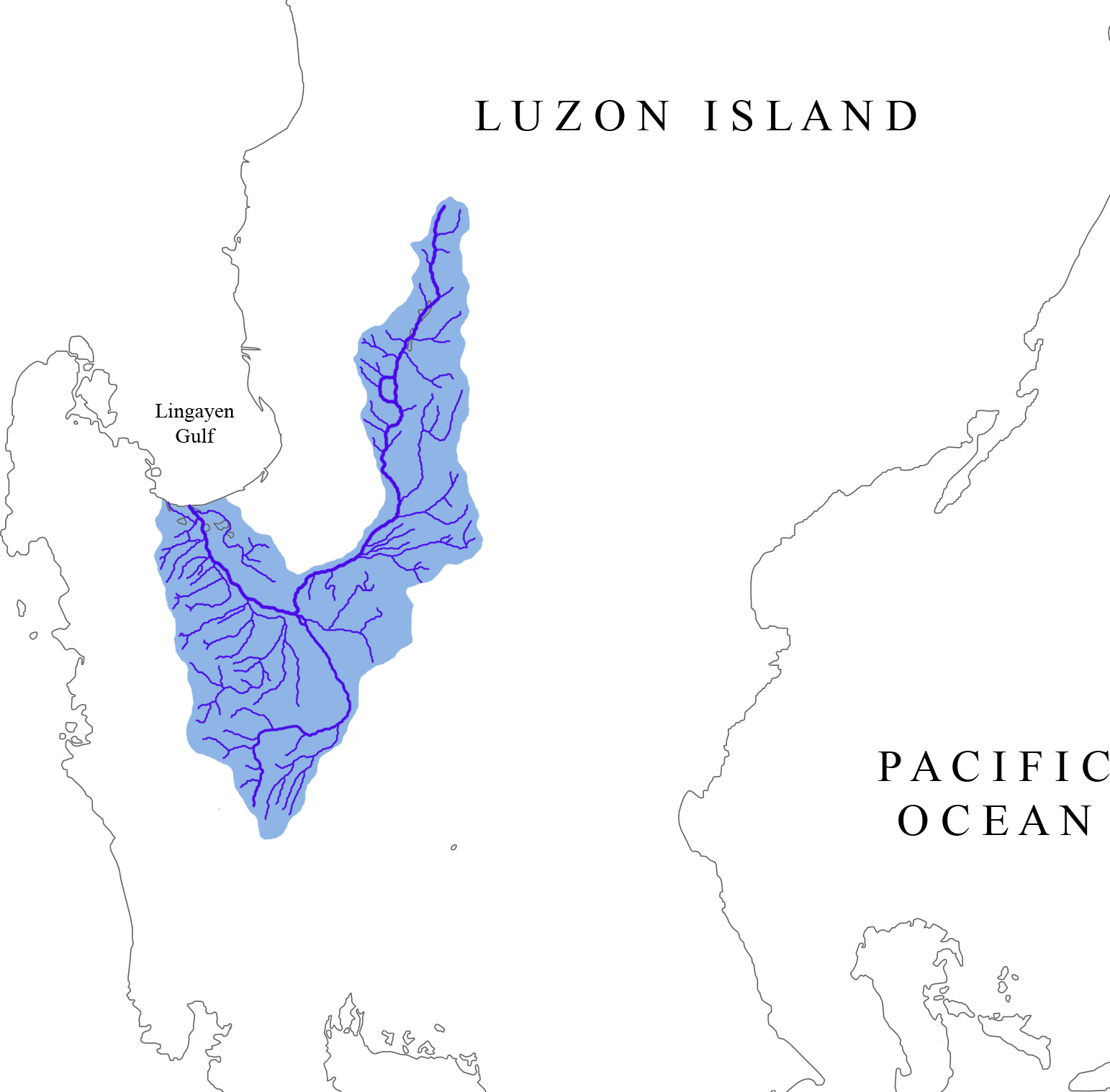
map_caption = Watershed of the Agno RiverAgno River is a river in the Philippine island of
Luzon , in the province ofPangasinan . It originates in theCordillera Mountains and empties into theSouth China Sea via theCordillera Mountains . The river is 206km long.Topography
The Agno River is the main drainage system of the area and has a catchment area of 5,952 square kilometers. It is the third largest river in Luzon (next to
Cagayan River andPampanga River ) and the fifth largest river in the Philippines.The Agno is the largest Philippine river in terms of water discharge, draining around 6.6 cubic kilometers of fresh water into
Lingayen Gulf , or almost 70% of the total fresh water input into the gulf.The headwaters of Agno River are at the slopes of
Mount Data in the Cordillera Mountains at an elevation of 2,090 m, where it drains Cretaceous to Paleocene igneous basement rocks, and marine siliciclastic and carbonate rocks. Of its total length, about 90 kilometers runs through mountainous terrain and canyons.As the river descends following a southerly course, it exhibits a braided channel pattern. It then transforms into a southwest-directed meandering river as it crosses the
Central Luzon Plain . From its confluence with theTarlac River emanating from the south, the Agno River then veers northward while draining the eastern flanks of theZambales Mountains .The Agno's principal tributaries include the Pila, Camiling, Tarlac and Ambayoan Rivers. The main branch of the Agno River is Tarlac River which originates from
Mount Pinatubo (elevation 1,745 m) inTarlac and joins the Agno River atPoponto Swamp nearBayambang . The swamp has an area of about 25 square kilometers and temporarily retains flood waters fromTarlac River .After passing through mountains at an average elevation of some 2,000 feet (180 m) ASL, the Agno River forms a vast alluvial fan and delta called the Pangasinan Plain, a historically vital ecoonomic hub on Luzon Island.
A number of faults of local and regional significance cut across the river. Joint systems are also found in the area. These faults and joints reduce the rock strength and rock coherence through which water could pass or slippage could occur.
The
Philippine Fault System -Digdig Fault System , which has been assessed as the causative fault of theJuly 16 ,1990 earthquake, San Manuel Fault, Bulangit Fault and the San Roque Fault are some of the major fault lines crossing the river.Flora and fauna
Spanish explorers who documented the catchment area of the river in the 16th century say the mouth of the Agno was an extensive marshland with rich alluvial soil. It was thickly covered with
mangrove andnipa palm trees which served as habitat to many marshland wildlife species.But the catchment area is now severely deforested. Primary forest has almost completely disappeared apart from a few areas above 800 m ASL. The forests have been replaced by grassland and riceland.
Flooding
Since the Agno River basin is characterized by mountainous topography, the flood runoff estimated annually at about 6,654 million cubic meters reaches the plain in several hours in the river mouth in about a day. Average annual rainfall varies from 2,000 mm in the neighborhood of Tarlac to 4,000 mm in the upper reaches of the Agno River.
The Pangasinan Plain suffers from recurrent and destructive floods. The catastrophic floods of July-August 1972 and May 1976 inundated the entire Pangasinan Plain, including the flood plains of the Tarlac River.
The Philippine Atmospheric, Geophysical and Astronomical Services Administration, the national weather bureau, has established a flood monitoring and warning center in Pangasinan.
People
The Agno traverses several towns in Benguet province where some 35,000 indigenous
Ibaloi ,Kankanaey andKalanguya people live. The Ibaloi people of Benguet regard the river as sacred because it gives life.Barangay Dalupirip, Itogon in Benguet province is held sacred by its people. Portions of the land serve as the burial grounds of their ancestors. The place holds great historical value and is considered one of the remaining seats of Ibaloi culture.Archaeological sites were discovered at Sitio Camanggaan, Barangay San Roque in San Manuel, Pangasinan and in surrounding areas. Yields consisted of tradeware and earthenware shards and Palaeolithic and Neolithic stone tools.
Economic importance
The river has three hydroelectric plants: Binga Dam in Itogon, Benguet (29 km upstream); Ambuklao Dam in Bokod, Benguet (37 km upstream) and the San Roque Dam in San Manuel, Pangasinan. Binga has been operational since 1960 and Ambuklao since 1956.
There are several mining concessions in the upper reaches of the river.
The government has also established the Agno River irrigation system to provide irrigation water to some 60 to 100 square kilometers of ricelands in Pangasinan.
Further reading
* Siringan, Fernando P. and Mateo, Zenon Richard P. "Sediment load partitioning of the Agno River and changes in the shoreline position," National Institute of Geological Sciences, University of the Philippines, Diliman, Quezon City
* Torres, Ronnie C.; Paladio, Ma. Lynn O.; Punongbayan, Raymundo S.; and Alonso, Rosalito A. "Mapping of Areas Affected by Liquefaction during the16 July 1990 Earthquake" Philippine Institute of Volcanology and Seismology and University of the Philippines National Institute of Geological SciencesExternal links
* [http://www.pagasa.dost.gov.ph Philippine Atmospheric, Geophysical and Astronomical Services Administration]
* [http://www.ipc-ateneo.org/social_envtl_safeguards/discussion.php?aid=14 Institute of Philippine Culture's Case Study of San Roque Multipurpose Project]
* [http://www.internationalrivers.org/ International Rivers]
Wikimedia Foundation. 2010.