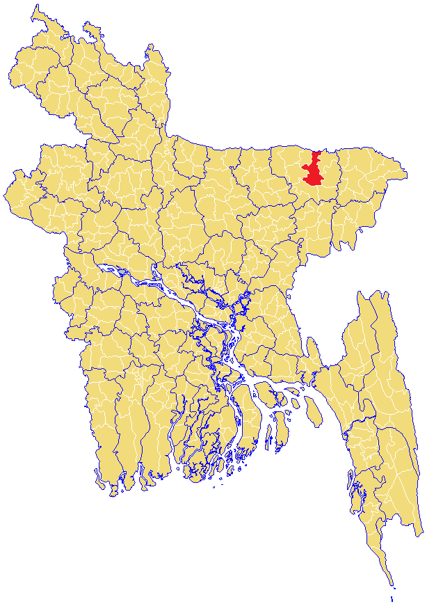
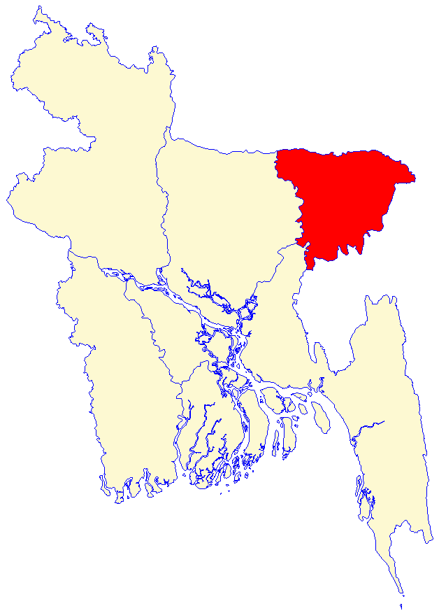
- Sunamganj Sadar Upazila
-
Sunamganj (Sadar)
সুনামগঞ্জ (সদর)
Division Sylhet Division District Sunamganj District Government – MPs (Sunamganj-3, Sunamganj-4) Begum Momtaz Iqbal (3-JP), MA Mannan (4-AL) Area – Total 560.76 km2 (216.5 sq mi) Population – Total 303,153 – Density 541/km2 (1,401.2/sq mi) Time zone BST (UTC+6) Postal code 3000 Sunamganj Sadar (Bengali: সুনামগঞ্জ সদর Sunamgonj Sodor) is an Upazila of Sunamganj District in the Division of Sylhet, Bangladesh.
Contents
Geography
Sunamganj Sadar is located at 25°04′30″N 91°14′00″E / 25.0750°N 91.2333°E. It has 50664 units of house hold and total area 560.76 km².
Demographics
As of 1991[update] Bangladesh census, Sunamganj Sadar has a population of 303,153. Males constitute are 51.27% of the population, and females 48.73%. This Upazila's eighteen up population is 153046. Sunamganj Sadar has an average literacy rate of 23.9% (7+ years), and the national average of 32.4% literate.[1] Religions: Muslim 65%, Hindu 35%, Christian 2%, Buddhist 0.72%, and others 0.28%
Based on 2001 census, the population of the upazila is approximately 367,230, with males constituting 51.32% of the population and, females 48.68% of the population (a drop of 0.5% since 1991). There are 401 villages present, with total households of 8,341, there are 236 mauzas, 14 unions, 44 mahallahs, and 9 wards. The total literacy rate for both females and males is 35.3%, an increase of 2.9% since 2001.[2]
Sunamganj Sadar- Mollapara
Technology
In the village of Durgapasha, the only sign of technology present is a radio tower, which provides wireless internet access. However, in some schools and classes there are computers available for the students. A project called, Learn Foundation funded by a Bangladeshi millionaire Imran Rashid, is believed to educate the children in the village about computer technology. The village receives frequent flooding as elsewhere in the country, which hampers development such as these projects. The Learn Foundation aims to redevelop the region by improving the availability of technology. As of 2002, it has managed to build seven radio towers in seven villages, aiming to establish a broadband network in a 2,500-square-kilometre (970 sq mi) area, improve communication and income for the people.[3]
See also
References
- ^ "Population Census Wing, BBS.". Archived from the original on 2005-03-27. http://web.archive.org/web/20050327072826/http://www.bangladeshgov.org/mop/ndb/arpc91_v1/tables04.htm. Retrieved November 10, 2006.
- ^ Area, Population and Literacy Rate by Upazila/Thana-2001 Bangladesh Bureau of Statistics
- ^ Watery region hides hi-tech hothouse - BBC News - Technology - BBC
 Upazilas of the Sylhet DivisionCapital: Sylhet
Habiganj District 
Maulvibazar District Sunamganj District Bishwamvarpur · Chhatak · Derai · Dharampasha · Dowarabazar · Jagannathpur · Jamalganj · Sullah · Sunamganj Sadar · TahirpurSylhet District Balaganj · Beanibazar · Biswanath · Companiganj · Fenchuganj · Golapganj · Gowainghat · Jaintiapur · Kanaighat · Sylhet Sadar · ZakiganjCategories:- Upazilas of Sunamganj District
- Bangladesh geography stubs
Wikimedia Foundation. 2010.