- Dharampasha Upazila
-
Dharampasha
ধরমপাশা
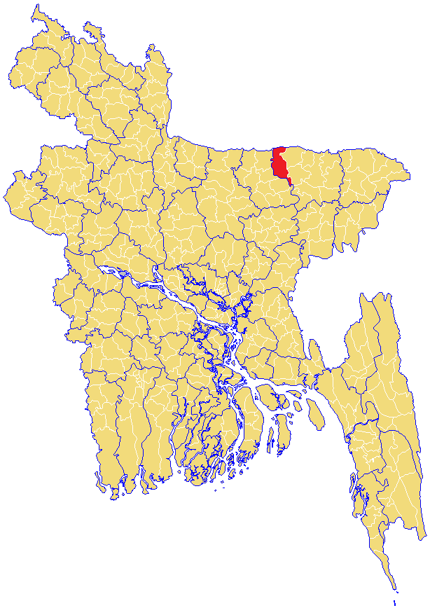
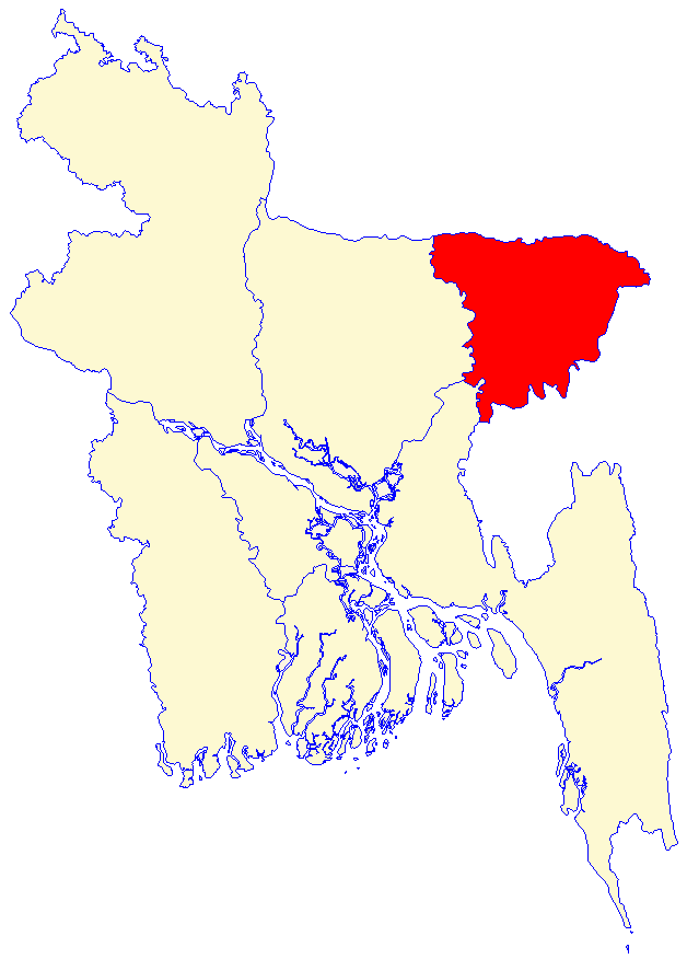
Division Sylhet Division District Sunamganj District Government – MP (Sunamganj-1) Moazzem Hossain Ratan (Awami League) Area – Total 496.03 km2 (191.5 sq mi) Population – Total 164,131 – Density 331/km2 (857.3/sq mi) Time zone BST (UTC+6) Postal code 2450 Dharampasha (Bengali: ধরমপাশা) is an Upazila of Sunamganj District in the Division of Sylhet, Bangladesh.
Contents
Geography
Dharampasha is located at 24°54′00″N 91°01′00″E / 24.9000°N 91.0167°E . It has 28368 units of house hold and total area 496.03 km². It is located on the banks of the Kangsha River close to the haor areas.The largest haor of Bangladesh called "Tanguar Haor" is located in this upazilla and its neighbouring upazilla Tahirpur.This haor is one of the world heritage sites.
Demographics
As of the 1991 Bangladesh census, Dharampasha has a population of 164131. Males constitute are 51.41% of the population, and females 48.59%. This Upazila's eighteen up population is 80347. Dharampasha has an average literacy rate of 20.8% (7+ years), and the national average of 32.4% literate.[1] The neighbouring upazilla are mohanganj,
Administrative
Dharampasha has 10 Unions/Wards, 182 Mauzas/Mahallas, and 313 villages.
School and Colleges
1. Dharampasha Janata High School (oldest one)
2. Dharampasha Girls School
3. Dharampasha Degree College
4. Dharampasha Model Primary School
5. Badshaganj Public High School
6. Badshaganj Degree College
7. Khoda-Box Public High school
8. Joysree High School, Joysree
9. Modhyanagar B.P. High School and College
10.Bongshikonda Momin High School
11.Moheskhola High School
12.Camardani High School
13.Patkura Govt. Primary School
14.Rouha Govt. primary School
15.Mewhary Govt.primary School
16.Kandhapara Govt.primary School
17.Camardani Govt.primary School.
See also
References
- ^ "Population Census Wing, BBS.". Archived from the original on 2005-03-27. http://web.archive.org/web/20050327072826/http://www.bangladeshgov.org/mop/ndb/arpc91_v1/tables04.htm. Retrieved November 10, 2006.
 Upazilas of the Sylhet DivisionCapital: Sylhet
Habiganj District 
Maulvibazar District Sunamganj District Bishwamvarpur · Chhatak · Derai · Dharampasha · Dowarabazar · Jagannathpur · Jamalganj · Sullah · Sunamganj Sadar · TahirpurSylhet District Balaganj · Beanibazar · Biswanath · Companiganj · Fenchuganj · Golapganj · Gowainghat · Jaintiapur · Kanaighat · Sylhet Sadar · ZakiganjCategories:- Upazilas of Sunamganj District
- Bangladesh geography stubs
Wikimedia Foundation. 2010.