- Changtongya
-
Changtongya
Mopungyimti, Ozumongdak
— town — Coordinates 26°34′N 94°42′E / 26.57°N 94.70°ECoordinates: 26°34′N 94°42′E / 26.57°N 94.70°E Country India State Nagaland District(s) Mokokchung Population
• Density
9,230 (2001[update])
• 2,307 /km2 (5,975 /sq mi)
Time zone IST (UTC+05:30) Area
4 square kilometres (1.5 sq mi)
• 506 metres (1,660 ft)
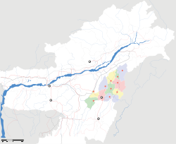
Website http://nagaland.nic.in/ Changtongya is a hilly town in Mokokchung district of Nagaland. Located around 40 km north of Mokokchung and 40 km south of Tuli, it lies midway between the two largest urban centres of the district. The town is located at an altitude of 954 metres above sea level. Ao is the language spoken here.
Changtongya town comprises two main divisions: Changtongya Headquarter; and Changtongya Electrical Colony.
Contents
Geography
Changtongya is located at 26°34′N 94°42′E / 26.57°N 94.70°E.[1] It has an average elevation of 506 m (1,660 ft).
Demographics
As per the census of 2001, the population of Changtongya town has been recorded as 9,387. Out of this, the population of Changtongya Headquarter was recorded as 7,763 while that of Changtongya Electrical Colony as 1,624. It is the third largest town in the district after Mokokchung and Tuli town
Nature and wildlife
Perched atop the Langpangkong Range which runs in a North-South direction, Changtonya is a picturesque town with the Tsula(Dikhu) river flowing parallel to the range on its east and the white waters of Melak flowing on its west. The town is an ideal place for observation of scenic beauty as it offers panoramic views of the Melak and the Tsula Valleys as well as numerous peaks and ranges of Naga hills rising from the valleys.
Changtongya has a no-hunting zone reserve forest, which is a haven for bird watchers. Migratory falcons from Mongolia and Germany fly to this forest. The ideal time to visit here is from October to the end of November.
The valleys provide an ambient spot for picnic goers. There is not a single day without some revellers going down into the tsula valley for fishing and fun.
An interesting feature of the Tsula(Dikhu) river is that here is a spot in the river where crude oil pops up which the locals called "menemtsu". The locals use the oil as night lamp and for other useful purpose.
Transport and Communication
Changtongya is well connected to every part of the district as also the state. National Highway-61 passes through this town. It is also the gateway to Longleng district where the highways to Longleng town and Tamlu originate from here. The nearest airport is Jorhat Civil Air Terminal and Dibrugarh in Assam.
Administration
Changtongya is a sub divisional headquarter under a Sub Divisional Officer, i.e. SDO(Civil).
Politics
Changtongya falls under 22 Arkakong Assembly Constituency of the Nagaland Legislative Assembly. Like most parts of Mokokchung District , it has been a stronghold of the Indian National Congress Party for a long time. The present MLA representing the constituency is Takatiba Masa of the Indian National Congress Party.
References
External links
Categories:- Mokokchung
- Cities and towns in Mokokchung District
- Nagaland
Wikimedia Foundation. 2010.


