- Yambuk, Victoria
-
Yambuk
Victoria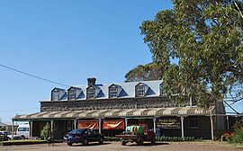
Yambuk Hotel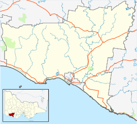
 Yambuk
Population: 540[1] Postcode: 3285 Coordinates: 38°18′S 142°03′E / 38.3°S 142.05°ECoordinates: 38°18′S 142°03′E / 38.3°S 142.05°E Location: - 296 km (184 mi) W of Melbourne
- 46 km (29 mi) W of Warrnambool
- 18 km (11 mi) W of Port Fairy
LGA: Shire of Moyne Yambuk is a town in Victoria, Australia. The township was established in the 1850s, the Post Office opening 1 March 1859.[2]
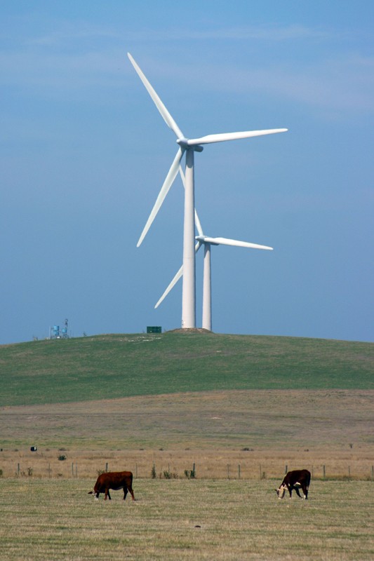
At the 2006 census, the town and surrounding area had a population of 540.[1] It is located where the Princes Highway crosses the Shaw River. It is the site of Pacific Hydro’s Yambuk Wind Farm[3] and the adjacent Codrington Wind Farm.
To the west of Yambuk is the locality of Codrington which is notable for the wind farm and for being the only township in Australia to be named after a bushranger. In 1850 Codrington Revingstone held up the Portland to Port Fairy mail coach three times and the area became known as "Codrington's Forest". In the 1870s a township was surveyed on the projected road to Portland close to the coast and named, unwittingly, as Codrington.[4] A road was later built inland and the township never established.
Yambuk is locally known for the Yambuk Slide, a large slide near the lake.
References and notes
- ^ a b Australian Bureau of Statistics (25 October 2007). "Yambuk (State Suburb)". 2006 Census QuickStats. http://www.censusdata.abs.gov.au/ABSNavigation/prenav/LocationSearch?collection=Census&period=2006&areacode=SSC27073&producttype=QuickStats&breadcrumb=PL&action=401. Retrieved 17 August 2007.
- ^ Premier Postal History. "Post Office List". https://www.premierpostal.com/cgi-bin/wsProd.sh/Viewpocd.w?. Retrieved 11 April 2008
- ^ "Portland Stage 1 - Yambuk Wind Farm". Pacific Hydro. http://pachydro.staging.cim.com.au/OurEnergy/WindEnergy/YambukWindFarm/tabid/133/Default.aspx. Retrieved 17 March 2007.
- ^ Learmonth, Noel F. (1970), Four Towns and a Survey., Hawthorn Press: Melbourne
- "Yambuk". Travel. The Sydney Morning Herald. 8 February 2004. http://www.smh.com.au/news/victoria/yambuk/2005/02/17/1108500207667.html. Retrieved 18 March 2007.
- "Yambuk". Gazetteer of Australia online. Geoscience Australia, Australian Government. http://www.ga.gov.au/bin/gazd01?rec=235352.
Towns in Moyne Shire Caramut · Ellerslie · Framlingham · Garvoc · Hawkesdale · Hexham · Kirkstall · Koroit · Macarthur · Mortlake · Panmure · Peterborough · Port Fairy · Purnim · Woolsthorpe · Woorndoo · Yambuk
Operational wind farms in Australia New South Wales 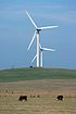
Queensland Windy HillSouth Australia Canunda · Cathedral Rocks · Hallett · Lake Bonney · Mount Millar · Snowtown · Starfish Hill · Waterloo · Wattle PointTasmania Huxley Hill · WoolnorthVictoria Western Australia Categories:- Towns in Victoria (Australia)
- Victoria (Australia) geography stubs


Wikimedia Foundation. 2010.