- Dehaqan
-
For the administrative subdivision, see Dehaqan County.
Dehaqan
دهاقان— city — 
 Dehaqan
Coordinates: 31°56′24″N 51°38′52″E / 31.94°N 51.64778°ECoordinates: 31°56′24″N 51°38′52″E / 31.94°N 51.64778°E Country  Iran
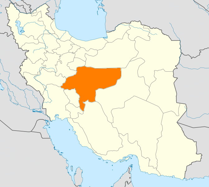
IranProvince Isfahan County Dehaqan Bakhsh Central Population (2006) - Total 16,899 Time zone IRST (UTC+3:30) - Summer (DST) IRDT (UTC+4:30) Dehaqan (Persian: دهاقان, also Romanized as Dehāqān)[1] is a city in and the capital of Dehaqan County, in western Isfahan Province, Iran. At the 2006 census, its population was 16,899, in 4,664 families.[2]
Situation
The town is consisted of the old town, Nehzat Abad neighbourhood and Ata Abad village (now part of the town). The old town itself consists of many neighborhoods, such as Melle Now (Mahalle Now), Posht Gombezi, Ghale, etc...
Dehaqan is located at 30 km from Shahreza city. The word "Dehaqan" originated from "Dehaq" which means "Watery Place"
The climatic condition of this city is divided into:
1. North and east zone, which experience semi-dry climate, suitable for agronomy and animal husbandry activities.
2. South and west zone, which has mountain climate and green hills.Its famous fruits are pear and walnut. There are so many springs(streams) around it. The most famous one is Cheshme Benoy. Its water is mineral and very tasty. In winter there is a place for skiing which is a very popular place for people in Isfahan province. In the first month of spring a very beautiful flower grows there which is called Lalehye wajgoon(upside down tulip). There is a university in dehaghan (Azad university)which is very famous. (Ali Keikha/kashef) www.dehaghan.net
References
- ^ Dehaqan can be found at GEOnet Names Server, at this link, by opening the Advanced Search box, entering "-3060239" in the "Unique Feature Id" form, and clicking on "Search Database".
- ^ "Census of the Islamic Republic of Iran, 1385 (2006)" (Excel). Islamic Republic of Iran. http://www.amar.org.ir/DesktopModules/FTPManager/upload/upload2360/newjkh/newjkh/10.xls.
 Isfahan Province
Capital Isfahan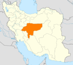
Counties (A-L)
and CitiesAran va Bidgol CountyBorkhar CountyDowlatabad • Dastgerd • Habibabad • Khvorzuq • Komeshcheh • ShahpurabadChadegan • RozvehDehaqanFalavarjan • Abrisham • Baharan Shahr • Imanshahr • Kelishad va Sudarjan • Pir Bakran • Qahderijan • ZazeranFaridan CountyFereydunshahr • Barf AnbarGolpayegan • Golshahr • GugedIsfahan • Baharestan • Ezhiyeh • Harand • Hasanabad • Khvorasgan • Kuhpayeh • Mohammadabad • Nasrabad • Nikabad • Sejzi • Tudeshg • VarzanehKhomeyni Shahr CountyKhomeyni Shahr • Dorcheh Piaz • KushkKhur and Biabanak CountyKhur • JandaqKhvansar CountyKhvansarZarrin Shahr • Bagh-e Bahadoran • Chamgardan • Charmahin • Fuladshahr • Sedeh Lenjan • Varnamkhast • Zayandeh RudCounties (M-Z)
and CitiesSemirom • Hana • Komeh • VanakShahin Shahr and Meymeh CountyShahin Shahr • Gaz • Meymeh • VazvanTiran and Karun CountyTiran • Asgaran • RezvanshahrLandmarks
and
SightsSemirom waterfall • Abyaneh • Niasar fire temple • Atashgah • Babapir • Gogad citadel • Yazdgerd's palace • Grand Bazaar, Esfahan • Kashan Bazaar • Fin Garden • Khaju Bridge • Tappeh Sialk • Si-o-se Pol • Ali Qapu • Shahghandab cave • Mashhad_Ardehal ceremony • Maranjab caravansary • Hasht Behesht • Vank Cathedral • Chahar Bagh School • Qamsar rose water ceremony • Jameh Mosque of Ashtarjan • Jameh Mosque of Isfahan • Shah Mosque • Sheikh Lotf Allah Mosque • Manar Jonban • Naqsh-e Jahan Square • Narin ghaleh • Sultan Amir Ahmad Bathhouse • Agha Bozorg Mosque • Boroujerdi ha Residence • Tabatabaie Residence • House of the Āmeri family • Abbasian House • Chahar Bagh • New JulfaCategories:- Dehaqan County
- Cities in Iran
- Cities in Isfahan Province
- Isfahan Province geography stubs

Wikimedia Foundation. 2010.