- Meshkat
-
Meshkat
مشكات— city — 
 Meshkat
Coordinates: 34°10′37″N 51°15′54″E / 34.17694°N 51.265°ECoordinates: 34°10′37″N 51°15′54″E / 34.17694°N 51.265°E Country  Iran
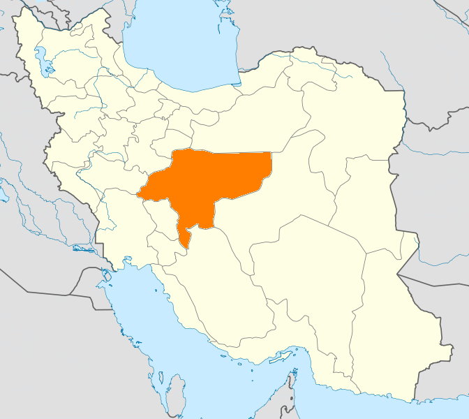
IranProvince Isfahan County Kashan Bakhsh Central Population (2006) – Total 4,960 Time zone IRST (UTC+3:30) – Summer (DST) IRDT (UTC+4:30) Meshkat (Persian: مشكات, pronounced /meʃ'ka:t/ with stress on second syllable; also known as Moshkān, Mashgān, and Maskhān)[1] is a city in the Central District of Kashan County, Isfahan Province, Iran. At the 2006 census, its population was 4,960, in 1,299 families.[2]
Situation
Meshkat is the northernmost town of Esfahan Province, Iran. It has a population of 6000, in 2011). It is situated between Qom-Kashan highway (named Amir Kabir Highway) on the South and Qom-Kashan International road on the north; these two main roads connect the north of the country to its south. It is situated in km 25 kashan-Qom road. Also, it is 195 km south of Tehran, and 250 km north of Esfahan. Meshkat is 880-910m above sea level.
It has a semi-warm climate. The people of this town are mainly farmers, factory workers or craftsmen. The most important agricultural products of Meshkat include wheat, pomegranate, greengage, cotton, among others. It is endowed with several brooks some of which are flowing all year long. Trees of various types help moderate the temperature in hot season; when passing by the thick vegetation areas beside the main road to meshkat, one could easily feel the considerable drop of temperature.Recently, a Calcium Bicarbonate Factory has been built near this town, promising prosperous economic future for the town. Meshkat is southerly limited to the Tehran-Ghom-Esfahan Expressway, while the main asphalt road, which connects Tehran to the south of the country, passes directly through this town. Also, a railroad passes by the northern side of the Meshkat's suburbs. Link to the official website of the municipality of Meshkat:
References
- ^ Meshkat can be found at GEOnet Names Server, at this link, by opening the Advanced Search box, entering "-3074257" in the "Unique Feature Id" form, and clicking on "Search Database".
- ^ "Census of the Islamic Republic of Iran, 1385 (2006)" (Excel). Islamic Republic of Iran. http://www.amar.org.ir/DesktopModules/FTPManager/upload/upload2360/newjkh/newjkh/10.xls.
 Isfahan Province
Capital Isfahan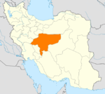
Counties (A-L)
and CitiesAran va Bidgol CountyBorkhar CountyDowlatabad • Dastgerd • Habibabad • Khvorzuq • Komeshcheh • ShahpurabadChadegan • RozvehFalavarjan • Abrisham • Baharan Shahr • Imanshahr • Kelishad va Sudarjan • Pir Bakran • Qahderijan • ZazeranFaridan CountyFereydunshahr • Barf AnbarGolpayegan • Golshahr • GugedIsfahan • Baharestan • Ezhiyeh • Harand • Hasanabad • Khvorasgan • Kuhpayeh • Mohammadabad • Nasrabad • Nikabad • Sejzi • Tudeshg • VarzanehKhomeyni Shahr CountyKhomeyni Shahr • Dorcheh Piaz • KushkKhur and Biabanak CountyKhur • JandaqKhvansar CountyKhvansarZarrin Shahr • Bagh-e Bahadoran • Chamgardan • Charmahin • Fuladshahr • Sedeh Lenjan • Varnamkhast • Zayandeh RudCounties (M-Z)
and CitiesSemirom • Hana • Komeh • VanakShahin Shahr and Meymeh CountyShahin Shahr • Gaz • Meymeh • VazvanTiran and Karun CountyTiran • Asgaran • RezvanshahrLandmarks
and
SightsSemirom waterfall • Abyaneh • Niasar fire temple • Atashgah • Babapir • Gogad citadel • Yazdgerd's palace • Grand Bazaar, Esfahan • Kashan Bazaar • Fin Garden • Khaju Bridge • Tappeh Sialk • Si-o-se Pol • Ali Qapu • Shahghandab cave • Mashhad_Ardehal ceremony • Maranjab caravansary • Hasht Behesht • Vank Cathedral • Chahar Bagh School • Qamsar rose water ceremony • Jameh Mosque of Ashtarjan • Jameh Mosque of Isfahan • Shah Mosque • Sheikh Lotf Allah Mosque • Manar Jonban • Naqsh-e Jahan Square • Narin ghaleh • Sultan Amir Ahmad Bathhouse • Agha Bozorg Mosque • Boroujerdi ha Residence • Tabatabaie Residence • House of the Āmeri family • Abbasian House • Chahar Bagh • New JulfaCategories:- Kashan County
- Cities in Iran
- Cities in Isfahan Province
- Isfahan Province geography stubs

Wikimedia Foundation. 2010.