- Najafabad
-
For other places with the same name, see Najafabad (disambiguation).
Najafabad
نجف آباد— city — 
 Najafabad
Coordinates: 32°38′04″N 51°22′00″E / 32.63444°N 51.3666667°ECoordinates: 32°38′04″N 51°22′00″E / 32.63444°N 51.3666667°E Country  Iran
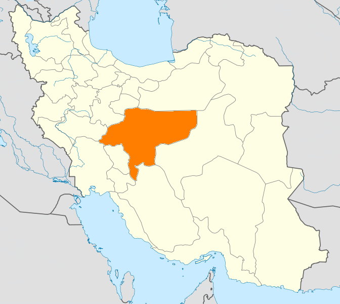
IranProvince Isfahan County Najafabad Bakhsh Central Population (2006) – Total 206,114 Time zone IRST (UTC+3:30) – Summer (DST) IRDT (UTC+4:30) Najafabad (Persian: نجف آباد, also Romanized as Najafābād and Nejafābād)[1] is a city in and the capital of Najafabad County, Isfahan Province, Iran. At the 2006 census, its population was 206,114, in 54,529 families.[2] It is located west of Isfahan and is increasingly becoming a part of Isfahan Metropolitan area.
Najafabad is the birthplace of Grand Ayatollah Hossein-Ali Montazeri, Mostafa Moeen and Moein. It is also the hometown of Iranian-American poet Dr. Mahnaz Badihian
The city serves as a trade center for agricultural products in the region, and is noted for its pomegranates.
One of the attractions of Najafabad is "Arg-e Sheykh Bahaie" that has recently been repaired.
The people of Najafabad mourned for the death of Ayatollah Hossein-Ali Montazeri on Sunday December 20 2009 and all shops were closed for the honor of his death.
References
- ^ Najafabad can be found at GEOnet Names Server, at this link, by opening the Advanced Search box, entering "6013169" in the "Unique Feature Id" form, and clicking on "Search Database".
- ^ "Census of the Islamic Republic of Iran, 1385 (2006)" (Excel). Islamic Republic of Iran. http://www.amar.org.ir/DesktopModules/FTPManager/upload/upload2360/newjkh/newjkh/10.xls.
External links
 Isfahan Province
Capital Isfahan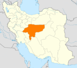
Counties (A-L)
and CitiesAran va Bidgol CountyBorkhar CountyDowlatabad • Dastgerd • Habibabad • Khvorzuq • Komeshcheh • ShahpurabadChadegan • RozvehFalavarjan • Abrisham • Baharan Shahr • Imanshahr • Kelishad va Sudarjan • Pir Bakran • Qahderijan • ZazeranFaridan CountyFereydunshahr • Barf AnbarGolpayegan • Golshahr • GugedIsfahan • Baharestan • Ezhiyeh • Harand • Hasanabad • Khvorasgan • Kuhpayeh • Mohammadabad • Nasrabad • Nikabad • Sejzi • Tudeshg • VarzanehKhomeyni Shahr CountyKhomeyni Shahr • Dorcheh Piaz • KushkKhur and Biabanak CountyKhur • JandaqKhvansar CountyKhvansarZarrin Shahr • Bagh-e Bahadoran • Chamgardan • Charmahin • Fuladshahr • Sedeh Lenjan • Varnamkhast • Zayandeh RudCounties (M-Z)
and CitiesNajafabad • Alavicheh • Dehaq • Goldasht • Jowzdan • Kahriz SangSemirom • Hana • Komeh • VanakShahin Shahr and Meymeh CountyShahin Shahr • Gaz • Meymeh • VazvanTiran and Karun CountyTiran • Asgaran • RezvanshahrLandmarks
and
SightsSemirom waterfall • Abyaneh • Niasar fire temple • Atashgah • Babapir • Gogad citadel • Yazdgerd's palace • Grand Bazaar, Esfahan • Kashan Bazaar • Fin Garden • Khaju Bridge • Tappeh Sialk • Si-o-se Pol • Ali Qapu • Shahghandab cave • Mashhad_Ardehal ceremony • Maranjab caravansary • Hasht Behesht • Vank Cathedral • Chahar Bagh School • Qamsar rose water ceremony • Jameh Mosque of Ashtarjan • Jameh Mosque of Isfahan • Shah Mosque • Sheikh Lotf Allah Mosque • Manar Jonban • Naqsh-e Jahan Square • Narin ghaleh • Sultan Amir Ahmad Bathhouse • Agha Bozorg Mosque • Boroujerdi ha Residence • Tabatabaie Residence • House of the Āmeri family • Abbasian House • Chahar Bagh • New JulfaCategories:- Najafabad County
- Cities in Iran
- Cities in Isfahan Province
- Isfahan Province geography stubs

Wikimedia Foundation. 2010.