- Thuraipakkam
-
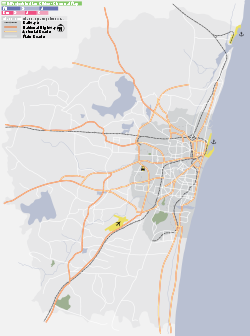
Thoraipakkam — suburb — Coordinates 12°58′N 80°15′E / 12.97°N 80.25°ECoordinates: 12°58′N 80°15′E / 12.97°N 80.25°E Country India State Tamil Nadu District(s) Kancheepuram Time zone IST (UTC+05:30) Thoraipakkam (Tamil: துரைப்பாக்கம்), also spelt Thuraipakkam, is an area of Chennai, India. It is situated on what is called as the IT expressway, on Old Mahabalipuram Road, now known as Rajiv Gandhi Salai, the first six lane road in Chennai. Thoraipakkam is on the eastern banks of the Pallikaranai marsh which has been designated as a reserve forest area and is one of the few remaining significant natural ecosystems within Chennai . Thoraipakkam is 3 km in length, starting from Perungudi to its north. Thoraipakkam consists of five main areas, named for nearby landmarks: Seevaram (tea stall bus stop area டீ கடை Krishna tea stall is a famous tea shop in OMR ), Jain College area, RRE area, Mettukkuppam and PTC quarters.
The Thoraipakkam Pallavaram Radial road running east to west connects the IT corridor and the GST Road (Grand Southern Trunk Road) making Thoraipakkam well connected to the airport especially after the opening of the flyover (ROB) at the western end of the radial road in October 2010.This road plays a significant role,enabling quicker and easier movement of traffic between the major arterial roads to the south of Chennai including GST Road,Tambaram-Velachery main road and Old Mahaballipuram Road.
Before construction of flyover at Pallavaram: Tambaram was reached following OMR towards Sholinganallur,then the Sholinganallur-Medavakkam link road and finally the Velachery road towards Tambaram. Pallavaram, Chrompet and Meenambakkam were reached following Rajiv Gandhi Salai towards Adyar,Sardar Patel road towards Guindy and finally the GST road
Thoraipakkam has experienced substantial growth over the past decade, and it serves as a residential and commercial hub for suburbs in the south of Chennai. A number of information technology companies are based in Thoraipakkam.
Thoraipakkam has pollution related problem because a portion of the Pallikaranai marsh has been converted into a dump yard and garbage including medical waste, plastics, tires, are burnt. However, since beginning of 2009, burning has been officially banned and this has led to considerable improvement in the air quality and reduced the levels of pollution in the area. Ground water is considerably better than Chennai city because of its proximity to the marsh though the water has become salty due to over exploitation.
After the Tsunami of 2004, affected fishermen were relocated to Kannagi Nagar which is a part of Thoraipakkam.
The recent decision by the government to expand the Chennai city corporation limits will see Thoraipakkam becoming fully a part of Chennai corporation in 2011 and it will then cease to be a village panchayat in Kanchipuram district as it is currently.
Location in Context
Areas of Chennai 
Pallikaranai Perungudi Palavakkam 
Pallikaranai 
Neelankarai  Thoraipakkam

Pallikaranai Karapakkam Injambakkam Transport
There are two bus routes for the OMR road. One is from Madhya Kailash and the other from {Adyar, Velachery, High Court, T.Nagar, Koyambedu, Saidapet, Parrys, Mahabalipuram, Kalpakkam}. Thoraipakkam is well connected to the city by the Chennai metropolitan transport corporation. Bus Route No's. [T51, 19B, 19C, M5, 21H, H21, T21, 519, 5G, M5G, M70, M19P, M5S, 570, 568C 521, M19D] All buses heading towards the city from Sholinganallur and Kelambakkam run through Thoraipakkam. Auto rickshaws also serve the area, with fares fixed by the state government of Tamilnadu. Moreover Share-Auto-s are also available which are comparatively cheaper than the former.
Categories:
Wikimedia Foundation. 2010.


