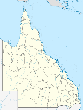
Dululu, Queensland

Dululu, Queensland
Dululu
Queensland
Dululu is located in Queensland
{{{alt}}}
Dululu
Postcode: 4702
LGA: Banana Shire Council

Dululu is a small town in Central Queensland, Australia, in northern Banana Shire. The town sits at the junction of the Burnett and Leichhardt highways, 70 km south-west of Rockhampton, Queensland and 610 km north-west of Brisbane.

The town's original name was Bunerba. The Railway Department changed this to Dululu in 1915 to avoid confusion with Buneru, another town located near Wowan. The name derives from an Indigenous word meaning "soft".[1]

External links


Coordinates: 23°51′S 150°15′E / 23.85°S 150.25°E / -23.85; 150.25


Wikimedia Foundation. 2010.

Игры ⚽ Поможем решить контрольную работу

Look at other dictionaries:

  • Dee River (Queensland) — Dee RiverVorlage:Infobox Fluss/GKZ fehlt Lage Queensland (Australien) Flusssystem Fitzroy River Abfluss über Don River → Dawson R …   Deutsch Wikipedia

  • Cracow, Queensland — Cracow Queensland …   Wikipedia

  • Moura, Queensland — Moura Queensland …   Wikipedia

  • Wowan, Queensland — Infobox Australian Place | type = town name = Wowan state = Qld caption = lga = Banana Shire postcode = 4702 pop = 338 pop footnotes = est = 1912 elevation= maxtemp = mintemp = rainfall = stategov = Callide fedgov = Flynn dist1 = 609 location1=… …   Wikipedia

  • Банана (графство) — Банана англ. Banana   Графство Австралии (АЕ 2 го уровня)  …   Википедия

  • Leichhardt Highway — Infobox Australian Road road name = Leichhardt Highway route route route photo = caption = Formerly length = 577 direction = North South start = finish = NSW/Qld Border est = through = Dululu, Banana, Taroom, Miles, Moonie route = Westwood… …   Wikipedia

  • Dawson Valley railway line — The Dawson Valley Branch Railway was a railway line in Central Queensland, Australia. Gold was discovered in the Mount Morgan region of Central Queensland in 1882. The Mount Morgan Gold Mining Company was authorised by government in 1890 to build …   Wikipedia

  • Comté de Banana — 24°23′52.44″S 150°30′39.76″E / 24.3979, 150.5110444 …   Wikipédia en Français

  • Shire of Banana — Infobox Australian Place | type = lga name = Banana Shire state = qld imagesize= 180 caption = Location within Queensland pop = 13,489 pop footnotes = (2006 census) [Census 2006 AUS | id = LGA30350 | name = Banana (S) (Local Government Area) |… …   Wikipedia

  • Burnett Highway — La Burnett Highway près de Binjour. La Burnett Highway est une route à l intérieur des zones rurales située dans le Queensland, en Australie. La route de direction générale nord sud, va de sa jonction avec la …   Wikipédia en Français

Share the article and excerpts

Direct link
Do a right-click on the link above
and select “Copy Link”