- Čičmany
-
Čičmany Village  Folk architecture in Čičmany
Country Slovakia Region Žilina District Žilina Elevation 655 m (2,149 ft) Coordinates 48°57′N 18°31′E / 48.95°N 18.517°E Area 9.00 km2 (3 sq mi) Population 204 (2004-12-31) Density 23 / km2 (60 / sq mi) Postal code 013 15 Area code +421-0 43 Car plate ZA 

 Location of Čičmany in Slovakia
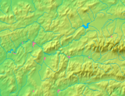
 Location of Čičmany in the Žilina Region
Wikimedia Commons: Čičmany Statistics: MOŠ/MIS Website: www.cicmany.viapvt.sk Čičmany (Hungarian: Csicsmány, German: Zimmermannshau) is a village and municipality in Žilina District in the Žilina Region of northern Slovakia. It is known as the first folk architecture reserve in the world (founded in 1977).
Contents
History
The first preserved reference to the village dates from 1272. After a great fire in 1921, the village was restored to its original appearance with generous contributions by the state. Until the mid-20th century, the village was a centre of sheep raising.
Geography
The municipality lies at an altitude of 655 metres and covers an area of 25.611 km². It has a population of about 204 people.
Culture
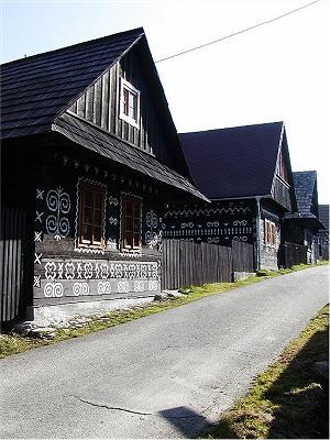
Timbered houses with ridge roofs, galleries and pointed or linear wall decorations have been preserved in Čičmany. Of particular interest are the very specific white patterns which are painted on the exterior walls of the houses to decorate them. The local folk music, special folk costumes and folk dances of the village have been preserved as well.
External links
- http://www.cicmany.info
- http://www.cicmany.viapvt.sk/
- http://www.peacegallery.com/europe/slovakia/slovakia11.htm
- http://www.mestozilina.sk/sprievodca/mesto/okolie/cicmany.html
Rajec · Rajecké Teplice · Žilina
Belá · Bitarová · Brezany · Čičmany · Divina · Divinka · Dlhé Pole · Dolná Tižina · Dolný Hričov · Ďurčiná · Fačkov · Gbeľany · Horný Hričov · Hôrky · Hričovské Podhradie · Jasenové · Kamenná Poruba · Kľače · Konská · Kotrčiná Lúčka · Krasňany · Kunerad · Lietava · Lietavská Lúčka · Lietavská Svinná-Babkov · Lutiše · Lysica · Malá Čierna · Mojš · Nededza · Nezbudská Lúčka · Ovčiarsko · Paština Závada · Podhorie · Porúbka · Rajecká Lesná · Rosina · Stránske · Stráňavy · Stráža · Strečno · Svederník · Šuja · Teplička nad Váhom · Terchová · Turie · Varín · Veľká Čierna · Višňové · Zbyňov Categories:
- Villages and municipalities in Žilina District
- Žilina Region geography stubs


Wikimedia Foundation. 2010.