- Terchová
Geobox | settlement
name = Terchová
category = Village
etymology =
official_name =
motto =
nickname =
image_caption =
symbol =
country = Slovakia
country_
state =
region = Žilina
district = Žilina
municipality =
part =
river =
location =
elevation = 514
lat_d = 49
lat_m = 16
lat_s = 00
lat_NS = N
long_d = 19
long_m = 02
long_s = 00
long_EW = E
coordinates_type = region:SK_type:city
highest =
highest_lat_d =
highest_long_d =
lowest =
lowest_lat_d =
lowest_long_d =
area = 84.54
area_round = 2
population = 4073
population_date = 2006
population_density = auto
established =
date =
mayor =
timezone =
timezone_DST =
postal_code = 01306
area_code = 421-41
code = ZA
code_type = Car plate
free =

map_background = Slovakia - background map.png
map_locator = Slovakia
map1 = Žilina Region - outline map.svg
map1_background = Žilina Region - background map.png
map1_locator = Žilina Region
commons = Terchová
statistics = [http://www.statistics.sk/mosmis/eng/prvav2.jsp?txtUroven430511&lstObec518042&Okruhzaklad MOŠ/MIS]
website = [http://www.terchova.sk www.terchova.sk]
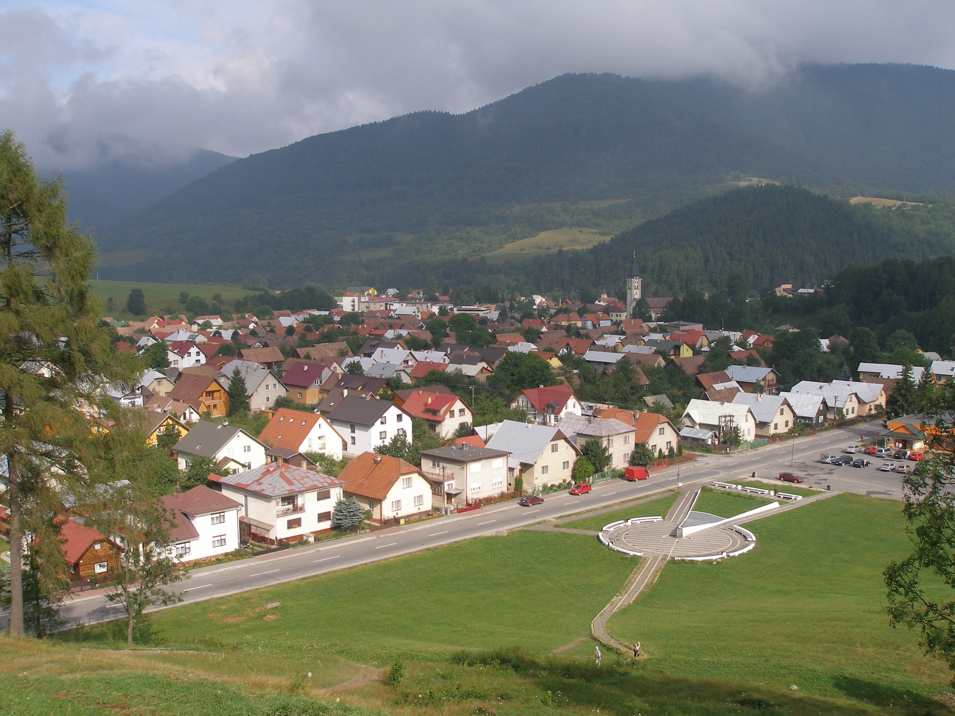
footnotes =Terchová is a large
village andmunicipality (population 4,073) in theMalá Fatra mountains inŽilina District in theŽilina Region of northernSlovakia .History
The village was established in
1580 , but the area was inhabited even before its establishment. Originally a Vlach settlement from the period of Vlach colonization, it slowly began to differentiate to the agricultural settlement, as many new settlers in the 17th century came to the village. In the 19th century, several droughts and plague depopulated the village, as many emigrated down south. Near the end ofWorld War II , half of the wooden part was burned down. During the first post-war years, it was reconstructed as part of two-year plan.Geography
The
municipality lies at analtitude of 514metres and covers anarea of 84.542km². It has apopulation of about 4073 people. The village lies in a valley in theMalá Fatra mountains, about 25 km east ofŽilina . The tourist resort ofVrátna dolina belongs to the village.Gallery
People
*Birthplace of
Juraj Jánošík , who is commonly referred to as a SlovakRobin Hood .
*Birthplace ofAdam František Kollár , Slovak writer, historian and librarian.External links
* [http://www.terchova.sk/ Terchová website]
* [http://www.terchova-info.sk/en/index.php Terchová Information in English]


Wikimedia Foundation. 2010.