Tatton, New South Wales

Tatton, New South Wales

Infobox Australian Place | type = suburb
name = Tatton
city = Wagga Wagga
state = nsw
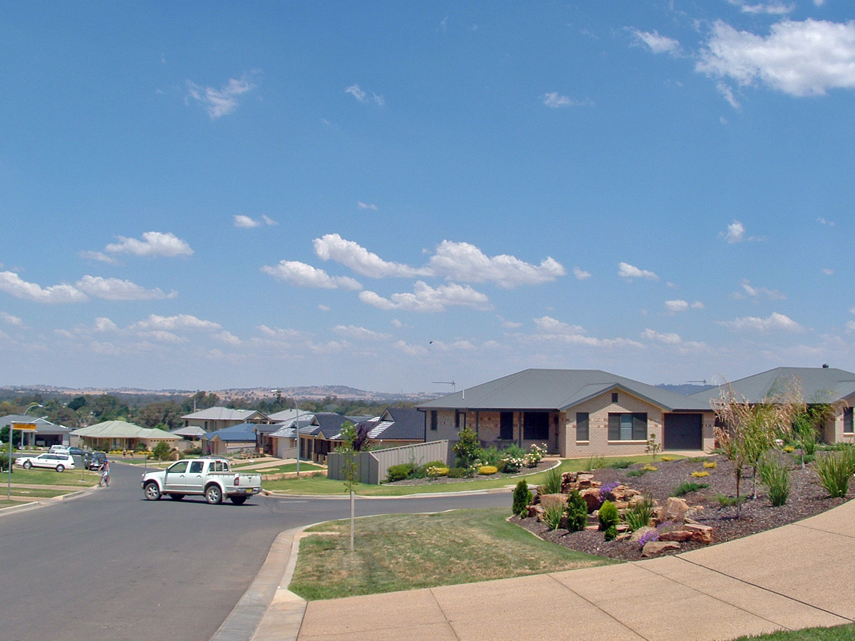


caption = Tamar Drive in Tatton
lga = City of Wagga Wagga
postcode = 2650
coordinates = coord|35|9|25.66|S|147|21|43.48|E|display=inline,title
est =
pop = 1,540Census 2006 AUS
id = SSC18985
name = Tatton (State Suburb)
quick = on
accessdate = 2008-06-29
]
area =
propval =
parish = South Wagga Wagga
county = Wynyard
stategov = Wagga Wagga
fedgov = Riverina
near-nw = Tolland
near-n = Tolland
near-ne = Kooringal
near-w = Bourkelands
near-e = Lake Albert
near-sw = Springvale
near-s = Gregadoo
near-se = Lake Albert
dist1 =
location1=

Tatton is an outer south-eastern suburb of Wagga Wagga, New South Wales, Australia. Located to the south of Kooringal, and to the West of Lake Albert, Tatton is one of Wagga Wagga's more expensive new suburbs. Subdivision of what was an area dominated by small rural holdings, commenced in the 1990s. Tatton Public School was previously located within the confines of the suburb, however this school closed down prior to the commencement of any significant development. Today the suburb is serviced by the private Lutheran Primary School.

References


Wikimedia Foundation. 2010.

Игры ⚽ Поможем сделать НИР

Look at other dictionaries:

  • Oura, New South Wales — Oura New South Wales Entering Oura …   Wikipedia

  • Downside, New South Wales — Downside New South Wales St Stephens Downside …   Wikipedia

  • Moorong, New South Wales — Moorong Wagga Wagga, New South Wales Moorong Geodetic Station on top of Mount Moorong. Populat …   Wikipedia

  • Kooringal, New South Wales — Infobox Australian Place | type = suburb name = Kooringal city = Wagga Wagga state = nsw caption = Suburb of Kooringal lga = City of Wagga Wagga postcode = 2650 est = pop = 7,422Census 2006 AUS id = SSC17739 name = Kooringal (State Suburb) quick …   Wikipedia

  • Tolland, New South Wales — Infobox Australian Place | type = suburb name = Tolland city = Wagga Wagga state = nsw caption = Tolland Shopping Centre lga = City of Wagga Wagga postcode = 2650 coordinates = coord|35|8|42.46|S|147|21|7.48|E|display=inline,title est = pop =… …   Wikipedia

  • Bourkelands, New South Wales — Infobox Australian Place | type = suburb name = Bourkelands city = Wagga Wagga state = nsw caption = View over Bourkelands lga = City of Wagga Wagga postcode = 2650 coordinates = coord|35|9|14.86|S|147|21|3.88|E|display=inline,title est = pop = 1 …   Wikipedia

  • Springvale, New South Wales — Infobox Australian Place | type = suburb name = Springvale city = Wagga Wagga state = nsw caption = Holbrook Road at Springvale. lga = City of Wagga Wagga postcode = 2650 coordinates = coord|35|10|7.02|S|147|20|3.33|E|display=inline,title est =… …   Wikipedia

  • Charles Sturt University, New South Wales — Charles Sturt University Wagga Wagga, New South Wales Charles Sturt University entrance Postcode …   Wikipedia

  • Mount Austin, New South Wales — Mount Austin Wagga Wagga, New South Wales Mount Austin suburb sign Population …   Wikipedia

  • Lake Albert (New South Wales) — Infobox Australian Place | type = suburb name = Lake Albert city = Wagga Wagga state = nsw caption = Lake Village Shopping Centre lga = City of Wagga Wagga postcode = 2650 est = pop = 5,853Census 2006 AUS id = SSC17783 name = Lake Albert (State… …   Wikipedia

Share the article and excerpts

Direct link
Do a right-click on the link above
and select “Copy Link”