- Sakurajima
-
Sakurajima 
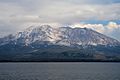
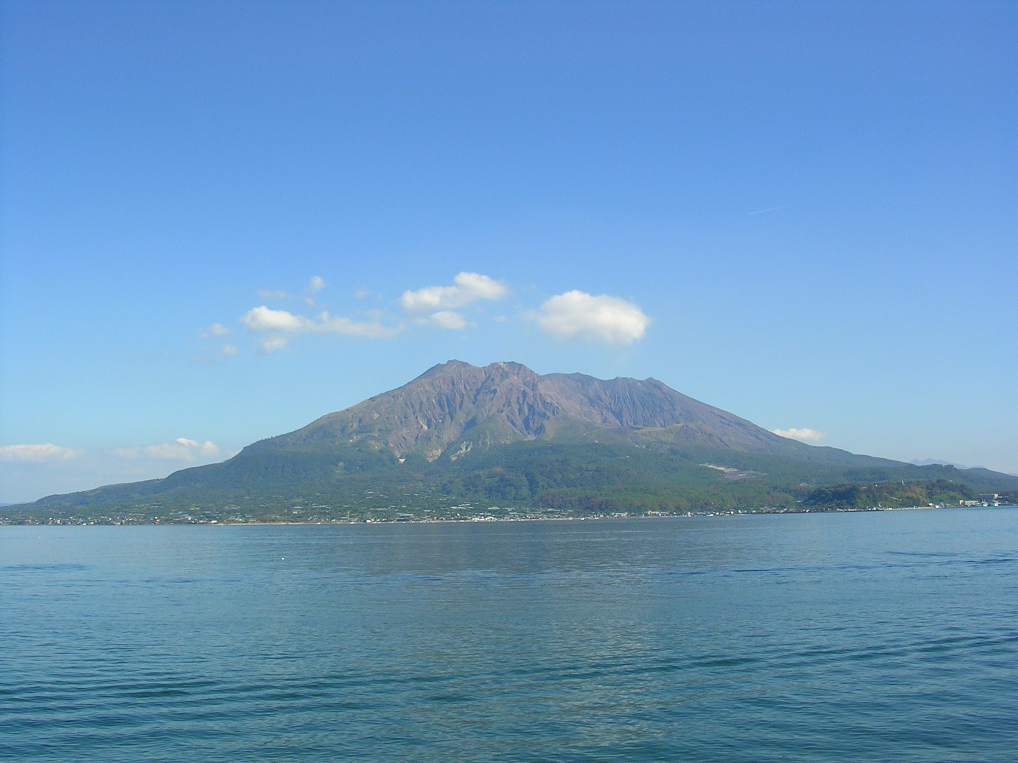
View of Sakurajima from mainland Kagoshima.Elevation 1,117 m (3,665 ft) Location Kagoshima, Japan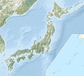
 Sakurajima
Coordinates 31°35′N 130°39′E / 31.583°N 130.65°ECoordinates: 31°35′N 130°39′E / 31.583°N 130.65°E Geology Type Stratovolcano Last eruption 2010 Sakurajima (桜島), also romanized as Sakurashima or Sakura-jima,[1] is an active composite volcano (stratovolcano) and a former island (now connected to the mainland) of the same name in Kagoshima Prefecture in Kyūshū, Japan. The lava flows of the 1914 eruption caused the former island to be connected with the Osumi Peninsula.[2]
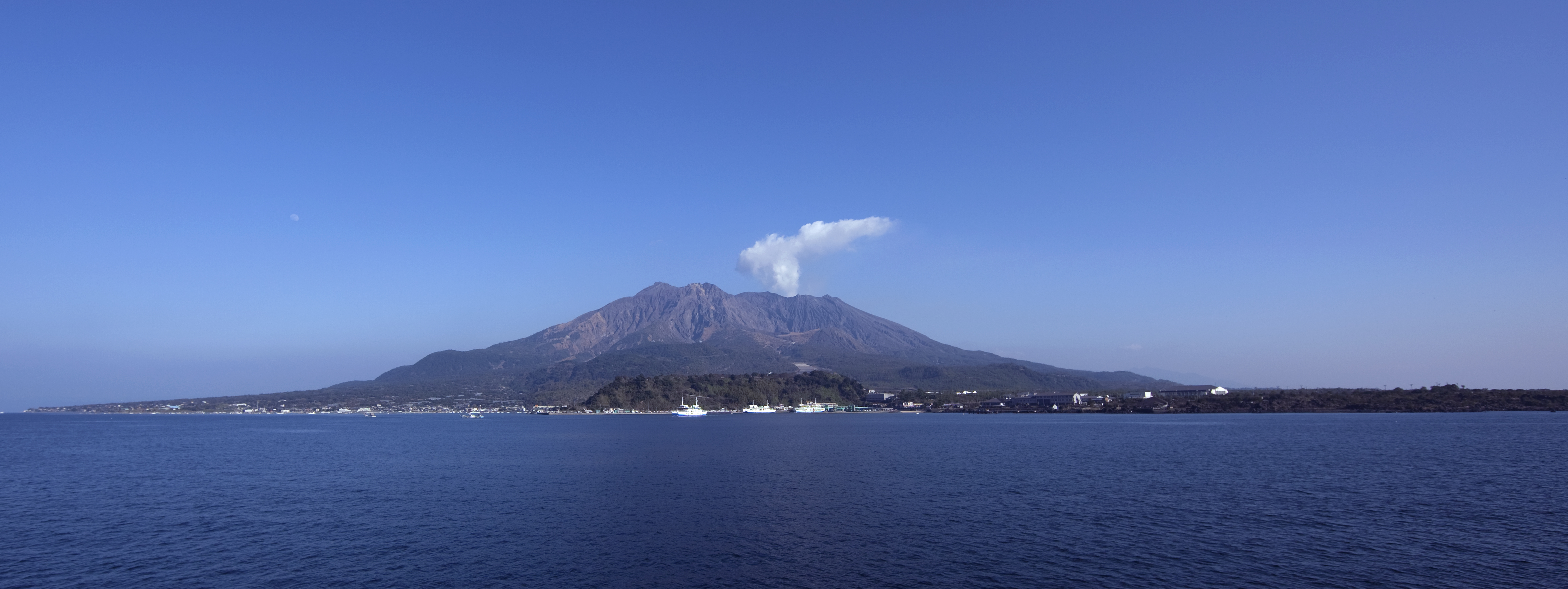
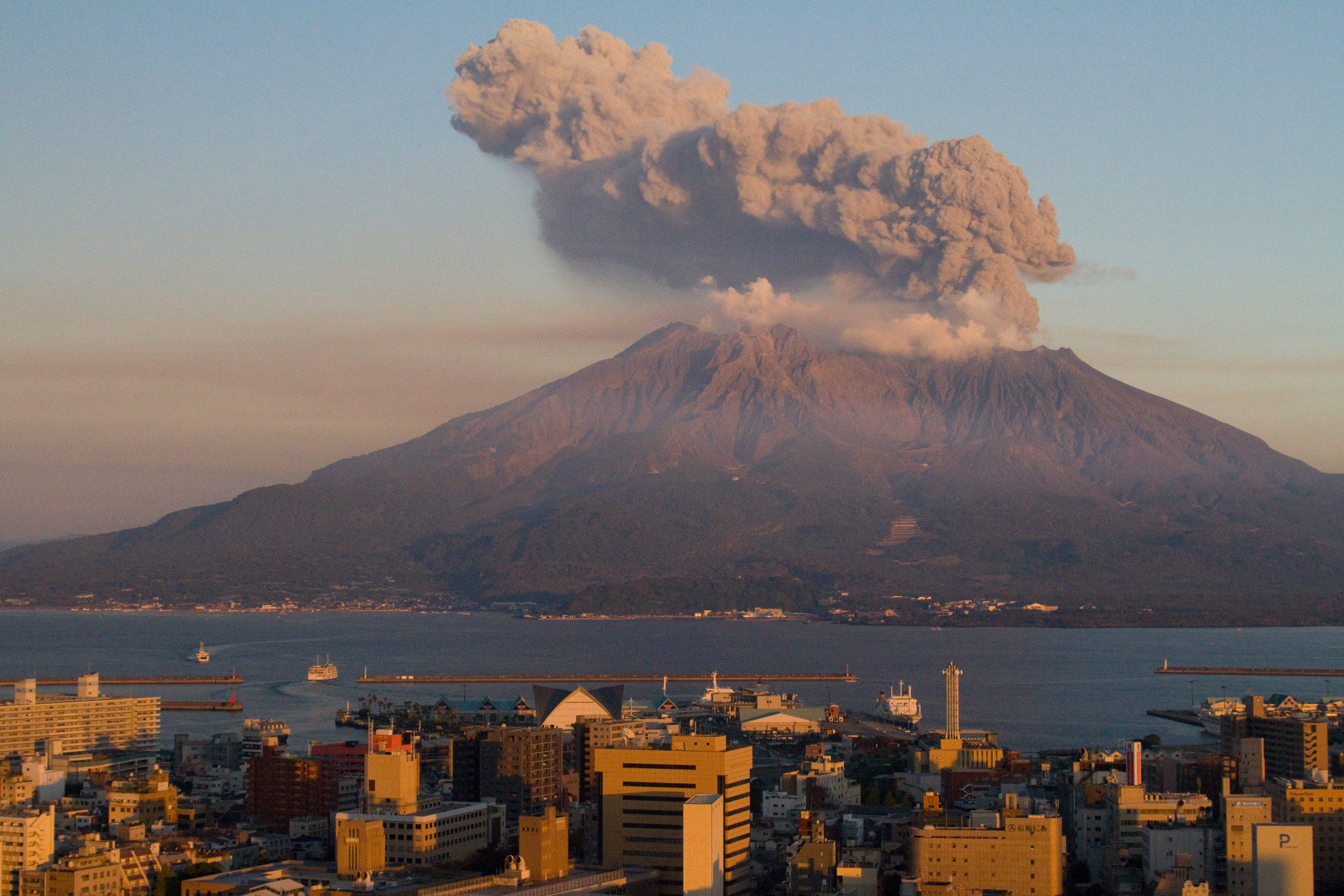
The volcanic activity still continues, dropping large amounts of volcanic ash on the surroundings. Earlier eruptions built the white sands highlands in the region.
Sakurajima is a composite mountain. Its summit is split into three peaks, Kitadake (northern peak), Nakadake (central peak) and Minamidake (southern peak) which is active now.
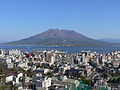
Today's north Peak (北岳 Kitadake) is Sakurajima's highest, rising to 1,117 metres (3,665 ft) above sea level. The mountain is located in a part of Kagoshima Bay known as Kinkō Bay (錦江湾 Kinkōwan). The former island is part of the city of Kagoshima. The surface of this volcanic peninsula is about 77 square kilometres (30 sq mi).
Contents
Geological history
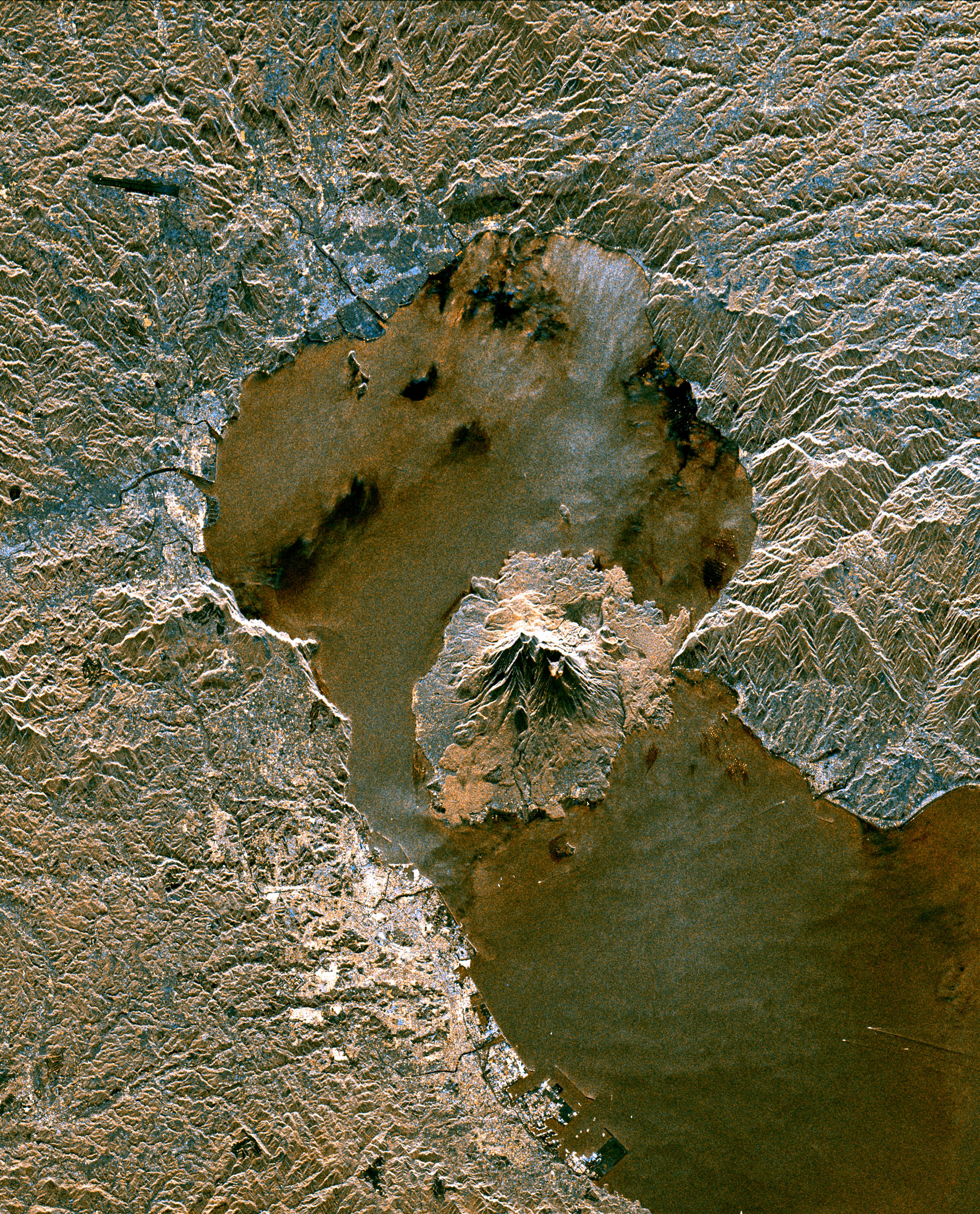
Sakurajima is located in the Aira caldera, formed in an enormous eruption 22,000 years ago.[3] Several hundred cubic kilometres of ash and pumice were ejected, causing the magma chamber underneath the erupting vents to collapse. The resulting caldera is over 20 kilometres (12 mi) across. Tephra fell as far as 1,000 kilometres (620 mi) from the volcano. Sakurajima is a modern active vent of the same Aira caldera volcano.
Sakurajima was formed by later activity within the caldera, beginning about 13,000 years ago.[4] It lies about 8 kilometres (5 mi) south of the centre of the caldera. Its first eruption in recorded history occurred in 963 AD.[5] Most of its eruptions are strombolian,[5] affecting only the summit areas, but larger plinian eruptions have occurred in 1471–1476, 1779–1782 and 1914.[6]
Volcanic activity at Kitadake ended around 4,900 years ago: subsequent eruptions have been centered on Minamidake.[7]
1914 eruption
1914 eruption of Sakurajima 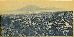
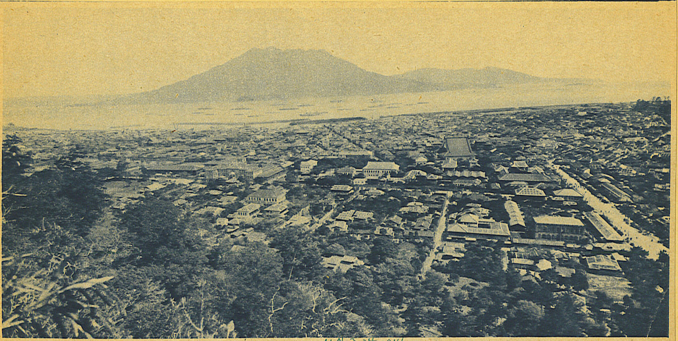
The city of Kagoshima was covered by deep ash during the 1914 eruption of the Sakurajima, which is visible across the bay.Date January 1914 Type Peléan VEI 4 Impact Pre-eruption earthquakes killed at least 35 people; caused an evacuation and significant changes to the local topology. The 1914 eruption was the most powerful in twentieth-century Japan. Lava flows filled the narrow strait between the island and the mainland, turning it into a peninsula. The volcano had been dormant for over a century until 1914.[3] The 1914 eruption began on January 11. Almost all residents had left the island in the previous days, in response to several large earthquakes that warned them that an eruption was imminent. Initially, the eruption was very explosive, generating eruption columns and pyroclastic flows, but after a very large earthquake on January 13, 1914 which killed 35 people, it became effusive, generating a large lava flow.[3] Lava flows are rare in Japan—the high silica content of the magmas there mean that explosive eruptions are far more common[8]—but the lava flows at Sakurajima continued for months.[3]
The island grew, engulfing several smaller islands nearby, and eventually becoming connected to the mainland by a narrow isthmus. Parts of Kagoshima bay became significantly shallower, and tides were affected, becoming higher as a result.[3]
During the final stages of the eruption, the centre of the Aira Caldera sank by about 60 centimetres (24 in), due to subsidence caused by the emptying out of the underlying magma chamber.[3] The fact that the subsidence occurred at the centre of the caldera rather than directly underneath Sakurajima showed that the volcano draws its magma from the same reservoir that fed the ancient caldera-forming eruption.[3] The eruption partly inspired a 1914 movie, Wrath of the Gods, centering around a family curse that ostensibly causes the eruption.
Current activity
 Sakurajima eruption in 1974
 Space radar image of Sakurajima. The volcano lies within the bay formed by the Aira caldera
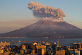
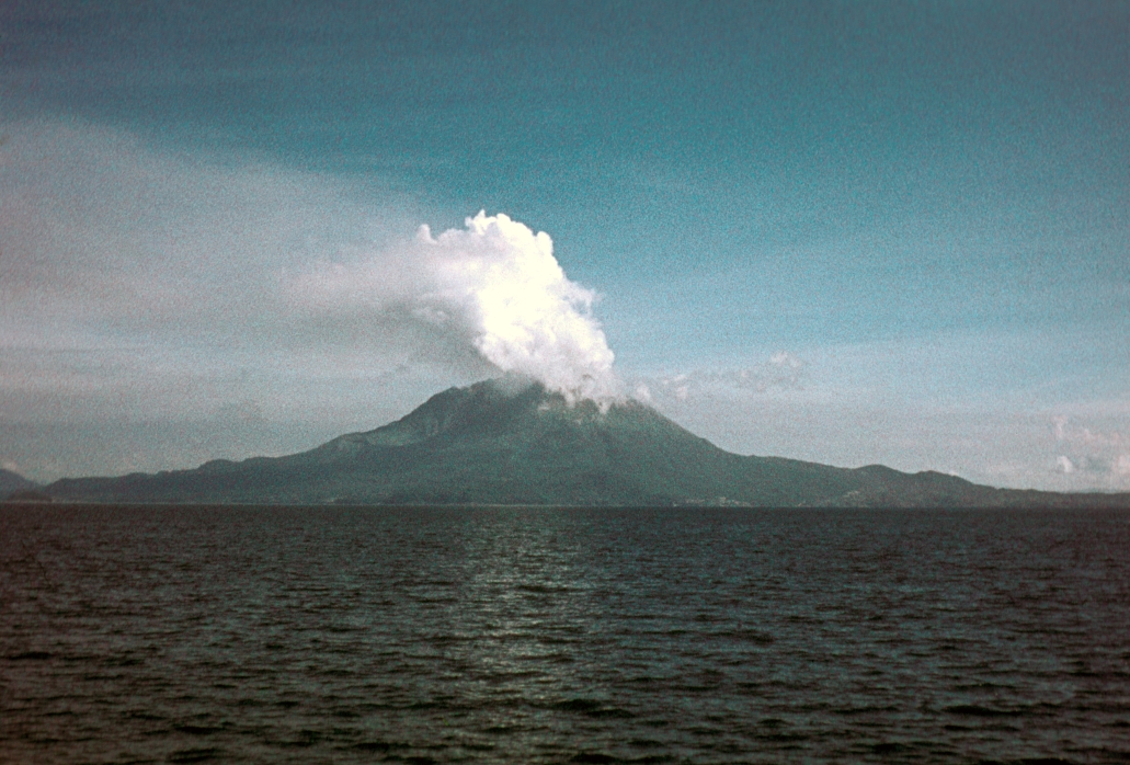
Sakurajima's activity became more prominent in 1955, and the volcano has been erupting almost constantly ever since. Thousands of small explosions occur each year, throwing ash to heights of up to a few kilometers above the mountain. The Sakurajima Volcano Observatory was set up in 1960 to monitor these eruptions.[5]
Monitoring of the volcano and predictions of large eruptions are particularly important because of its location in a densely populated area, with the city of Kagoshima's 680,000 residents just a few kilometers from the volcano. The city conducts regular evacuation drills, and a number of shelters have been built where people can take refuge from falling volcanic debris.[9]
In light of the dangers it presents to nearby populations, Sakurajima was designated a Decade Volcano in 1991, identifying it as worthy of particular study as part of the United Nations' International Decade for Natural Disaster Reduction.[10]
Sakurajima is part of the Kirishima-Yaku National Park, and its lava flows are a major tourist attraction. The area around Sakurajima contains several hot spring resorts. One of the main agricultural products of Sakurajima is a huge basketball-sized white radish (sakuradaikon).[11]
On March 10, 2009, Sakurajima erupted, sending debris up to 2 km away. An eruption had been expected following a series of smaller explosions over the weekend. It is not thought there was any damage caused by the latest eruption.[1]
Gallery
-

2004
-
2004
-
2009
-
2010
See also
- List of volcanoes in Japan
- Sakurajima daikon
- Tourism in Japan
Notes
- ^ photo, caption -- Kagoshima after Sakurashima eruption, Illustrated London News. January 1914.
- ^ Davison, C. "The Sakura-Jima Eruption of January, 1914," Nature. 98:57-58 (21 September 1916) | doi:10.1038/098057b0; Illustrated London News. January 24, 1914.
- ^ a b c d e f g "The 1914 Sakurajima explosion at Volcanoworld". http://volcano.und.edu/vwdocs/vw_hyperexchange/sakura-jima.html. Retrieved 2007-08-03.
- ^ "Sakurajima at Activolcan.info". http://www.activolcans.info/fiche.php?NomVolcan=Sakurajima. Retrieved 2007-08-03. French
- ^ a b c "Sakura-jima, Japan". VolcanoWorld. Oregon State University. http://volcano.oregonstate.edu/volcanoes/volc_images/north_asia/sakura.html. Retrieved 2008-10-12.
- ^ "Sakurajima at the Earthquake Research Institute, University of Tokyo.". http://hakone.eri.u-tokyo.ac.jp/unzen/sakura/geol.html. Retrieved 2007-08-03.
- ^ "Sakura-jima". Global Volcanism Program, Smithsonian Institution. http://www.volcano.si.edu/world/volcano.cfm?vnum=0802-08=. Retrieved 2007-08-04.
- ^ "Japanese Volcanoes at the Northern Illinois University". http://jove.geol.niu.edu/students/mdare/VirtualFieldTrip/Mt_Fuji/volcanoinfo.htm. Retrieved 2007-08-06.
- ^ "Reuters report on Sakurajima explosion, June 5th 2006". http://standeyo.com/NEWS/06_Earth_Changes/060605.Sakurajima.html. Retrieved 2007-08-06.
- ^ "Decade Volcano Sakurajima at the Earthquake Research Institute". http://hakone.eri.u-tokyo.ac.jp/unzen/sakura/sakura.html. Retrieved 2007-08-06.
- ^ "Touristic information on synapse.ne.jp". http://www.synapse.ne.jp/update/whatup/back/sakurajima-e.html. Retrieved 2007-08-06.
References
- Townley, S.D. (1915). "Seismographs at the Panama-Pacific Exposition," Bulletin of the Seismological Society of America. Stanford, California: Seismological Society of America. OCLC 1604335
Further reading
- Aramaki S. (1984), Formation of the Aira Caldera, Southern Kyūshū, ~22,000 years ago, Journal of Geophysical Research, v. 89, issue B10, p. 8485.
- Guide-books of the Excursions: Pan-Pacific Science Congress, 1926, Japan. Tokyo: Tokyo Printing Co. OCLC 7028702
External links
Decade Volcanoes Categories:- Kagoshima Prefecture
- Volcanoes of Kyūshū
- Stratovolcanoes
- Subduction volcanoes
- Decade Volcanoes
- Active volcanoes
- VEI-6 volcanoes
- Volcanic events
-

Wikimedia Foundation. 2010.