- Chestnut Hill Reservoir
-
Chestnut Hill Reservoir 
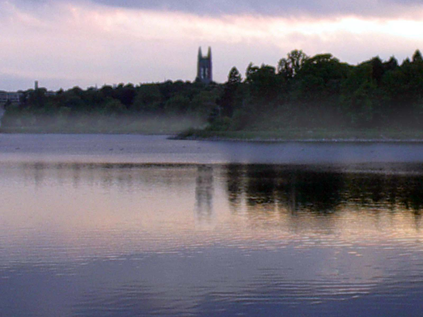
View of Boston College from across the reservoir Location Boston, Massachusetts Coordinates 42°20′6.30″N 71°9′30.52″W / 42.335083°N 71.1584778°WCoordinates: 42°20′6.30″N 71°9′30.52″W / 42.335083°N 71.1584778°W Lake type reservoir Basin countries United States Chestnut Hill Reservoir is a reservoir created in 1870 on existing marshes and meadowland to supplement the city of Boston's water needs. It is surrounded by Chestnut Hill, a neighborhood which consists of parts of Boston, Brookline, and Newton. The reservoir, though, is located entirely within the city limits of Boston[1] A 1.56 mile[2] jogging loop abuts the reservoir. Chestnut Hill Reservoir was taken offline in the 1970s as it was no longer needed for regular water supply distribution,[3] but is maintained in emergency backup status.[4][5] It is recognized today on the National Register of Historic Places and it has designation as a City of Boston Landmark.
On May 1, 2010, the Chestnut Hill Reservoir was temporarily brought back online during a failure of a connecting pipe at the end of the MetroWest Water Supply Tunnel. Though a boil-water order was issued for fear that the water would not be safe to drink, following heavy treatment with chlorine later tests showed the water to be completely safe for drinking.[6][7]
See also
References
- ^ AAA Map of Boston including Arlington, etc., 2007, Heathrow, Florida: AAA
- ^ Water For Greater Boston Brighton Allston Historical Society. See paragraph 9.
- ^ Department of Conservation and Recreation
- ^ Massachusetts Water Resources Authority (May 4, 2009). "Water Supply and Demand". http://www.mwra.com/04water/html/wsupdate.htm. Retrieved 2009-08-16.
- ^ Massachusetts Water Resources Authority (August 9, 2006). "Water System History". http://www.mwra.com/04water/html/hist1.htm. Retrieved 2009-08-16. "Completion to the Dorchester Tunnel in 1978 allowed the demands of the southern systems to be removed from the Sudbury Aqueduct. However, because there is no redundancy for the Dorchester Tunnel, the facilities taken off line in 1978 must remain in stand-by status."
- ^ Daley, Beth; Gil, Gideon (May 5, 2010). "Tests confirm it — water was OK to drink all weekend". The Boston Globe. http://www.boston.com/news/local/massachusetts/articles/2010/05/05/turns_out_water_was_ok_to_drink_after_all/.
- ^ http://www.wbur.org/2010/05/03/laskey-debrief
External links
Categories:- Landforms of Boston, Massachusetts
- Landforms of Suffolk County, Massachusetts
- Reservoirs in Massachusetts
- Buildings and structures in Suffolk County, Massachusetts
- Massachusetts geography stubs
Wikimedia Foundation. 2010.