- Cornettsville, Kentucky
-
Cornettsville — Unincorporated community — Location within the state of Kentucky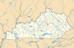
 Cornettsville
Coordinates: 37°08′02″N 83°04′37″W / 37.13389°N 83.07694°WCoordinates: 37°08′02″N 83°04′37″W / 37.13389°N 83.07694°W Country United States State Kentucky County Perry Elevation 932 ft (284 m) Population (2000) - Total 792 Time zone Eastern (EST) (UTC-5) - Summer (DST) EDT (UTC-4) ZIP codes 41731 Area code(s) 606 FIPS code GNIS feature ID 490126 Cornettsville is an unincorporated community in Perry County, Kentucky, United States, within the state's eastern mountain region known for coal mining. The population is 792 as of the 2000 United States Census. The town was named for one of the early pioneers to the area, William Jesse Cornett, whose log cabin and burial site can still be seen today.[1]
Geography
Cornettsville is located at 37°08′02″N 83°04′37″W / 37.13389°N 83.07694°W, with an elevation of approximately 932 feet (284 m).[2] The town is located in the Eastern Mountain Coal Fields region of Kentucky and it is in the eastern time zone of the United States. The zip code for Cornettsville is 41731.[3]
References
- ^ Rennick, Robert M. (1988). "Place Names". Kentucky Place Names. Lexington, Kentucky: The University Press of Kentucky. ISBN 0813101794. Retrieved on 2010-07-01
- ^ U.S. Geological Survey Geographic Names Information System: Cornettsville, Kentucky Retrieved on 2010-07-01
- ^ Cornettsville, Kentucky community profile KY HomeTownLocator. Retrieved on 2010-07-01
Municipalities and communities of Perry County, Kentucky County seat: Hazard Cities 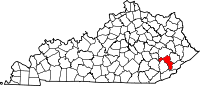
Unincorporated
communitiesCategories:- Populated places in Perry County, Kentucky
- Unincorporated communities in Kentucky
- Kentucky geography stubs


Wikimedia Foundation. 2010.