Chimney Rock, Colorado

Chimney Rock, Colorado
—  Town  —
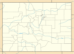
Chimney Rock, Colorado is located in Colorado
Chimney Rock, Colorado
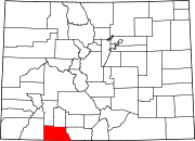
Location within the state of Colorado
Coordinates: 37°13′43″N 107°20′45″W / 37.22861°N 107.34583°W / 37.22861; -107.34583Coordinates: 37°13′43″N 107°20′45″W / 37.22861°N 107.34583°W / 37.22861; -107.34583
Country  United States
State  Colorado
County Archuleta[1]
Government
 - Type unincorporated community
Elevation[1] 7,867 ft (2,398 m)
Time zone MST (UTC-7)
 - Summer (DST) MDT (UTC-6)
ZIP Code 81127[2]
GNIS feature ID 0196439

Chimney Rock is an unincorporated community and USPS in Archuleta County, Colorado, United States. The Chimney Rock Post Office has the ZIP Code 81127.[2]

Geography

The Chimney Rock Post Office is located at 37°13′43″N 107°20′45″W / 37.22861°N 107.34583°W / 37.22861; -107.34583 (37.228610,-107.345830). The town name is derived from a nearby rock formation, now contained within the Chimney Rock Archeological Site.

See also

References

  1. ^ a b "US Board on Geographic Names". United States Geological Survey. 2007-10-25. http://geonames.usgs.gov. Retrieved 2008-01-31. 
  2. ^ a b "ZIP Code Lookup" (JavaScript/HTML). United States Postal Service. December 22, 2006. http://zip4.usps.com/zip4/citytown.jsp. Retrieved December 22, 2006. 

Wikimedia Foundation. 2010.

Игры ⚽ Поможем решить контрольную работу

Look at other dictionaries:

  • Chimney Rock — can refer to one of the following sites in the United States and Canada: Chimney Rock National Historic Site, a 325 foot geological formation in Nebraska Chimney Rock, North Carolina Chimney Rock State Park, a 315 foot granite monolith near… …   Wikipedia

  • Chimney Rock Archeological Site — This is an article about Chimney Rock Archaeological Site in Colorado. For the Chimney Rock in Nebraska, see Chimney Rock National Historic Site Chimney Rock Archeological Site U.S. National Register of Historic Places …   Wikipedia

  • Chimney Rock National Historic Site — This article is about the landmark in Nebraska along the historic Oregon Trail and Mormon Pioneer National Historic Trail; for other uses, see Chimney Rock (disambiguation). Chimney Rock National Historic Site IUCN Category III (Natural Monument) …   Wikipedia

  • Rock formations in the United States — The following is a partial list of rock formations in the United States, by state: Arizona*Peralta Canyon, Phoenix *Red Rock Country, Sedona California*Alabama Hills *Castle Crags *El Capitan *Half Dome *Indian Rock, Indian Rock Park *Nine… …   Wikipedia

  • Colorado State Highway 151 — State Highway 151 Route information Maintained by CDOT Length: 33.9 mi …   Wikipedia

  • National Register of Historic Places listings in Colorado — There are more than 1,300 properties and historic districts in Colorado listed on the National Register of Historic Places. They are distributed over 63 of Colorado s 64 counties. (Broomfield County is the sole exception.) Contents: Counties in… …   Wikipedia

  • List of cities and towns in Colorado — Adams Alam Arapahoe …   Wikipedia

  • Hole-in-the-Rock-Trail — Der Hole in the Rock Trail ist eine rund 320 Kilometer lange historische Überlandverbindung im Süden Utahs. Inhaltsverzeichnis 1 Geschichte 2 Hole in the Rock Road 3 Referenzen 4 Weblinks …   Deutsch Wikipedia

  • List of places in Colorado: A–D — Adams Alam Arapahoe …   Wikipedia

  • Hole in the Rock Road — The Hole in the Rock Road runs through an area west of the Escalante River, in southern Utah in the western United States. It is within the borders of the Grand Staircase Escalante National Monument and the adjacent Glen Canyon National… …   Wikipedia

Share the article and excerpts

Direct link
Do a right-click on the link above
and select “Copy Link”