- Akhurian River
-
For the village in Armenia, see Akhuryan.
Akhurian
Ախուրյան
Arpaçay
Ахурян
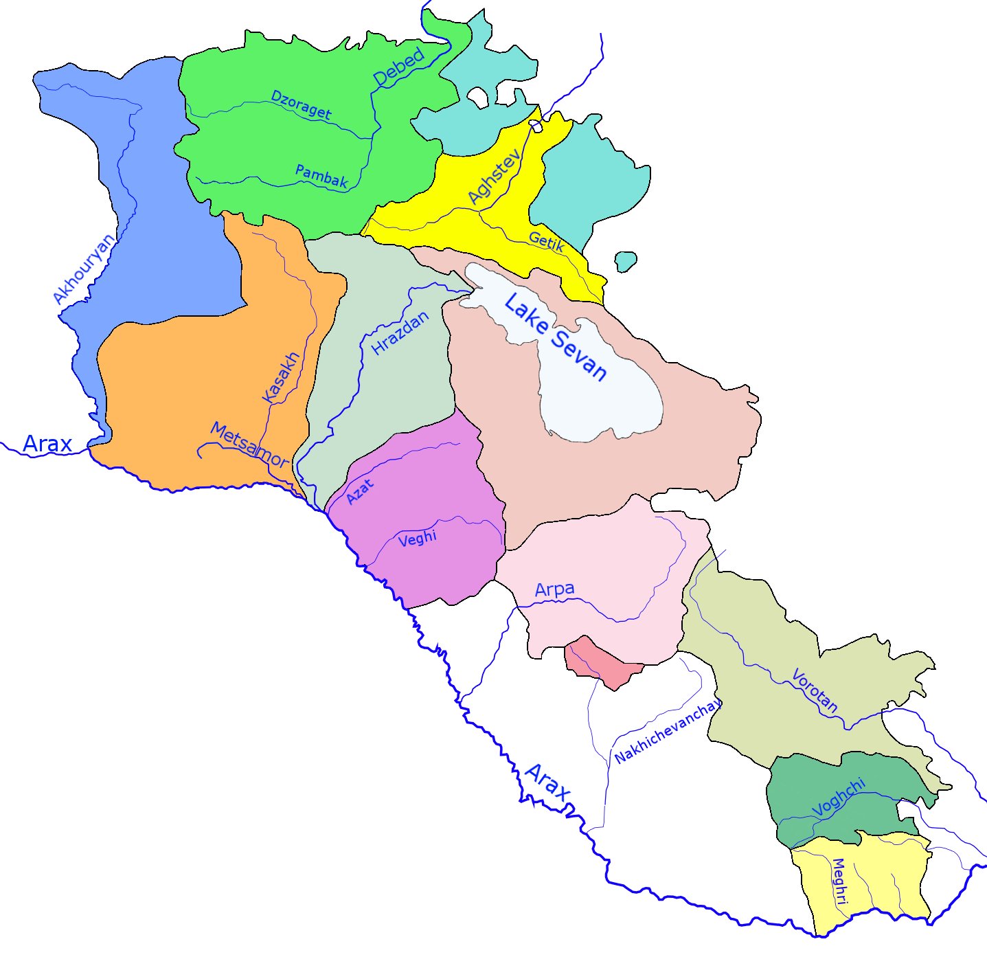
The Akhurian River seen from the ancient Armenian capital of Ani in Turkey.Origin Lake Arpi, Shirak, Armenia Mouth Near Bagaran Basin countries Armenia and Turkey Length 186 km (116 mi) Source elevation 2,023 m (6,637 ft)  Akurian river and its basin (blue) within Armenia
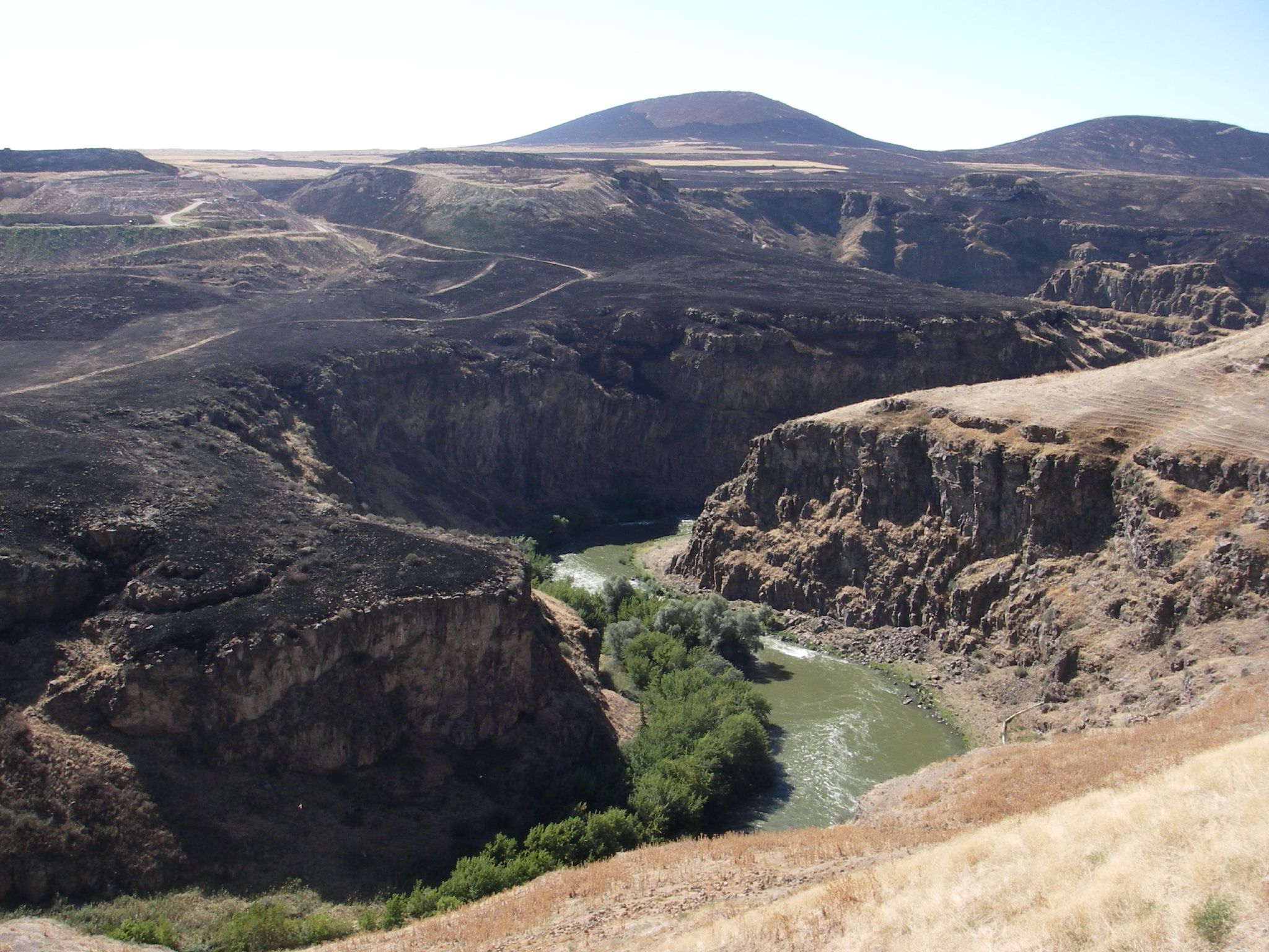
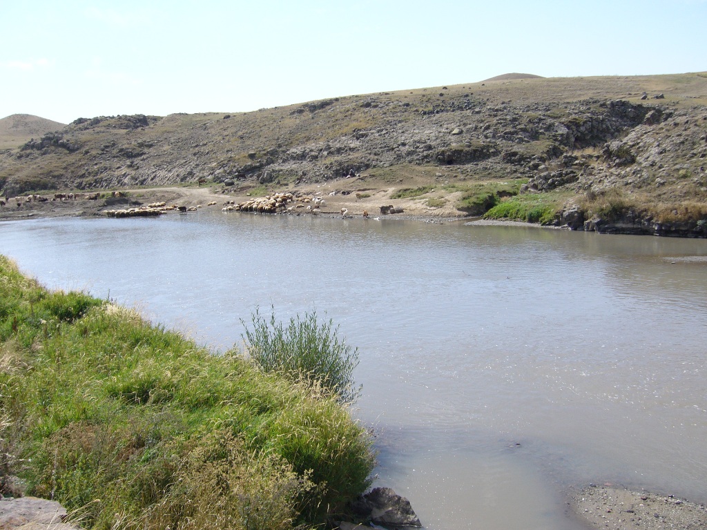
The Akhurian, Akhuriyan, Akhuryan or Akhouryan (Armenian: Ախուրյան; Turkish: Arpaçay; Russian: Арпачай or Ахурян[1][2]) is a river in the South Caucasus. It originates in Armenia and flows from Lake Tseli south, along the border with Turkey, forming part of the geographic border between the two states, until it flows into the Aras River as a left tributary near Bagaran. The Akhurian drains an area of about 9,500 km² (3,700 mi²); and has total length of 186 km (116 mi).
Gyumri, the second largest city of Armenia, is located on the east bank of the river, which also flows past four of the twelve historical capitals of Armenia: Ani, Bagaran, Yervandashat and Yerazgavors.
Contents
History
When the Byzantine army arrived in the province of Shirak in 1041, local Armenian nobles (nakharars) assembled together against them under the command of the Pahlavuni general Vahram Pahlavouni. Vahram then selected a body of 30,000 infantry and 20,000 cavalry, forming three divisions, which fought against the Byzantines.[3] A battle ensued in which the invaders were routed with great slaughter. The fight was so ferocious that the effusion of blood flowing into the Akhurian River is said to have coloured its waters completely red.[4][5] The Byzantines left 20,000 dead behind. This victory allowed Vahram Pahlavuni along with Catholicos Petros Guedadarts to crown Gagik II king of Armenia and subsequently take the fortress of Ani, which had been in the hands of Vest Sarkis.
Bridges over the Akhurian River
Several medieval bridges once existed over the Akhurian River. The bridge at Ani may date back to the Bagratuni Dynasty.[6] More likely it dates to the thirteenth century. An inscription found nearby said that building work was done on the approach to the bridge in the early fourteenth century.[7]
The bridge's single arch has fallen, leaving only tall abutments that were perhaps part of a fortified gate.[7] Nineteenth century travelers reported a guardhouse next to the bridge, but this has since disappeared.[7]
Notes
- ^ Arpachay. Brockhaus and Efron Encyclopædic Dictionary.
- ^ Other names by which the river is known are: Arpa Çayı, Akhoran, Akhoren, Akhura, Akhuran, Akhurats’ Get, Akhuren, Ahur, Ahura, Ahuran, Ano Jur, Anu Jur, Arrp’ach’ay, Arevntyan Arrp’ach’ay, Nerk’in Arevnytyan Arp’ach’ay, Gareget, Garu Get, Metsamor, Zapadnyy Arpa-Chay, Western Arpa-Chay, Arapçayı, Arpa-Chay and Arpa-Chai River
- ^ History of Armenia by Father Michael Chamich from B.C. 2247 to the Year of Christ 1780, or 1229 of the Armenian era – Page 124 by Mik'ayel Ch'amch'yants'
- ^ History of Armenia by Father Michael Chamich from B.C. 2247 to the Year of Christ 1780, or 1229... – Page 124 by Mik'ayel Ch'amch'yants'
- ^ History of Armenia: From B.C. 2247 to the Year of Christ 1780, Or 1229 of the Armenian Era – Page 124 by Michael Chamich, John Audall, Mikʻayel Chʻamchʻyantsʻ, Hovhannēs Avdaleantsʻ – 1827
- ^ A system of geography, popular and scientific: or A physical, political, and statistical account... – Page 143 by James Bell – 1832
- ^ a b c VirtualAni: The Bridge Over the Akhurian River
See also
Categories:- Rivers of Armenia
- Rivers of Turkey
- International rivers of Europe
- International rivers of Asia
- Armenia–Turkey border
-
Wikimedia Foundation. 2010.