- Rice Creek (Minnesota)
Infobox River
river_name = Rice Creek
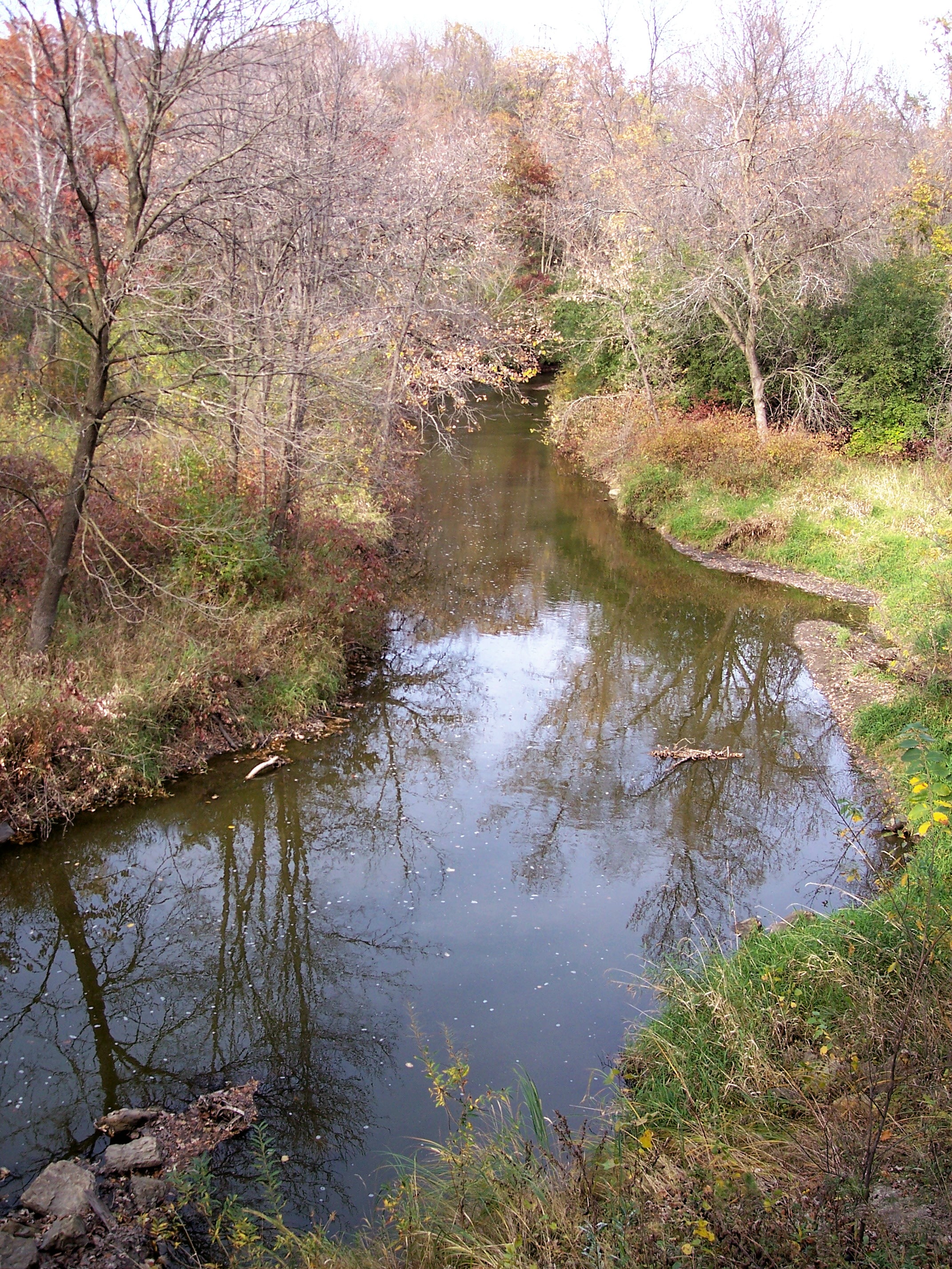
caption = Rice Creek in Fridley
origin = Clear Lake,Forest Lake, Minnesota
mouth =Mississippi River ,Fridley, Minnesota
basin_countries =United States
length = 28 mi (45 km)
elevation = 890 ft (271 m)
mouth_elevation = 806 ft (246 m)
discharge =
watershed = 201 mi² (521 km²)Rice Creek is a
tributary of theMississippi River in the northern suburbs of theMinneapolis-St. Paul metropolitan area ofMinnesota in theUnited States . It is approximately 28 miles (45 km) long and drains a watershed of 201 square miles (521 km²).Rice Creek Watershed District. "Overall Plan, Rice Creek Watershed District." "Prescribed by Minnesota Water Resources Board, December 1975."]Course
Rice Creek has its source at Clear Lake in the city of Forest Lake in Washington County and flows generally southwestwardly through Anoka and Ramsey Counties, through the cities of Columbus, Lino Lakes, Circle Pines, Shoreview, Arden Hills, Mounds View, New Brighton and Fridley."King's Twin Cities Metro Street Atlas '04." Minneapolis: The Lawrence Group. 2004. ISBN 1-58301-215-X.] It joins the Mississippi River at Manomin County Park in Fridley, [ [http://www.anokacountyparks.com/qlinks/Parks/Manomin/manomin.htm Anoka County Department of Parks and Recreation: Manomin County Park] ] about 1.5 miles (2.4 km) north of the
I-694 Bridge . The creek drops about 84 feet (26 m) along its course, from its source elevation of 890 feet (271 m) to its mouth at 806 feet (246 m), with most of the drop (64 ft/20 m) occurring in the 8 miles (13 km) upstream of its mouth; a lowlandfloodplain adjoins the stream in this reach.In Anoka County, Rice Creek passes through an extensive network of
lake s known as the Lino Lakes Chain of Lakes, a portion of which is preserved in the Rice Creek Chain of Lakes Regional Park Reserve, [ [http://www.anokacountyparks.com/qlinks/Parks/RiceCreek/ricecreek.htm Anoka County Department of Parks and Recreation: Rice Creek Chain of Lakes Regional Park Reserve] ] aregional park maintained by the government of Anoka County. In New Brighton, the creek passes through Long Lake, which is bordered by Long Lake Regional Park, maintained by Ramsey County. [ [http://www.co.ramsey.mn.us/NR/rdonlyres/2A6C7DEB-7C73-4878-A632-18FEA355C095/2947/LongLakeRegionalPark.pdf Ramsey County, Minnesota: Long Lake Regional Park map] ] In Fridley, the lower course of creek is roughly paralleled by the Rice Creek West Regional Trail, a biking and hiking trail. [ [http://www.anokacountyparks.com/qlinks/Parks/Locke/locke.htm Anoka County Department of Parks and Recreation: Locke County Park and Rice Creek West Regional Trail] ]Rice Creek's principal tributaries are Hardwood Creek, [Gnis|644665|Hardwood Creek] which drains an area of 44 square miles (114 km²) in the cities of Hugo, Forest Lake, and Lino Lakes; and Clearwater Creek, [Gnis|641317|Clearwater Creek] 8.33 miles (13.4 km) long, which drains an area of 62 square miles (161 km²) in White Bear Lake, White Bear Township, Hugo, Lino Lakes, and Centerville. Both tributaries join Rice Creek in Anoka County as part of the chain of lakes.
History
According to the
Minnesota Historical Society , Rice Creek was named forHenry Mower Rice , one of the first pair of U.S. Senators sent to represent Minnesota upon its statehood, who acquired extensive lands near the lower course of the creek in 1849.Minnesota Historical Society . [http://mnplaces.mnhs.org/upham/waterway.cfm?PlaceNameID=2543&BookCodeID=9&County=2&SendingPage=Results.cfm Minnesota Place Names. Anoka County: Rice Creek] . Retrieved onDecember 6 ,2006 .] [Minnesota Historical Society . [http://mnplaces.mnhs.org/upham/waterway.cfm?PlaceNameID=2543&BookCodeID=9&County=62&SendingPage=Results.cfm Minnesota Place Names. Ramsey County: Rice Creek] . Retrieved onDecember 6 ,2006 .] Early surveys conducted byJoseph Nicollet record the name of Rice Creek as "Ottonwey River" or "Atoonowe-ziibi" in theOjibwe language meaning "River for making Canoes." [Nicollet, Joseph Nicolas and J. C. Fremont. Report intended to illustrate a map of the Upper Mississippi River. Washington, DC: Blair and Rives, 1843.] However, its Ojibwe language name has also been recorded as "Manominikan Sibi" or "Manoominikaan-ziibi", meaning "river full ofwild rice ," [Durand, Paul C., and Robin Siev Durand. "Where the Waters Gather and the Rivers Meet: An Atlas of the Eastern Sioux." Published by the author. Prior Lake, MN: 1994.] Nicollet, Joseph N. "Journals of Joseph N. Nicollet" St. Paul: Minnesota Historical Society Press, reprint 2004. ISBN 0873514939] which is known to have grown plentifully in the lakes of the watershed. Nicollet described the creek as: "At 2:45, as we left the islands behind, a rivulet about thirty feet wide entered the river from the left. Its shores are adorned with beautiful white lilies. Chagobay told me that it winds back to the vicinity of the Falls of the St. Croix River, being separated from the latter by only a short portage. Its course links several alkes, while irrigating a land abundant with wild rice where the Sioux gather their yearly provisions. The Sioux call it in their language Wild Rice River, and the Chippewa "Manominikan Sibi", which means river where one reaps wild rice." "Manomin" (wild rice) was also the basis for the naming of the former Manomin County, which later was incorporated into Anoka County and ultimately became, in part, the city of Fridley, where the creek joins the Mississippi River.Archaeological evidence exists that suggests ancestors of the
Sioux hunted and fished in the vicinity of Bald Eagle Lake (approximately present-day White Bear Township) in the Rice Creek watershed, and had a summer village in the present-day city of Centerville as early as 2000 B.C.A series of
burial mounds (one linear and twelve conical) on the north side of Centerville Lake along the creek's course through Centerville are believed to have been built by people of theMississippian culture who arrived in the area around the year 1400. [Koenen, Bruce. [http://www.admin.state.mn.us/osa/docs/2001abstracts.pdf "Archaeology in Minnesota: 2001 Project Report Summaries."] Office of the the State Archaeologist. St. Paul: September 2002.]Watershed
The Rice Creek watershed drains portions of Anoka, Hennepin, Ramsey, and Washington Counties:
*Anoka County - 76 mi² (197 km²)
*Hennepin County - less than 0.1 mi² (<0.2 km²)
*Ramsey County - 48 mi² (124 km²)
*Washington County - 77 mi² (199 km²)The watershed occupies portions of the following jurisdictions: [ [http://www.ricecreek.org/content/documents/map/District_Map.pdf Rice Creek Watershed District: District Map] ]
About 10 percent, or approximately 19 mi² (49 km²), of the watershed's surface area is occupied by lakes, the largest of which are White Bear Lake at convert|2140|acre|km2; and Bald Eagle Lake at convert|1046|acre|km2. Twenty-eight lakes in the watershed exceed convert|100|acre|km2 in size. About 13 percent, or approximately 26 mi² (67 km²), of the watershed consists of
wetland s.
Wikimedia Foundation. 2010.