- Oodnadatta Track
-
Oodnadatta Track 
From  Stuart Highway,
Marla (27°18′S 133°37′E / 27.3°S 133.617°E)To  Birdsville Track,
Marree (29°38′S 138°03′E / 29.633°S 138.05°E)Length 620 km State(s) South Australia Region(s) Lake Eyre National Park Permit No Fuel supply Marla, Oodnadatta, William Creek, Marree Facilities airstrips,charters at all towns; UHF Radio repeaters with 100 km range on various channels provide emergency contact with locals. Swim Pools and Police stations at Oodnadatta and Marla  Lake Eyre South from Oodnadatta Track
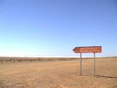
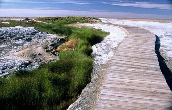
 Mound Springs on the Oodnadatta Track.
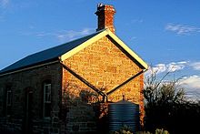 Railway Cottage at Coward Springs- Oodnadatta Track.
The Oodnadatta Track (28°54′S 136°21′E / 28.9°S 136.35°ECoordinates: 28°54′S 136°21′E / 28.9°S 136.35°E), Australia is an unsealed 620 kilometre track between Marree and Marla via Oodnadatta in South Australia. It passes the southern lake of the Lake Eyre National Park.
The Track follows a traditional aboriginal trading route, and provides travellers with some stunning semi-desert scenery. Along the Track are numerous springs feeding water from the Great Artesian Basin, the most accessible examples being the mound springs found in Wabma Kadarbu Mound Springs Conservation Park near Coward Springs. Later, because of the availability of water, the route was chosen for the steam-train powered Central Australian Railway, the original route of The Ghan, also the route taken by the explorer John McDouall Stuart on his third expedition in 1859.[1] Remnants of the many railway sidings and Overland Telegraph repeater stations are still along the track - some of the best preserved are the Coward Springs Campground - complete with natural artesian spa and Curdimurka. Today, the Oodnadatta Track roughly follows the former railway line as far north as Oodnadatta, and then turns to the west, meeting the sealed Stuart Highway at Marla. In dry weather, it is passable to most vehicles and caravans, but a 4-wheel-drive is preferable. The Track was named by Adam Plate of the Oodnadatta Progress Association Inc. in about 1980 to form a trilogy of unsealed tourist routes with the Birdsville and Strzelecki Tracks nearby.
See also
References
- ^ "Outback: The Oodnadatta Track". National Roads and Motorists' Association (NRMA). http://www.mynrma.com.au/cps/rde/xchg/mynrma/hs.xsl/oodnadatta_track.htm. Retrieved 2008-06-24.
External links
- "Tracking History to Oodnadatta" by Roderick Eime
Categories:- Australia road stubs
- Highways in South Australia
- Australian outback tracks
- Far North (South Australia)


Wikimedia Foundation. 2010.