- Metal Bridge, Cumbria
-
Coordinates: 54°58′26″N 3°00′19″W / 54.9740°N 3.0054°W
Metal Bridge
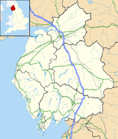
 Metal Bridge shown within Cumbria
Population Unknown OS grid reference NY356648 Parish Rockcliffe / Westlinton District City of Carlisle Shire county Cumbria Region North West Country England Sovereign state United Kingdom Post town CARLISLE Postcode district CA6 Dialling code 01228 Police Cumbria Fire Cumbria Ambulance North West EU Parliament North West England UK Parliament Carlisle List of places: UK • England • Cumbria Metal Bridge is a small settlement in Cumbria, England between Carlisle and Gretna, formerly on the main A74 road.
The settlement consists of a few properties clustered around a public house (no longer open to the public) of the same name[1], on the south bank of the River Esk.
The settlement and pub (and nearby forest plantation) derive their name from the metal bridge that spanned the river at this point on the road to Scotland.
The M6 motorway extension opened in December 2008 and bypasses the village, replacing the A74 road dual carriageway as the main route across the Scottish border.[2]
References
- ^ Todhills Blackford Pubs & Inns Metal Bridge Inn Near Carlisle Carlisle & East Cumbria UK
- ^ M6 Carlisle to Guards Mill Extension
Categories:- Cumbria geography stubs
- Hamlets in Cumbria
Wikimedia Foundation. 2010.

