- M-211 (Michigan highway)
-
M-211
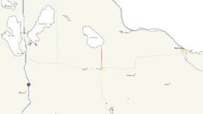
M-211 highlighted in redRoute information Maintained by MDOT Length: 5.147 mi[3] (8.283 km) History: ca. 1924[1] – 1934 as M-95
1934[2] – present as M-211Major junctions South end:  M-68 in Onaway
North end: Onaway State Park near Onaway Location Counties: Presque Isle Highway system Michigan State Trunkline Highway System
Interstate • US • State←  M-210
M-210M-212  →
→M-211 is a short state trunkline highway in the Lower Peninsula (LP) of Michigan that connects the community of Onaway with Onaway State Park. The highway runs through farmland and forest along the 5.174-mile (8.327 km) to the park. The trunkline was originally designated M-95 before 1934. In that year, the designation was swapped to a highway in the Upper Peninsula (UP), and the state park connector was given the current number.
Contents
Route description
M-211 is a rural two-lane highway that starts at M-68 in Onaway and runs north out of town on Main Street. The trunkline passes the Leo E. Getz County Airport north of town and enters an area of farmland. As the highway continues north and approaches the Onaway State Park, the terrain transitions to forest land. M-211 ends at Bonz Beach Highway in front of the gate of Onaway State Park, located on the shore of Black Lake. All of M-211 is undivided,[4][5] and none of it is listed on the National Highway System.[6]
History
Before 1924, a highway was designated between M-10 in Onaway and the state park; this highway was numbered M-95. In 1934, the highway was redesignated to free up the M-95 number. At the time, a highway in the UP was numbered M-45, but US Highway 45 was being extended into Michigan. The Michigan State Highway Department renumbered M-45 in the UP as M-95, and M-95 in the LP as M-211.[2] The M-45 designation was later reused in the Grand Rapids area in 1964.[7][8] By the middle of 1960, all of the current M-211 was paved.[9]
Major intersections
The entire highway is in Presque Isle County.
Location Mile[3] Destinations Notes Onaway 0.000 M-68 – Indian River, Rogers CityNorth Allis Township 5.174 Bonz Beach Highway Onaway State Park gate 1.000 mi = 1.609 km; 1.000 km = 0.621 mi References
- ^ Michigan State Highway Department (May 15, 1924). Official Highway Service Map (Map). Cartography by MSHD.
- ^ a b Michigan State Highway Department (September 1, 1934). Official Michigan Highway Map (Map). Cartography by Rand McNally. Section E11.
- ^ a b "MDOT Physical Reference Finder Application". Michigan Department of Transportation. 2009. http://www.mcgi.state.mi.us/prfinder/. Retrieved September 29, 2010.
- ^ Michigan Department of Transportation (2010). Official Department of Transportation Map (Map). 1 in:15 mi/1 cm:9 km. Section E11.
- ^ Google, Inc. Google Maps – Overview Map of M-211 (Map). Cartography by Google, Inc. http://maps.google.com/maps?f=d&source=s_d&saddr=Main+St&daddr=M-211+N&hl=en&geocode=FT4atAIdfsj6-g%3BFWA9tQIdUMT6-g&mra=dme&mrcr=0&mrsp=1&sz=13&sll=45.398329,-84.231663&sspn=0.113907,0.116386&ie=UTF8&t=h&z=13. Retrieved September 28, 2010.
- ^ Michigan Department of Transportation (April 23, 2006) (PDF). National Highway System, Michigan (Map). http://www.michigan.gov/documents/MDOT_NHS_Statewide_150626_7.pdf. Retrieved October 7, 2008.
- ^ Michigan State Highway Department (1964). Official Highway Map (Map). Section K8.
- ^ Michigan State Highway Department (1965). Official Highway Map (Map). Section K8.
- ^ Michigan State Highway Department (1960). Official Highway Map (Map). Section E11. (Includes all changes through July 1, 1960)
External links
Categories:- State highways in Michigan
- Presque Isle County, Michigan


Wikimedia Foundation. 2010.