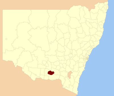
Lockhart Shire — Shire of Lockhart Lage des Lockhart Shire in New South Wales Gliederung … Deutsch Wikipedia
Urana Shire Council — Infobox Australian Place | type = lga name = Urana Shire caption = Administration office, Urana Shire Council. state=New South Wales region=Riverina area=3357 seat=Urana (William Street)cite web title=Urana Shire Council publisher = Department of … Wikipedia
Narrandera Shire Council — Infobox Australian Place | type = lga name = Narrandera Shire caption = Location in NSW state=New South Wales region=Riverina area = 4116.02 area footnotes = [cite web|title = Narrandera Regional Profile | url =… … Wikipedia
Forbes Shire Council — Infobox Australian Place | type = lga name = Forbes Shire state = nsw caption = Location in New South Wales pop = 9,691 Census 2001 AUS|id=LGA12900|name=Forbes (A) (Local Government Area)|accessdate=2007 06 30|quick=on] area = 4720 est = seat =… … Wikipedia
Corowa Shire Council — Infobox Australian Place | type = lga name = Corowa Shire caption = Location in New South Wales state=New South Wales region=Riverina area=2324 seat=Corowa (Corner Bow Street Honour Avenue)cite web title=Corowa Shire Council publisher =… … Wikipedia
Lockhart, New South Wales — Infobox Australian Place | type = town name = Lockhart state = nsw caption = Looking east in the main street of Lockhart lga = Lockhart Shire Council postcode = 2656 pop = 887 est = elevation= maxtemp = mintemp = rainfall = county = Urana… … Wikipedia
Shire of Croydon — Queensland Location within Queensland Population … Wikipedia
Shire of Nebo — Queensland Location within Queensland Population: 2,520 (20 … Wikipedia
Lockhart River, Queensland — Infobox Australian Place type = town name = Lockhart River state = qld caption = lga = Lockhart River Aboriginal Shire Council postcode = 4871 coordinates = coord|12.7861|S|143.3419|E|display=inline,title|region:AU QLD type:city est = pop = 542… … Wikipedia
Shire of Cook — Queensland Location within Queensland Population: 3,976(201 … Wikipedia