Greater Hume Shire Council
- Greater Hume Shire Council
Infobox Australian Place | type = lga
name = Greater Hume
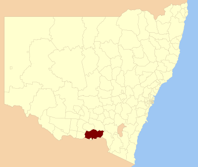
caption = Location in New South Wales
state=New South Wales
region=Riverina
area=5746
seat=Holbrook (39 Young Street}[cite web]
title=Greater Hume Shire Council
publisher = Department of Local Government
url = http://www.dlg.nsw.gov.au/dlg/dlghome/dlg_CouncilContactDetails.asp?slacode=3370
accessdate = 2006-11-09 ]
est =
pop=10,510 [cite web
publisher = Australian Bureau of Statistics
title=Regional Population Growth, Australia, 2004-05
url = http://abs.gov.au/Ausstats/abs@.nsf/Latestproducts/3218.0Main%20Features22004-05?opendocument&tabname=Summary&prodno=3218.0&issue=2004-05&num=&view=
accessdate = 2006-12-03 ]
url=http://www.greaterhume.nsw.gov.au
mayor=Denise Osborne
deputymayor=John Ross
fedgov =Farrer
stategov =Albury
near-nw= Urana
near-w= Corowa
near-sw= Indigo (Vic)
near-s= Albury
near-se= Tumbarumba
near-e= Tumbarumba
near-ne= Tumut
near-n= Wagga Wagga
Greater Hume Shire Council is a Local Government Area (LGA) of New South Wales, Australia. The Council was formed in 2004 incorporating Culcairn Shire, the majority of Holbrook Shire and part of Hume Shire.
The Shire is crossed by the Hume, Olympic and Riverina Highways.
Major towns in the LGA are Holbrook (postcode: 2644, coord|35|42|S|147|19|E|region:AU-NSW) and Culcairn (postcode: 2660, coord|35|39|S|147|02|E|region:AU-NSW). Other towns are: Brocklesby, Bungowannah, Burrumbuttock, Gerogery and Gerogery West, Henty, Jindera, Morven, Walbundrie and Walla Walla.
Towns such as Howlong, were cut off from Hume Shire in the amalgamation, Howlong is now apart of the Corowa Shire Council.
References
Wikimedia Foundation.
2010.
Look at other dictionaries:
Greater Hume Shire — Shire of Greater Hume Lage des Greater Hume Shire in New South Wales Gliederung … Deutsch Wikipedia
Hume — ( Home is an older variant spelling of Hume, still used for the senior branches of the family) is a surname that originated in the South East of Scotland, of which the senior representatives are the Earls of Home. The name can refer to several… … Wikipedia
Hume County — Map of all coordinates from Google Map of all coordinates from Bing Export all coordinates as KML … Wikipedia
Lockhart Shire Council — Infobox Australian Place | type = lga name = Lockhart Shire state = nsw caption = Location in New South Wales pop = density = area = 2895.32 area footnotes = [cite web|title = Lockhart Regional Profile | url =… … Wikipedia
Urana Shire Council — Infobox Australian Place | type = lga name = Urana Shire caption = Administration office, Urana Shire Council. state=New South Wales region=Riverina area=3357 seat=Urana (William Street)cite web title=Urana Shire Council publisher = Department of … Wikipedia
Tumut Shire Council — Infobox Australian Place | type = lga name = Tumut Shire caption = Location in New South Wales state=New South Wales region=South West Slopes area=4566 area footnotes = cite web title=Tumut Shire Council publisher = Department of Local Government … Wikipedia
Tumbarumba Shire Council — Infobox Australian Place | type = lga name = Tumbarumba Shire caption = Location in New South Wales state=New South Wales region=Riverina area=4392 area footnotes = cite web title=Tumbarumba Shire Council publisher = Department of Local… … Wikipedia
Corowa Shire Council — Infobox Australian Place | type = lga name = Corowa Shire caption = Location in New South Wales state=New South Wales region=Riverina area=2324 seat=Corowa (Corner Bow Street Honour Avenue)cite web title=Corowa Shire Council publisher =… … Wikipedia
Shire of Towong — Lage des Towong Shire in Victoria Basisdaten Bundesstaat: Victoria Hauptort: Tallangatta Fläche: 6.635 … Deutsch Wikipedia
Shire of Melton — Victoria Location of Melton within Melbourne s metropolitan area. Population: 78,912 (2006) … Wikipedia