- Oranjemund
-
Oranjemund
O.J— Formal — Nickname(s): O – Town Motto: Excellence Integrity Teamwork Diversity Location in Namibia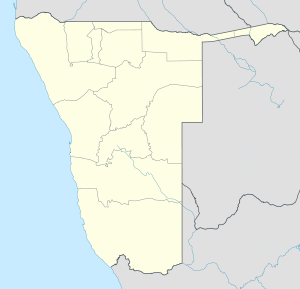
 Oranjemund
Coordinates: 28°33′6″S 16°25′35″E / 28.55167°S 16.42639°ECoordinates: 28°33′6″S 16°25′35″E / 28.55167°S 16.42639°E Country  Namibia
Region Karas Region Constituency Oranjemund Constituency Elevation 39 ft (12 m) Population (2001)[1] – Total 4,451 Time zone South African Standard Time (UTC+1) Oranjemund (German for: "Mouth of Oranje") is a town of 4,000 inhabitants situated in the extreme southwest of Namibia, on the northern bank of the Orange River mouth. It exists to service the diamond industry.
The town is run by Namdeb (formerly Consolidated Diamond Mines), now a subsidiary of De Beers. Access to, and settlement in Oranjemund is restricted to employees and their relatives. Its infrastructure is superior to that of other towns in Namibia's South, due to it not being dependent on cost recovery from its inhabitants. In the second half of the 20th century, Oranjemund featured a large recreational complex with swimming pool, cinema, restaurants and bars.[2] Water is still provided free of charge, and until 2009 so was electricity.[3] There is a border post to South Africa, only persons with pre-application of 1 month are allowed to cross the border.
First established in 1936, following Hans Merensky's discovery of significant alluvial diamond deposits on the north bank of the Orange River and the adjacent northern coastline. Production of mainly gem-quality diamonds has remained in the region of 2 million carats (400 kg) per year since inception of the mine, mainly through improvements in technology.
Contents
Geography
Climate
Oranjemund has a mild desert climate (BWn, according to the Köppen climate classification), with pleasant temperatures throughout the year. The average annual precipitation is 50 mm (2 in).
Oranjemund Climate chart (explanation) J F M A M J J A S O N D 1241532315424143231372311721106209720942010421112221322314Average max. and min. temperatures in °C Precipitation totals in mm Source: World Climate Guide Imperial conversion J F M A M J J A S O N D 075590.173590.275570.173550.373520.370500.268480.368480.268500.270520.172550.17357Average max. and min. temperatures in °F Precipitation totals in inches Transportation
The Oranjemund Airport has services operated by Air Namibia going to Cape Town, Lüderitz, Walvis Bay and Windhoek.
References
- ^ Republic of Namibia 2001 Population and Housing Census (Basic Analysis with Highlights ed.). Windhoek: Central Bureau of Statistics, National Planning Commission. July 2003. p. 21. ISBN 0869766147.
- ^ Alexander, Mike. "THE REC CLUB!". oranjemundonline.com. http://www.oranjemundonline.com/newspowerstation.html. Retrieved 16 March 2011.
- ^ Alexander, Mike. "Paying for Power!". oranjemundonline.com. http://www.oranjemundonline.com/newspowerstation.html. Retrieved 16 March 2011.
External links
- Oranjemund Online, unofficial website with historic pictures
- Oranjemund weather conditions
Categories:- Namibia–South Africa border crossings
- Karas Region
- Mining communities in Africa
- Towns in Namibia
- Mining in Namibia
- Namibia geography stubs

Wikimedia Foundation. 2010.