- Oranjemund Airport
-
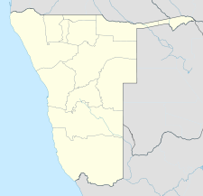
Oranjemund Airport IATA: OMD – ICAO: FYOG Location of airport in Namibia Summary Airport type Public Serves Oranjemund, Namibia Elevation AMSL 14 ft / 4 m Coordinates 28°35′05″S 016°26′48″E / 28.58472°S 16.44667°E Runways Direction Length Surface m ft 02/20 1,601 5,252 Asphalt Source: DAFIF[1][2] Oranjemund Airport (IATA: OMD, ICAO: FYOG) is an airport serving Oranjemund,[1] a town in the Karas Region of Namibia. The town and airport are located near the northern bank of the Orange River, which is the border between Namibia and South Africa.
Contents
Facilities
The airport resides at an elevation of 14 feet (4 m) above mean sea level. It has one asphalt paved runways designated 02/20 which measures 1,601 by 18 metres (5,253 × 59 ft).[1]
Airlines and destinations
Airlines Destinations Air Namibia Cape Town, Lüderitz, Walvis Bay, Windhoek References
- ^ a b c Airport information for FYOG from DAFIF (effective October 2006)
- ^ Airport information for OMD at Great Circle Mapper. Source: DAFIF (effective Oct. 2006).
Bay Air Swakopmund Oranjemund West Air Charters Windhoek, Rosh Pinah, Oranjemund
External links
Categories:- Airports in Namibia
- Buildings and structures in Karas Region
- Southern African airport stubs
- Namibian building and structure stubs
Wikimedia Foundation. 2010.

