- Mardale Ill Bell
-
Mardale Ill Bell Cumbria,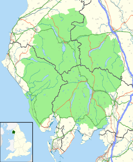
 Mardale Ill Bell
 England
Elevation 760 m (2,493 ft) Prominence c. 14 m Parent peak High Street Listing Wainwright, Location Range Lake District, Far Eastern Fells Coordinates 54°29′03″N 2°51′13″W / 54.48413°N 2.85352°WCoordinates: 54°29′03″N 2°51′13″W / 54.48413°N 2.85352°W Topo map OS Explorer OL5, Explorer OL7 OS grid NY448102 Mardale Ill Bell is a fell in the English Lake District, rising to the south west of Haweswater Reservoir. It stands on the watershed between Mardale and Kentmere and is the highpoint of the south eastern ridge of High Street, midway on its course to Harter Fell.
Contents
Topography
The head of the Kentmere valley lies to the south west of the fell with rough slopes leading down over scree to Kentmere Reservoir. Mardale Ill Bell sends out a short grass topped spur, Lingmell End, which splits the head of the valley into two.
The north eastern face of Mardale Ill Bell forms the craggy backdrop to Blea Water. This perfect corrie tarn is the deepest in the Lake District at 207 ft [1]. It's outflow feeds Haweswater, joining with that of a second tarn, Small Water. Between the two, Mardale Ill Bell throws out the rocky spur of Piot Crag. Two tiers of crag drop down to the confluence at Mardale Waters.
South east of the summit a rough narrowing ridge drops to Nan Blield pass at 2,100 ft, before rising again over rocky steps to Harter Fell. Nan Bield was the ancient trading route between Kentmere and the now drowned village of Mardale Green, submerged by the raising of Haweswater in the 1940s. Near the shore of Small Water on the descending path are a number of stone shelters, pointers to the earlier importance of the pass. These each provide refuge for one person in extremis, entrance being via crawling.
North west from Mardale Ill Bell the grassy ridge crosses a wet depression and then expands into a wide plateau, triangular in plan. High Street and Thornthwaite Crag are at the other two corners, with the roman road crossing north to south.
Summit and view
The summit has two large cairns on grass, the northern one being the top. The view westwards is confined by higher fells but the Ill Bell ridge and Coniston range are seen to good effect.[2] Blea Water and Small Water can be brought into sight from the rim of the crags.
Ascents
The most popular routes of ascent are on the Mardale side. From the road end Nan Bield pass can be used, or the impressive scenery of Piot Crag can be attained from the shore of either Blea or Small Water. From Kentmere, Nan Bield provides the obvious route, although a pathless climb up to the top of Lingmell End is possible.
References
- ^ Blair, D: Exploring Lakeland Tarns: Lakeland Manor Press (1993) ISBN 0-9543904-1-5
- ^ Alfred Wainwright:A Pictorial Guide to the Lakeland Fells, Book 2: ISBN 0-7112-2455-2
Wainwright's Far Eastern Fells Angletarn Pikes · Arthur's Pike · Beda Fell · Bonscale Pike · Branstree · Brock Crags · Caudale Moor (Stony Cove Pike) · Froswick · Gray Crag · Grey Crag · Hallin Fell · Harter Fell (Mardale) · Hartsop Dodd · High Raise · High Street · Ill Bell · Kentmere Pike · Kidsty Pike · The Knott · Loadpot Hill · Mardale Ill Bell · The Nab · Place Fell · Rampsgill Head · Rest Dodd · Sallows · Selside Pike · Shipman Knotts · Sour Howes · Steel Knotts · Tarn Crag · Thornthwaite Crag · Troutbeck Tongue · Wansfell · Wether Hill · YokeFull list of Wainwrights by area Categories:- Fells of the Lake District
- Wainwrights

Wikimedia Foundation. 2010.