- Oţelu Roşu
-
Oţelu Roşu — Town — 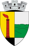
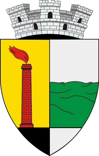
Coat of armsLocation of Oţelu Roşu
Country  Romania
County Caraş-Severin County Status Town Government – Mayor Simion Iancu (Democratic Party) Area – Total 63.81 km2 (24.6 sq mi) Population (2002) – Total 11,747 – Density 184/km2 (476.6/sq mi) Time zone EET (UTC+2) – Summer (DST) EEST (UTC+3) Website http://www.otelurosu.info Oţelu Roşu (Romanian pronunciation: [oˌt͡selu ˈroʃu]; formerly Ferdinand; Hungarian: Nándorhegy; German: Ferdinandsberg) is a town in southwestern Caraş-Severin County, Romania, in the Bistra Valley. It is situated on the national road 68, between Caransebeş (21 km away) and Haţeg. The town administers two villages, Cireşa and Mal.
Contents
Geography
Oţelu Roşu is located at an altitude of approximately 300 meters in Valea Bistrei valley, which is between the Poiana Ruscăi mountains to the north and the Ţarcu Mountains to the south. To the south of Oţelu Roşu is a large piedmont of the Ţarcu Mountains, locally named Gai. To the north the town makes direct contact with the foothills of the Poiana Ruscăi Mountains. Dominant heights are the hill of Ferdinand (overlooking the foundry) and the hill of Chiciura.
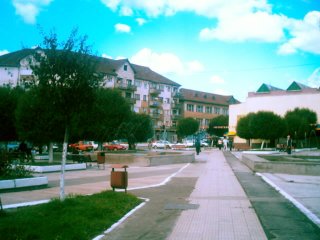
 Town center
Oţelu Roşu is subjected to west European climatic influences because of its altitude and location. The altitude and the neighbouring forests and mountains ensure a mild climate. In the winter, snow may persist as much as two or three months, however the temperatures do not drop too low. In the spring months, especially May, floods are possible due to the melting of the snow in the high areas of the Ţarcu Mountains and abundant rains. The most recent flood took place in the year 2000, destroying several bridges across the river Bistra.
History
The first signs of human habitation date from the Paleolithic, in form of primitive tools. Sporadic remnants from the Neolithic age have been found in the neighbouring areas.
During the wars between Romans and Dacians, the Bistra Valley was the route used by the emperor Trajan in penetrating into the heartland of Dacia. A Roman castrum can be found near the cemetery of Zăvoi (ancient Agnaviae), a settlement close to Oţelu Roşu.
In the fifteenth century, during medieval times, Oţelu Roşu was mentioned under the name of "Bistra", and later with the Hungarian name of Nándorhegy. After the expulsion of Turks from Banat by the Habsburgs, the area was colonised by Germans. Also, Italians are brought in to work in metalworking industry. Later, as Transylvania became part of Romania, the name of Nándorhegy was replaced with the Ferdinand.
After 1947 the name Ferdinand did not please the communists, therefore they changed it to Oţelu Roşu ("[The] Red Steel") in order to underline the importance of the town's metalworking industry.
Population
The population was 12,989 (2000) and 13,128 (1999). Causes of this demographic regress are among others the problems of the metalworking industry and the high unemployment, making many young people leave the town and move into regional centers such as Timişoara and other areas of Romania.
At the 2002 census, 90.2% of inhabitants were Romanians, 4.1% each Germans and Hungarians and 0.8% Roma. After 1989, most of the town's Germans, Italians and Slovaks emigrated. In 2002, 76.7% of residents were Romanian Orthodox, 11.4% Roman Catholic, 4.8% Pentecostal, 4.4% Baptist and 1% Reformed.
Education
The town has three schools and one industrial high school.
External links
Caraş-Severin County, Romania Cities Reşiţa (county seat) · Caransebeş
Towns Anina · Băile Herculane · Bocşa · Moldova Nouă · Oraviţa · Oţelu Roşu
Communes Armeniş · Bănia · Băuţar · Berlişte · Berzasca · Berzovia · Bolvaşniţa · Bozovici · Brebu · Brebu Nou · Buchin · Bucoşniţa · Caraşova · Cărbunari · Ciclova Română · Ciuchici · Ciudanoviţa · Constantin Daicoviciu · Copăcele · Cornea · Cornereva · Coronini · Dalboşeţ · Doclin · Dognecea · Domaşnea · Eftimie Murgu · Ezeriş · Fârliug · Forotic · Gârnic · Glimboca · Goruia · Grădinari · Iablaniţa · Lăpuşnicel · Lăpuşnicu Mare · Luncaviţa · Lupac · Marga · Măureni · Mehadia · Mehadica · Naidăş · Obreja · Ocna de Fier · Păltiniş · Pojejena · Prigor · Răcăşdia · Ramna · Rusca Montană · Sacu · Sasca Montană · Sicheviţa · Slatina-Timiş · Socol · Şopotu Nou · Târnova · Teregova · Ticvaniu Mare · Topleţ · Turnu Ruieni · Văliug · Vărădia · Vermeş · Vrani · Zăvoi · Zorlenţu Mare
Categories:- Populated places in Caraş-Severin County
- Towns in Romania

Wikimedia Foundation. 2010.