- North Bass Trail
-
This article is about the hiking trail at the north rim of Grand Canyon. For the trail from the south rim, see South Bass Trail.
North Bass Trail 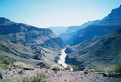
The Colorado River viewed from the near-terminus of the North Bass Trail. Length 13.5 mi; 22.7 km Location Grand Canyon National Park, Arizona, United States Trailheads North Rim
Colorado River
Grand Canyon (North Rim)Use Hiking
BackpackingElevation Change 5728 ft Highest point North Rim, 7928 ft Lowest point Colorado River, 2200ft Trail difficulty Very Strenuous Season Early Spring to
Late FallSights Grand Canyon
Colorado riverHazards Severe Weather
Overexertion
Dehydration
Flash FloodThe North Bass Trail is a hiking trail located on the North Rim of the Grand Canyon National Park, located in the U.S. state of Arizona.
Contents
Access
The trail is accessible by use of U.S. Forest Service roads along the north rim of Grand Canyon. The trailhead is located in the remote backcountry of the forests on the canyon's the north rim. To reach it, an 18-mile drive by high-clearance (4-wheel drive preferred) vehicles is required. The trail begins at Swamp Point at an elevation of 7,500 feet at the end of Swamp Point Road.
Description
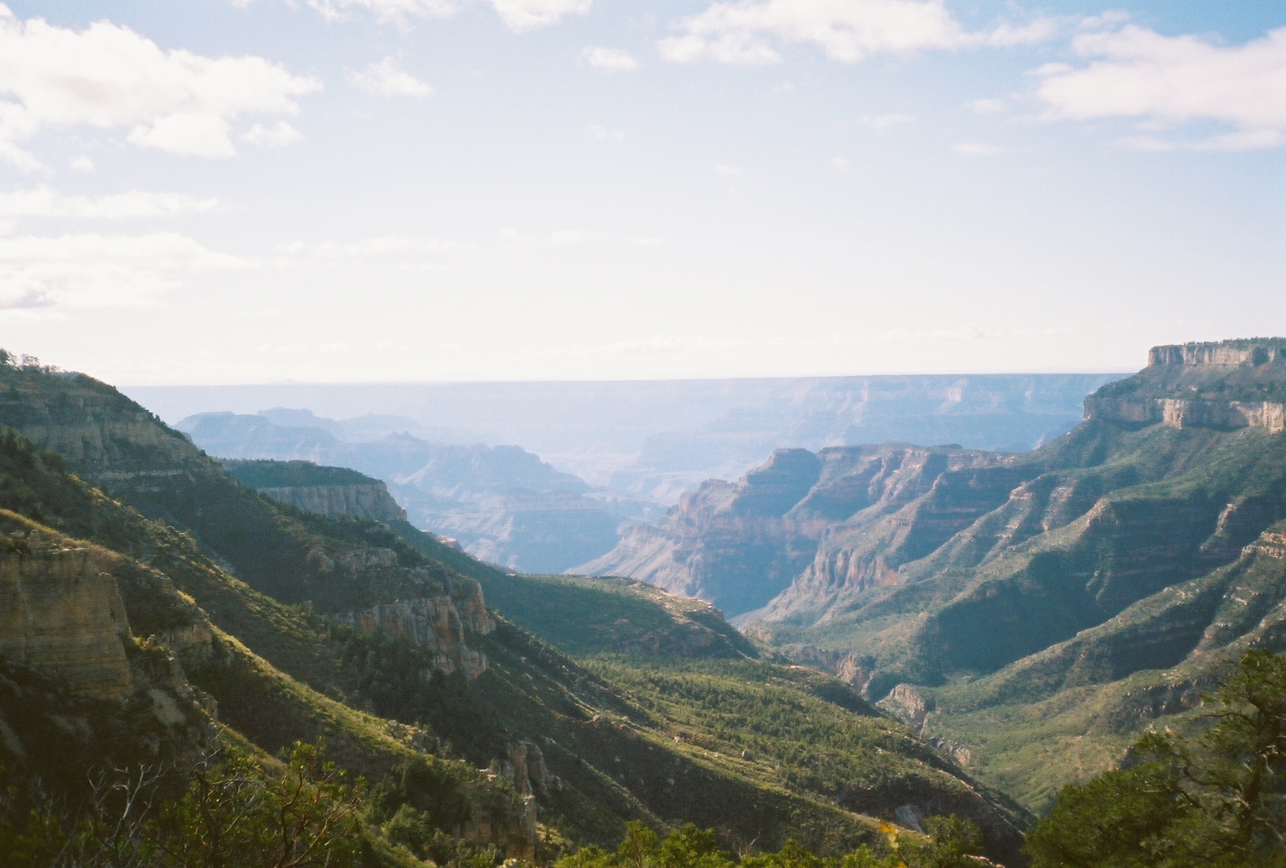
 The canyon where the North Bass Trail is located.
This 14-mile trail is considered difficult, primarily due to length and elevation. Until recently the trail was very eroded and required considerable route-finding expertise. A major reconstruction effort by a volunteer crew in 2005 restored much of the original trailbed, improving travel and navigation, but still one of the Canyon's most strenuous trails and providing access to an exceptional wilderness area.
No services are available, water sources include perennial flow in Shinumo Creek and at the Colorado River, which must be treated before consuming.
History
At one time, this trail was connected to the South Bass Trail via a cable and platform that crossed the Colorado River. The tramway no longer exists, and river crossing can only be made by raft.
See also
- The Grand Canyon
- List of trails in Grand Canyon National Park
References
External links
Coordinates: 36°20′10″N 112°20′52″W / 36.336°N 112.34783°W
Grand Canyon trails Above-rim Trails: Below-rim Trails: Beamer Trail • Bill Hall Trail • Boucher Trail • Bright Angel Trail • Clear Creek Trail • Deer Creek Trail • Dripping Springs Trail • Escalante Route • Esplanade Route • Grandview Trail • Havasupai Trail • Hermit Trail • Kanab Creek Trail • Lava Falls Trail • Nankoweap Trail • New Hance Trail • North Bass Trail • North Kaibab Trail • Plateau Point Trail • River Trail • Royal Arch Route • South Bass Trail • South Canyon Trail • South Kaibab Trail • Tanner Trail • Thunder River Trail • Tonto Trail • Tuckup Trail • Waldron TrailCategories:- Hiking trails in Grand Canyon National Park
- Arizona geography stubs
- United States trail stubs

Wikimedia Foundation. 2010.