- North Carolina Highway 143
-
NC 143
Route information Maintained by NCDOT Length: 38.3 mi[1] (61.6 km) Existed: 1979 – present Major junctions West end:  SR-165 at the TN line
 US 129 in Robbinsville
East end:  NC 28 near Stecoah
Location Counties: Graham Highway system ←  NC 142
NC 144  →
→North Carolina Highway 143 is a primary state highway in the U.S. state of North Carolina. It runs from the Tennessee state line to NC 28, near the community of Stecoah. It is best known for its 18-mile (29 km) section of the Cherohala Skyway, shared with Tennessee State Route 165.
Contents
Route description
NC 143 begins at the Tennessee state line at Beech Gap, along the Unicoi Crest. For the next 18 miles (29 km), known as the Cherohala Skyway, the highway stays along mostly the north-side of the Johns Knob, Little Haw Knob, Haw Knob, Hooper's Bald, and Cedar Top, before descending at the Santeetlah Gap. The overall driving experience is similar to the Blue Ridge Parkway; it has the same max speed of 45 miles per hour (72 km/h), and during winter the road is not maintained against snow and ice.
The next 11 miles (18 km) of highway is completely different, as NC 143 goes around south of Lake Santeetlah to Robbinsville. It has a lot of twist and turns, though (luckily) not much on elevation changes. In Robbinsville, it is overlapped with US 129 for a few miles before continuing east to Stecoah.
The last 3.6 miles (5.8 km) of NC 143 feature steep elevation changes. From Orr Branch Road (elevation 2,300 feet (700 m)), the road climbs ups the southwestern side of the Cheoah Mountains. At Stechoah Gap, the NC 143 peaks at an elevation of 3,165 feet (965 m) (this is also where the Appalachian Trail meets). The highway goes north along the eastern side of the Cheoah Mountains, reaching NC 28 at Johnson Gap (elevation 2,523 feet (769 m)).
Scenic byways
Cherohala Skyway is an 18 miles (29 km) byway and National Scenic Byway in western Graham County. It is known as a connector between the Cherokee National Forest and the Nantahala National Forest, thus the name Cherohala. The entire route offers scenic views of unspoiled forested mountains in Western North Carolina.[2]
Junction list
The entire route is in Graham County.
Location Mile[1] Destinations Notes 18 Santeetlah Road East end of Cherohala Skyway 28 US 129 north (Tapaco Road) – Tapaco, MaryvilleNorth end of US 129 overlap Robbinsville 29 
 NC 143 Bus. east (Main Street)
29.5 
US 129 south / NC 143 Bus. west (Rodney Orr Bypass)South end of US 129 overlap Stecoah 38.3 NC 28 (Fontana Road) – Fontana, Bryson CityNC 143 ends 1.000 mi = 1.609 km; 1.000 km = 0.621 mi
Concurrency terminus • Closed/Former • Incomplete access • UnopenedBannered routes
Business Loops
NC 143 has one business loops:
- Robbinsville – Established in February, 1997, the 1 mile (1.6 km) route goes through downtown Robbinsville via North and East Main Streets. It meets back with NC 143 (unsigned) on Rodney Orr Bypass. Historically, NC 143 has never been routed through Robbinsville; though US 129 has before the bypass.[3]
History
In 1979, NC 143 was established as a new primary route between Robbinsville and Stecoah, on already existing roads. Topography maps of Graham County in the early 1990's show an incomplete Cherohala Skyway already numbered as NC 143; however, this was not official until October 12, 1996, when NC 147 was extended to a completed Cherohala Skyway and its current western terminus at the Tennessee state line.[3][4]
The Cherohala Skyway segment dates earlier than NC 143 (1962), but was not completed until 1996 with a total cost of $100 million over the whole 34 years of construction.[5]
Alternate names
Though the highway is commonly known as "NC 143" or the "Cherohala Skyway" throughout the state, the highway does have other known names it uses locally in areas.
- Rodney Orr Bypass - Road name in Robbinsville.
- Sweetwater Road - Road name between Robbinsville to Stecoah.
- Tapaco Road - Road name when overlapped with US 129, except in Robbinsville.
Photo gallery
-

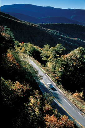
Cherohala Skyway in early autumn.
-
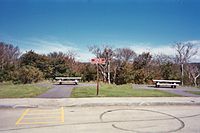
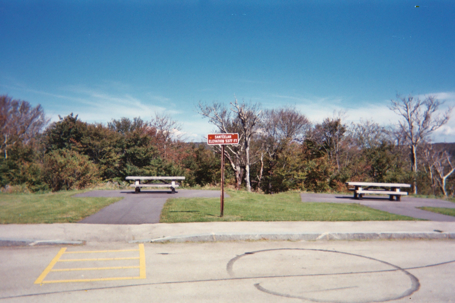
High point of the Skyway (2004-09-23).
See also
- Cheoah River
- Cherokee National Forest
- Cherohala Skyway
- Joyce Kilmer-Slickrock Wilderness
- Lake Santeetlah
- Nantahala National Forest
- Unicoi Mountains
References
- ^ a b "Google Maps". http://maps.google.com. Retrieved 2011-01-07.
- ^ "NCDOT: Scenic Byways". http://www.ncdot.org/travel/scenic/. Retrieved 2011-01-07.
- ^ a b "NCRoads.com: N.C. 143". http://members.cox.net/ncroads/nc143.html. Retrieved 2011-01-07.
- ^ "NC State Highway 143 Ends". http://www.state-ends.com/ncends/state/143.html. Retrieved 2011-01-07.
- ^ "Cherohala Skyway". http://www.cherohalaskyway.com/index.html. Retrieved 2011-01-07.
Categories:- State highways in North Carolina
- Transportation in Graham County, North Carolina

Wikimedia Foundation. 2010.