- Chiredzi
-
This article is about the town. For district, see Chiredzi (District).
Chiredzi — Town — 
Coat of armsNickname(s): Chilas 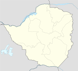
 Chiredzi
Coordinates: 21°05′S 31°40′E / 21.083°S 31.667°ECoordinates: 21°05′S 31°40′E / 21.083°S 31.667°E Country  Zimbabwe
Province Masvingo District Chiredzi Established late 19th century Elevation 438 m (1,437 ft) Population (2002)[1] - Total 26,129 - Estimate (2010) 30,430 estimated Time zone CAT (UTC+2) - Summer (DST) not observed (UTC+2) Area code(s) 031 Website chiredzi.co.zw Chiredzi is a small town in Masvingo province in south-east Zimbabwe. Together with its sister town of Triangle, it is the major center of sugar production in the country.
Contents
Background
Chiredzi is a town in the Masvingo Province of Zimbabwe, near the Runde River. It is the administrative center for Chiredzi District and it is where both the rural & district councils are based.
It is served by a small international airport at Buffalo Range called Buffalo Range Airport (BFO)[2]. The non-profit organization the Elias Fund has its Zimbabwean base of operations in Chiredzi. The Mashoko/Hippo Valley Christian Mission also had headquarters in Chiredzi, from which it oversees two orphanages and a number of schools and churches throughout the province.
Population
The census of 2002 recorded the population of the town at 26,129. Hippo Valley Hospital, found in the district, is one of a numbers of center for HIV/AIDS treatment in the province.[3]
The town is made up of one high-density suburb, Tshovani and one low density suburb. The high-density of Tshovani suburb is further subdivided into smaller sub-units namely kwaZava, KwaVhurumuku, KwaMakondo. Popular night spots include Chigarapasi beerhall, which is the biggest beerhall in Zimbabwe, Masiza nengere night club, Saratoga bottle store, Club Labamba popularly known as the "Lab", e.t.c. Bottle stores at kwaZava are very popular with patrons especially during weekends.
The town has various primary and secondary schools including Tshovani, Shingai, Chiredzi government and one other primary school in the Makondo area. Two Secondary schools namely Chiredzi Christian College and Chiredzi government secondary school are in Tshovani although the area is also serviced by neighbouring Hippo Valley high, South Eastern College to mention but a few. The success of these schools is attributed by the immense contributions of veteran educationalists such as Takunda PS. Bere, Gerasimos Bhambazha, both formerly of Chiredzi Christian College while the success story of neighbouring Hippo High can be directly linked to former Zimbabwe Teachers Association (ZIMTA) chief Mr Errison Huruba, whose academic experience dates back to his teaching days at Rudhanda high school in the Maroyi village under chief Bota of Zaka. A large section of the residents are employed by the estate while the rest work in the service industry supplying services to the commercial farmers near the town.
Industry
The major industry of Chiredzi is sugar production. As is true throughout Zimbabwe, recent economic problems have impacted the lives of people locally. The growth of the town is mainly attributed to the sugar industry in the town. The town is located within the land claims of Hippo Valley Estate, which help the town council with both funding for infrastructural development and manpower. The estate is in charge of water treatment and distribution in the city.
Together with its sister town of Triangle Estate, Hippo Valley Estate form the center of sugar cane production in the country. It is on the edge of and serves the Hippo Valley Estate and serves as the main commercial centre for the estate and surrounding ranches. Chiredzi also serves as a hub for the local tourism industry.
References
- ^ "Zimbabwe - Largest Cities (per geographical entity)". World Gazetteer. http://world-gazetteer.com/wg.php?x=1&men=gpro&lng=en&des=gamelan&geo=-247&srt=npan&col=abcdefghinoq&msz=1500&pt=c&va=&geo=248241166. Retrieved 25 July 2011.
- ^ "Airport Information - Buffalo Range Airport, Chiredzi, Zimbabwe". P.L.M. van Smeden. http://www.airport-information.org/ZW/BFO/. Retrieved 27 July 2011.
- ^ AIDS treatment centers [1](accessed 18 February 2008)
Masvingo Province Business Centres Towns & Cities Districts Noteworthy Places Categories:- Populated places in Zimbabwe
- Masvingo Province
- Chiredzi District

Wikimedia Foundation. 2010.