- Markušovce
-
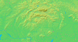
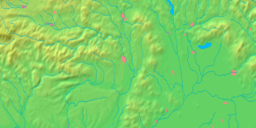
Markušovce Village Country Slovakia Region Košice District Spišská Nová Ves Elevation 435 m (1,427 ft) Coordinates 48°55′N 20°38′E / 48.917°N 20.633°E Area 18.5 km2 (7.1 sq mi) Population 3,533 (2004-12-31) Density 191 / km2 (495 / sq mi) First mentioned 1289 Postal code 053 21 Area code +421-53 Car plate SN Statistics: MOŠ/MIS Markušovce is a village and municipality in the Spišská Nová Ves District in the Košice Region of central-eastern Slovakia.
History
Markušovce was founded in the 12th century before the Tatar invasions of the region. The village was owned by the Mariassy family from the 13th century, and many members of the family are buried in the village's Church of St. Michael.
The castle of Markušovce dates from 1284. but was not used after a fire in 1773.
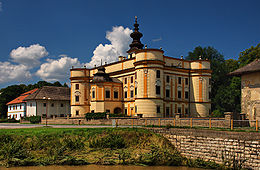
The manor house of Markušovce was built in 1643 and is now a museum, together with the rococo belvedere or garden house 'Dardanely', dating from 1778, which stands in its grounds; this contains a collection of musical instruments and is frequently used for concerts.
Geography
The village lies at an altitude of 435 metres and covers an area of 18.509 km². It has a population of about 3,535 people.
External links
Krompachy · Spišská Nová Ves · Spišské Vlachy
Arnutovce · Betlanovce · Bystrany · Danišovce · Harichovce · Hincovce · Hnilčík · Hnilec · Hrabušice · Chrasť nad Hornádom · Iliašovce · Jamník · Kaľava · Kolinovce · Letanovce · Lieskovany · Markušovce · Matejovce · Mlynky · Odorín · Olcnava · Oľšavka · Poráč · Rudňany · Slatvina · Slovinky · Smižany · Spišské Tomášovce · Spišský Hrušov · Teplička · Vítkovce · Vojkovce · Žehra Categories:
- Villages and municipalities in Spišská Nová Ves District
- Košice Region geography stubs
Wikimedia Foundation. 2010.


