- Mount Hebo
-
Mount Hebo 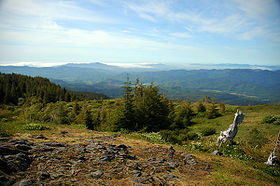
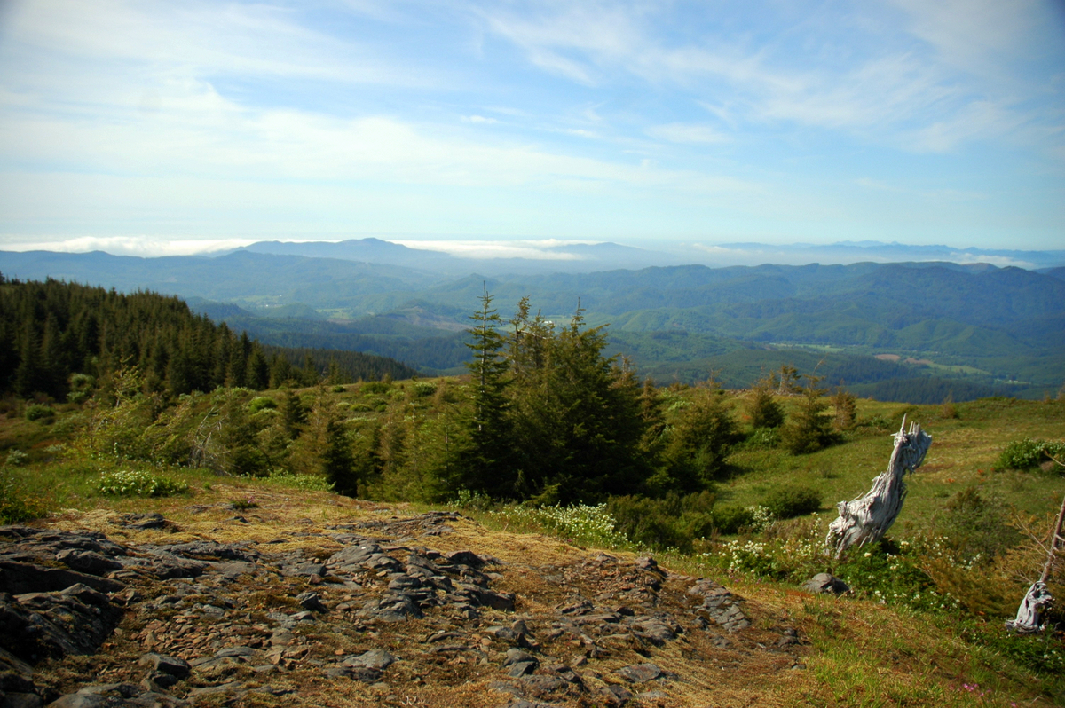
View from Mount Hebo.Elevation 3,154 ft (961 m) NAVD 88[1] Location Location Yamhill / Tillamook counties, Oregon, USA Range Northern Oregon Coast Range, Oregon Coast Range Coordinates 45°12′51.9″N 123°45′23.2″W / 45.214417°N 123.756444°WCoordinates: 45°12′51.9″N 123°45′23.2″W / 45.214417°N 123.756444°W[1] Topo map USGS Hebo Mount Hebo is a mountain located on the border of Tillamook County and Yamhill County in the U.S. state of Oregon. Mount Hebo is known for being one of the best, most easily accessed viewpoints in the north Oregon Coast, with a 360-degree view from the summit.[2]
Mount Hebo is part of the Northern Oregon Coast Range and is located in the Siuslaw National Forest overlooking the Pacific Ocean. Access to the summit is provided by an eight-mile forest service road that begins about a quarter mile from the junction of U.S. Route 101 and Oregon Route 22 in the community of Hebo.[2]
Mount Hebo was apparently named by a viewing party seeking a new route to the Willamette Valley that climbed the mountain to get a better view of the terrain. A member of the party said the mountain should be called "Heave Ho" because from their position it looked like it had been heaved up from its surroundings. The name became distorted over the years to its present form.[3]
Mount Hebo was the site of the Mount Hebo Air Force Station, a long-range radar installation, 1956–1980.
References
- ^ a b "Hebo Reset". NGS data sheet. U.S. National Geodetic Survey. http://www.ngs.noaa.gov/cgi-bin/ds_mark.prl?PidBox=RD1843. Retrieved 2008-11-01.
- ^ a b Fencsak, Richard. "Mt. Hebo: A view that makes you feel on top of world". The Oregonian. http://www.oregonlive.com/oregoncoast/oregonian/related.ssf?/outdoors/hiking/hike38_990827.html. Retrieved 2008-04-03.
- ^ McArthur, Lewis A.; Lewis L. McArthur (2003) [1928]. Oregon Geographic Names (Seventh Edition ed.). Portland, Oregon: Oregon Historical Society Press. ISBN 0-87595-277-1.
External links
- "Mount Hebo". Geographic Names Information System, U.S. Geological Survey. http://geonames.usgs.gov/pls/gnispublic/f?p=gnispq:3:::NO::P3_FID:1143444. Retrieved 2008-11-01.
- "Siuslaw National Forest". U.S. Forest Service. http://www.fs.fed.us/r6/siuslaw/. Retrieved 2008-04-03.
Oregon Coast Range Northern - Five highest peaks: Rogers Peak
- South Saddle Mountain
- Larch Mountain
- Trask Mountain
- Saddle Mountain
Central - Five highest peaks: Marys Peak
- Grass Mountain
- Laurel Mountain
- Prairie Peak
- Saddle Bag Mountain
Southern - Four highest peaks: Bone Mountain
- Kenyon Mountain
- Bear Mountain
- Buzzard Rock
See also Categories:- Mountains of Oregon Coast Range
- Landforms of Tillamook County, Oregon
- Landforms of Yamhill County, Oregon
- Oregon geography stubs
Wikimedia Foundation. 2010.