- Oklahoma State Highway 162
-
State Highway 162
Route information Maintained by ODOT Length: 1.32 mi[1] (2.12 km) Existed: ca. 1967 – present Major junctions South end: 

 US-62/US-64/SH-16, 10 mi. W of Muskogee
North end: Taft Highway system Oklahoma State Highways
Oklahoma turnpike system←  SH-156
SH-164  →
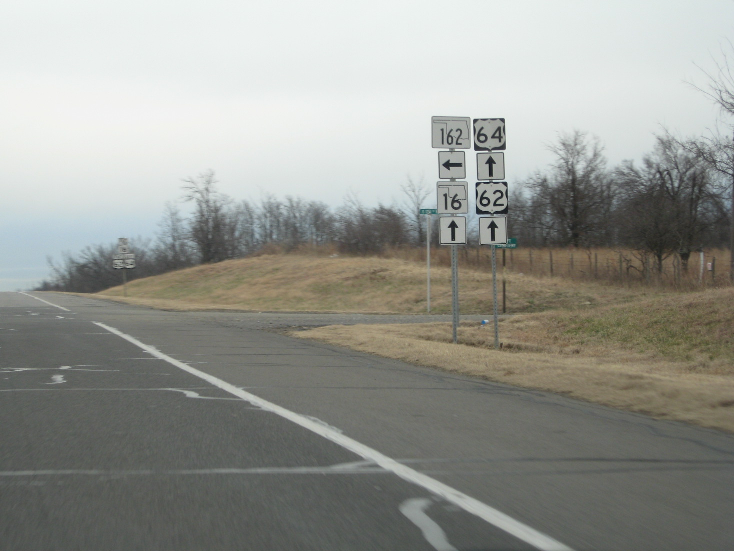
→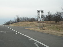 SH-162 on a sign assembly along US 62 et al.
State Highway 162 (SH-162/OK-162) is a 1.3-mile[1] (2.1 km) state highway in the U.S. state of Oklahoma that provides access from US-62/US-64/SH-16 to the town of Taft. The highway lies entirely within Muskogee County. Serving as a spur route itself, the highway has no letter-suffixed spur routes of its own.
Contents
Route description
SH-162 begins at the US-62/64/SH-16 expressway south of Taft, then proceeds due north for 1.32 miles (2.12 km), ending on the western edge of town.[1] The route's northern terminus is at Old Taft Road,[2] the old alignment of US-62/64.[3]
History
From the routes' establishment into the mid-1960s, US-62 and US-64 passed through Taft along what is now Old Taft Road en route to the county seat of Muskogee.[3] On July 10, 1967, however, the state shifted the routes onto the present-day expressway south of town.[4] SH-162 was created around the same time, allowing Taft to remain connected to the state highway system. The change to US-62/64/SH-16's alignment was not reflected on the official state highway map until the 1969 edition; this was also the first edition of the state highway map to show SH-162.[5]
Junction list
The entire route is in Muskogee County.
Location Mile[1] Destinations Notes 0.00 US-62 / US-64 / SH-16Southern terminus Taft 1.32 Old Taft Rd.[2] Northern terminus 1.000 mi = 1.609 km; 1.000 km = 0.621 mi References
- ^ a b c d Oklahoma Department of Transportation. Muskogee County. ODOT 2006 Control Section Maps. URL accessed 20 September 2006.
- ^ a b DeLorme (2006). Oklahoma Atlas and Gazetteer (Map). 1:200,000. p. 45, section 10A.
- ^ a b Oklahoma Department of Highways. Oklahoma 1966 (Map). http://www.odot.org/hqdiv/p-r-div/maps/state-maps/pdfs/1966.pdf. Retrieved 2011-11-15.
- ^ Oklahoma Department of Transportation, Planning & Research Division. "Memorial Dedication & Revision History - US-62". http://www.okladot.state.ok.us/memorial/legal/us62.htm. Retrieved 2011-11-14.
- ^ Oklahoma Department of Highways. Oklahoma 1969 (Map). http://www.odot.org/hqdiv/p-r-div/maps/state-maps/pdfs/1969.pdf. Retrieved 2011-11-15.
External links
Categories:- State highways in Oklahoma

Wikimedia Foundation. 2010.