- Mývatn
-
Mývatn Coordinates 65°36′N 17°00′W / 65.6°N 17°WCoordinates: 65°36′N 17°00′W / 65.6°N 17°W Lake type eutrophic Primary outflows Laxá Basin countries Iceland Surface area 37 km² Average depth 2.5 m Max. depth 4.5 m Surface elevation 288 m Mývatn is a shallow eutrophic lake situated in an area of active volcanism in the north of Iceland, not far from Krafla volcano. The lake and its surrounding wetlands have an exceptionally rich fauna of waterbirds, especially ducks. The lake was created by a large basaltic lava eruption 2300 years ago, and the surrounding landscape is dominated by volcanic landforms, including lava pillars and rootless vents (pseudocraters). The effluent river Laxá is known for its rich fishing for Brown Trout and Atlantic Salmon.
The name of the lake (Icelandic mý ("midge") and vatn ("lake"); the lake of midges) comes from the huge numbers of flies (midges) to be found there in the summer.
The name Mývatn is sometimes used not only for the lake but the whole surrounding inhabited area. The River Laxá, Lake Mývatn and the surrounding wetlands are protected as a nature reserve (The Mývatn-Laxá Nature Conservation Area).
Since the year 2000, a marathon around the lake takes place in summer.
Contents
Waterbirds
The lake is fed by nutrient-rich springwater and has a high abundance of aquatic insects (Chironomidae) and Cladocera that form an attractive food supply for ducks. Thirteen species of ducks nest here. The duck species composition is unique in the mixture of Eurasian and North American elements and of boreal and arctic species. Most of the ducks are migratory, arriving in late April - early May from north-western Europe. The most abundant is the Tufted Duck, which immigrated to Iceland at the end of the 19th century. The Greater Scaup is the second most common duck species.
Other common species include the Barrow's Goldeneye, Red-breasted Merganser, Wigeon, Gadwall, Mallard, Common Scoter, Long-tailed duck and Teal. The outflowing Laxá river has a dense colony of Harlequin Ducks and there is a large colony of Eiders at the river mouth some 50 km away from Lake Mývatn. The Barrow's Goldeneye is special in being the only nearctic duck in the area (and Iceland as a whole). Its population of about 2000 birds relies entirely on the habitat provided by the Mývatn-Laxá water system and its surrounding lava fields. Most of the Barrow's Goldeneyes overwinter there, using ice-free areas kept open by emerging spring water (both warm and cold) and in the strong river current. This species is a hole-nester, in North America using tree-holes, but at Mývatn the birds use cavities in the lava for nesting. The other duck species nest abundantly in the numerous islands of the lake and the surrounding marshlands. There is a long tradition of harvesting duck eggs for home use on the local farms. To ensure sustainability, the harvesting follows strict age-old rules of leaving at least four eggs in a nest for the duck to incubate.
Other common waterbirds include the Slavonian Grebe, Red-necked Phalarope, Great Northern Diver, Red-throated Diver and Whooper Swan.
The waterbird situation has been monitored annually since 1975 by the Mývatn Research Station.
Volcanism
Lake Mývatn was created about 2300 years ago by a large fissure eruption pouring out basaltic lava. The lava flowed down the Laxárdalur Valley to the lowland plain of Aðaldalur where it entered the Arctic Ocean about 50 km away from Mývatn. The Crater Row that was formed on top of the eruptive fissure is called Þrengslaborgir (or Lúdentarborgir) and has often been used as a textbook example of this type of volcanic activity. There was a large lake in the area at the time, a precursor of the present-day Mývatn. When the glowing lava encountered the lake some of the water-logged lake sediment was trapped underneath it. The ensuing steam explosions tore the lava into small pieces which were thrown up into the air, together with some of the lake.
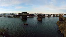
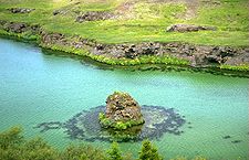
By repeated explosions in a number of locations, groups of craters built up and now dominate the landscape on the shore of Lake Mývatn and also form some of the islands in the lake. This type of lava formation is known as pseudocraters or rootless vents. A group of such craters at Skútustaðir on the south shore of the lake is protected as a natural monument and is frequented by tourists. Other pseudocrater groups in this lava field are in the Laxárdalur Valley and Aðaldalur. The formation of pseudocraters halted the advance of the lava in some places creating temporal lava lakes. The lava eventually drained from the lakes, leaving behind a forest of rock pillars. The biggest of these formations is named Dimmuborgir. At another place, Höfði, the pillars stand in the lake water. The lava created by the Þrengslaborgir eruption is known as the Younger Laxá Lava.
The Mývatn district lies on the western border of the volcanic zone which cuts across north-eastern Iceland from north to south and is an extension of the Mid-Atlantic Ridge. All geological formations are quite recent, dating from the Ice Age and postglacial times.
The bedrock of the moors west of Lake Mývatn is made up of interglacial lava flows. Most of the mountains in the vicinity of the lake were formed by eruptions under the ice sheet in the glacial periods of the Ice Age. Eruptions that melted their way up through the ice formed table mountains (Mounts Bláfjall, Sellandafjall, Búrfell, Gæsafjöll), those which didn't formed hyaloclastite ridges (Mounts Vindbelgjarfjall, Námafjall, Dalfjall, Hvannfell).
At the close of the Ice Age, about 10,000 years ago, the Mývatn basin was covered by a glacier which pushed up huge end moraines which can still be seen at the north end of the lake. After the glacier started melting, a glacial lake was dammed up in the Mývatn depression until the glacier retreated from the present course of Laxá river.
Postglacial volcanism in the Mývatn district may be divided into three cycles. The Lúdent cycle commenced shortly after the close of the Ice Age. The explosion crater (tephra ring) Lúdent dates from this cycle. Its eruption was followed by a number of small fissure eruptions. About 3800 years ago the shield volcano Ketildyngja was formed about 25 km south-east of Mývatn, and from it a huge lava flow, the Older Laxá-lava, spread over the southern part of the district, plunged down the Laxárdalur valley and flowed almost to the sea. This lava dammed up the first Mývatn, which was about as large as the present lake.
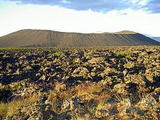
The second volcanic cycle, the Hverfjall cycle, began 2500 years ago with a gigantic but brief eruption, which formed the explosion crater (tephra ring ) Hverfjall (also named Hverfell). An eruption in Jardbadshólar followed, producing the lavafield between Reykjahlíð and Vogar. Approximately 200 years later a vast lava flow, the Younger Laxá-lava, was erupted (see above). The lava dammed up the present Lake Mývatn and also the lakes Sandvatn, Grænavatn and Arnarvatn.
The third volcanic cycle began with the Mývatnseldar eruptions in 1724-1729 which commenced with an explosion that formed the crater lake Víti. Later lava flowed from Leirhnjúkur down to the north end of Lake Mývatn, destroying two farms. The Mývatnseldar eruptions are quite similar in character to the recent volcanic activity near Krafla in 1975-1984. The source of both is a central volcano lying between Krafla and Gæsafjöll. Inside the volcano resides a magma chamber from which molten magma periodically bursts into a swarm of fissures that cut through the volcano from north to south.
The recent activity was characterized by periods of slow land rise, interspersed by shorter periods of rapid subsidence, underground magma bursts, rifting, earthquakes and eruptions (nine in all). This is an excellent example of the process of continental drift in Iceland. A central volcano and its associated fissure swarm is called a volcanic system. The Krafla volcanic system is one of several such systems which together form the volcanic zone of Iceland.
A few rhyolite mountains border the Krafla central volcano (Mounts Hlíðarfjall, Jörundur, Hrafntinnuhryggur).
Because of the volcanic origin, there are silica quarries in the lake.
Plants
Lake Mývatn is one of the few places in the world that grows Marimo, also known as Cladophora ball, Lake ball, or Moss Balls in English, a species of filamentous green algae (Chlorophyta).
Bibliography
- Einarsson, Á., Stefánsdóttir, G., Jóhannesson, H., Ólafsson, J.S., Gíslason, G.M., Wakana, I., Gudbergsson, G. and Gardarsson, A. 2004. The ecology of Lake Mývatn and the River Laxá: variation in space and time. Aquatic Ecology 38: 317-348.
- Gardarsson, A. and Einarsson, Á. eds. 1991. Náttúra Mývatns. Hið íslenska Náttúrufræðifélag, Reykjavík. 372 pp. (in Icelandic)
- Gardarsson, A. and Einarsson, Á. 2000. Monitoring waterfowl at Mývatn, Iceland. Pp. 3–20 in F.A. Comin, J.A. Herrera-Silveira and J.Ramirez-Ramirez (eds.): Limnology and Aquatic birds. Monitoring, Modelling and Management. Universidad Autonoma de Yucatan, Merida, Yucatan, Mexico.
- Gíslason, G.M. 1994. River management in cold regions: a case study of the River Laxá, North Iceland. Pp. 464–483 in: The Rivers Handbook. Hydrological and Ecological Principles. Vol. 2. Eds. P. Calow & G.E. Petts. Blackwell, Oxford. 483 pp.
- Jónasson, P.M. ed. 1979. Ecology of Eutrophic, Subarctic Lake Mývatn and the River Laxá. Oikos 32.
See also
- Lakes of Iceland
- Volcanism in Iceland
- Geography of Iceland
- Cladophora
External links
- Geological map[1]
- A complete bibliography on the natural history of Mývatn[2]
- Current seismic activity at Mývatn[3]
- Lake Myvatn images
- Facts and photos
- Photos[4][5]
- Seacology Lake Myvatn Project Seacology
- Mývatn panoramic virtual tour
Lakes of Iceland Apavatn · Blöndulón · Breiðárlón · Elliðavatn · Fjallsárlón · Frostastaðavatn · Grænalón · Grímsvötn · Hóp · Hreðavatn · Hvalvatn · Hvítárvatn · Hvítavatn · Jökulsárlón · Kleifarvatn · Kvíslavatn · Lagarfljót · Langisjór · Laugarvatn · Mývatn · Öskjuvatn · Sigöldulón · Skorradalsvatn · Sultartangalón · Svínavatn · Þingvallavatn · Þórisvatn · Tjörnin Categories:
- Lakes of Iceland
- North Iceland
- 1724 in Europe
Wikimedia Foundation. 2010.


