- Drawsko County
-
Drawsko County
Powiat drawski— County — 
Flag
Coat of armsLocation within the voivodeship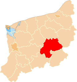 Division into gminas
Coordinates (Drawsko Pomorskie): 53°32′N 15°48′E / 53.533°N 15.8°ECoordinates: 53°32′N 15°48′E / 53.533°N 15.8°E Country  Poland
Voivodeship West Pomeranian Seat Drawsko Pomorskie Gminas Area – Total 1,764.21 km2 (681.2 sq mi) Population (2006) – Total 58,073 – Density 32.9/km2 (85.3/sq mi) – Urban 35,764 – Rural 22,309 Car plates ZDR Website http://www.powiatdrawski.pl Drawsko County (Polish: powiat drawski) is a unit of territorial administration and local government (powiat) in West Pomeranian Voivodeship, north-western Poland. It came into being on January 1, 1999, as a result of the Polish local government reforms passed in 1998. Its administrative seat is the town of Drawsko Pomorskie, which lies 82 kilometres (51 mi) east of the regional capital Szczecin. The county contains three other towns: Złocieniec, 15 km (9 mi) east of Drawsko Pomorskie, Czaplinek, 29 km (18 mi) east of Drawsko Pomorskie, and Kalisz Pomorski, 29 km (18 mi) south of Drawsko Pomorskie.
The county covers an area of 1,764.21 square kilometres (681.2 sq mi). As of 2006 its total population is 58,073, out of which the population of Złocieniec is 13,377, that of Drawsko Pomorskie is 11,465, that of Czaplinek is 6,933, that of Kalisz Pomorski is 3,989, and the rural population is 22,309.
The eastern part of the county contains part of the protected area known as Drawsko Landscape Park.
Neighbouring counties
Drawsko County is bordered by Świdwin County to the north, Szczecinek County and Złotów County to the east, Wałcz County to the south-east, Choszczno County to the south, Stargard County to the west, and Łobez County to the north-west.
Administrative division
The county is subdivided into six gminas (four urban-rural and two rural). These are listed in the following table, in descending order of population.
Gmina Type Area
(km²)Population
(2006)Seat Gmina Drawsko Pomorskie urban-rural 344.8 16,537 Drawsko Pomorskie Gmina Złocieniec urban-rural 194.5 15,571 Złocieniec Gmina Czaplinek urban-rural 364.7 11,795 Czaplinek Gmina Kalisz Pomorski urban-rural 480.5 7,150 Kalisz Pomorski Gmina Wierzchowo rural 229.3 4,489 Wierzchowo Gmina Ostrowice rural 150.4 2,531 Ostrowice References
Urban-rural gminas 
Rural gminas Counties of West Pomeranian Voivodeship City counties 
Land counties Categories:- Drawsko County
- Land counties of West Pomeranian Voivodeship


Wikimedia Foundation. 2010.